1.6 miles
Distance
413 ft
Climb
-462 ft
Descent
1,288 ft
High Point
-49 ft
Altitude change
870 ft
Altitude min
920 ft
Altitude start
869 ft
Altitude end
-0.6%
Grade
-42.7%
Grade max
32.8%
Grade min
3,734 ft
Distance climb
4,380 ft
Distance down
328 ft
Distance flat

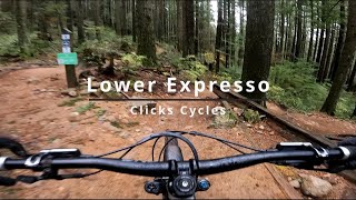
Fun loop to ride fast and flowy jump/berm trails. Do as many loops as you want.

Detailed Description
Flow Loop 1 is a 2 mile popular intermediate route located near North Vancouver British Columbia. This mountain bike only route can be used one direction and has a moderate overall physical rating. This route includes 15 trails. This route climbs 413 ft with a max elevation of 1,288 ft then descends -462 ft.
Local Trail Association
Local trail association
North Shore Mountain Bike Association (nsmba.ca)
Please consider joining or donating to the local riding association to support trail development & maintenance.
Donate to earn trail karma!

Stats

  • Distance
    2 miles
  • Avg time
    26 min 12 sec
  • Altitude min
    870 ft
  • Altitude start
    920 ft
  • Altitude end
    869 ft
  • Climb
    413 ft
  • Descent
    -462 ft
  • Grade
    -0.6%
  • Grade max
    -42.7%
  • Grade min
    32.8%
  • Distance climb
    3,734 ft
  • Distance down
    4,380 ft
  • Distance flat
    328 ft

80 Reviews & Comments


We hope you've been enjoying Trailforks!

Create a FREE account to view route comments and much more.

Details

  • Riding area
  • Primary Activity
    Mountain Bike
  • Difficulty rating
    Blue
  • Route Type
    Loop
  • Bike type
    AM
  • Direction
    One Direction
  • Physical rating
    Moderate
  • Ridelogs
    296
Avg: 5 (1 votes)
close
3D
Trail Conditions
  • Unknown
  • Snow Groomed
  • Snow Packed
  • Snow Covered
  • Snow Cover Partial
  • Freeze/thaw Cycle
  • Icy
  • Prevalent Mud
  • Wet
  • Variable
  • Ideal
  • Dry
  • Very Dry
Trail Flow (Ridden Direction)
Trailforks scans users ridelogs to determine the most popular direction each trail is ridden. A good flowing trail network will have most trails flowing in a single direction according to their intension.
The colour categories are based on what percentage of riders are riding a trail in its intended direction.
  • > 96%
  • > 90%
  • > 80%
  • > 70%
  • > 50%
  • < 50%
  • bi-directional trail
  • no data
Trail Last Ridden
Trailforks scans ridelogs to determine the last time a trail was ridden.
  • < 2 days
  • < 1 week
  • < 2 weeks
  • < 1 month
  • < 6 months
  • > 6 months
Trail Ridden Direction
The intended direction a trail should be ridden.
  • Downhill Only
  • Downhill Primary
  • Both Directions
  • Uphill Primary
  • Uphill Only
  • One Direction
Contribute Details
Colors indicate trail is missing specified detail.
  • Description
  • Photos
  • Description & Photos
  • Videos
Trail Popularity ?
Trailforks scans ridelogs to determine which trails are ridden the most in the last 9 months. Trails are compared with nearby trails in the same city region with a possible 25 colour shades. Think of this as a heatmap, more rides = more kinetic energy = warmer colors.
  • most popular
  • popular
  • less popular
  • not popular
ATV/ORV/OHV Filter
Max Vehicle Width
inches
US Cell Coverage
Legend
cell carrier legend

Radar Time
Activity Recordings
Trailforks uses anonymized public activity data. ?
Activity Recordings
Trailforks uses anonymized public activity data. ?
Personal Heatmap
Activity Types
all / none
Options
2
Date range month
Winter Trails
Warning A routing network for winter maps does not exist. Selecting trails using the winter trails layer has been disabled.
Missing Trails
Most Popular
Least Popular
Trails are colored based on popularity. The more popular a trail is, the more red. Less popular trails trend towards green.
Jump Magnitude Heatmap
Heatmap of where riders jump on trails. Zoom in to see individual jumps, click circles to view jump details.
BC Backroad Status

Service Road Atlas is a free to use, community-driven service for viewing and creating reports on the numerous back-country service roads around B.C. and Alberta.

map legend
Slope Aspect
Direction the slope faces
Flat N NE E SE S SW W NW
Trails Deemphasized
Trails are shown in grey.
disable
Only show trails with no bike usage.
Enable
Suggested Layers
Based on selected activity type

    Save the current map location and zoom level as your default home location whenever this page is loaded.

    Save
    Trail transparency
    • Singletrack
    390 | 1 faves
    463 | 1 faves
    418
    561

    Recent Trail Reports Along Route

    statustraildateconditiondescription
    Lower Digger
    Jun 18, 2026 @ 5:19pm (America/Vancouver)
    3 days
    Lower Expresso
    Jun 18, 2026 @ 5:19pm (America/Vancouver)
    3 days
    For The Kids
    Jun 18, 2026 @ 5:19pm (America/Vancouver)
    3 days
    Tennis Court Access
    Jun 18, 2026 @ 5:19pm (America/Vancouver)
    3 days
    Dreamweaver
    Jun 15, 2026 @ 11:42am (America/Vancouver)
    Jun 15, 2026
    Wonderfully jank
    more reports »
    • By mrj27TF Pro & contributors
    • #13707 - 2,899 views

    Hit the Trail

    Open in App

    Get this route on your phone instantly.

    Download Route

    Save to wishlist, Garmin & download.