

more stats
2.2 miles
Distance
128 ft
Climb
-1,311 ft
Descent
1 mile
High Point
-1,183 ft
Altitude change
4,646 ft
Altitude min
5,829 ft
Altitude start
4,646 ft
Altitude end
-10.239%
Grade
-31.096%
Grade max
21.241%
Grade min
809 ft
Distance climb
2 miles
Distance down

Big Silverlead Details

  • Activities
    • Mountain Bike
    • Hike
    • Trail Running
  • Riding Area
    Wagonhammer
    North Fork, Idaho
  • Ref Number
    #136
  • Difficulty Rating
  • Local Popularity
    80 in Mountain Biking [+]
    • 5 in Trail Running
    • 5 in Hiking
  • Global Ranking
    #83561 in Mountain Biking [+]
    • #327050 in Trail Running
    • #354652 in Hiking
  • State Ranking
    #705 in Mountain Biking · Idaho [+]
    • #2,513 in Trail Running
    • #2,933 in Hiking
  • Trail Type
    Singletrack
  • Direction
    Both Directions
    Popular In Reverse
  • Season
    Apr-Oct
  • Dogs Allowed
    Yes

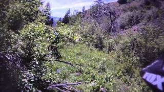
Big Silverlead is sweet for technical downhilling, tough for climbing.

The upper portion of this trail flows through big Pine and Fir trees and has steep sections. The middle portion, in the narrowest part of the canyon, is rocky and wet and technical. The lower, more open, part of Big Silverlead is smoother and meanders through the big pines again.

The obelisk of old steel parts marks the junction with Silverleads Connector.

Disclaimer

Please Close ALL Gates between June 1 and Sept 1.

Tags
Trail Supporters
Local Trail Association
Traditionally Indigenous Territory

Recent Activity on Trail

Past Week
  • 0 rides
  •  
6 Months
  • 3 rides
  • 16 miles avg distance
All
  • 7 rides
  • Last: May 23, 2026
c1c2c3c4
January
February
March
April
May
June
July
August
September
October
November
December
update trails status or condition

Big Silverlead Trail Reports

statusdatedescription
May 13, 2026 @ 10:27am (America/Boise)
May 13, 2026
reporter
Tread work and trail cleanup from FR063 to the Silverleads Connector - 5/12/26. Trail is clear of deadfall and riding great (except for that...
Aug 1, 2025 @ 10:57am
Aug 1, 2025
reporter 7/29/25: Trail is in pretty bad shape after grazing, mostly in the section above the Silverleads Connector. Quite a bit of cleanup work is...
Jun 9, 2025 @ 9:22am
Jun 9, 2025
reporter 6/7/25 - Brushing, trail cleanup, tread work, and drainage work from FR63 to Trail#134 Junction. Reconstructed stream crossings so that water no...
May 24, 2025 @ 4:51pm
May 24, 2025
Trail is clear of blowdowns. Rather wet due to the spring running down the trail
May 30, 2024 @ 5:15pm
May 30, 2024
Two blowdowns across the trail above the connector and two blowdowns across the trail shortly below the connector.
more »
Status:
on May 13, 2026
Dry
Avg: 3.86 (2 votes)
Your vote: 0

view (20)
close
      Directions to big-silverlead trailhead (45.447550, -113.927000)

      Photos

      5 more »
      report
      mtb
      78 |
      Aug 1, 2025 @ 11:12am
      Aug 1, 2025
      report
      mtb
      91 |
      May 17, 2023 @ 6:31pm
      May 17, 2023
      report
      mtb
      69 |
      May 17, 2023 @ 6:30pm
      May 17, 2023
      report
      mtb
      79 |
      May 11, 2023 @ 5:41pm
      May 11, 2023

      Videos

      2 more »
      Silverlead Wipeout
      mtb
      838 | Oct 3, 2014 , North Fork
      Silverlead
      mtb
      782 | Oct 3, 2014 , North Fork

      Routes with this trail

      13 miles • 980 ft • 8 • Shuttled •
      The Stein Mountain Route gives a grand tour of Wagonhammer's great trails while descending over 5000'.
      3.5 ★★★★★
      2 Ratings
      5 ★
      4 ★ 50%
      3 ★ 50%
      2 ★
      1 ★

      1 Review & Comments

      lewisma lewisma
      Trail is a bit on the wild. It is a good way to connect trails for a bigger loops in the area

      We hope you've been enjoying Trailforks!

      Create a FREE account to view all trail reviews and much more.

      • By toddTF Pro Trailforks & contributors
      • #14293 - 1,824 views

      Frequently Asked Questions

      ▼ Where is Big Silverlead located?
      Big Silverlead is located in Wagonhammer, North Fork, Idaho, United States. It is part of the Wagonhammer trail network. The trailhead is located at coordinates 45.44755, -113.927.
      ▼ How hard is Big Silverlead?
      Big Silverlead is rated as Black Diamond difficulty. The average grade is 10.239%.
      ▼ What is the elevation gain for Big Silverlead?
      Big Silverlead has 128 ft of elevation gain. The trail has 1,311 ft of elevation descent. The elevation ranges from 4,646 ft to 5,829 ft.
      ▼ Is Big Silverlead a point to point trail?
      Big Silverlead is not a point to point trail. The direction is Both Directions. The trail type is singletrack.
      ▼ How long is Big Silverlead?
      Big Silverlead is 2.2 miles long. The trail type is singletrack.
      ▼ Are dogs allowed on Big Silverlead?
      Yes, dogs are allowed on Big Silverlead. Please keep dogs on a leash where required and clean up after them.
      ▼ When is the best time of year to ride Big Silverlead?
      Based on activity log data, the most popular months to ride Big Silverlead are:
      • May (4 activities)
      Check the reports page for current trail conditions.
      ▼ How do I access Big Silverlead? Where is the closest parking trailhead?
      The closest parking and trailhead locations to Big Silverlead are: View all parking locations in the area.
      ▼ How busy is Big Silverlead?
      Big Silverlead is a very popular trail. There have been 18 recorded activities on this trail. The trail has received 20 check-ins. View recent activity on this trail.

      Hit the Trail

      Open in App

      Get this trail on your phone instantly.

      open trail in app

      Download Trail

      Save to wishlist, Garmin & download.
      save the trail

      Find Related Routes

      Find routes and users activities that include this trail.
      find routes for this trail

      You must enter a description before submitting.