more stats
4,327 ft
Distance
448 ft
Climb
-142 ft
Descent
00:14:40
Avg time
305 ft
Altitude change
3,051 ft
Altitude min
3,358 ft
Altitude max
3,053 ft
Altitude start
3,360 ft
Altitude end
7.1%
Grade
-27.8%
Grade max
38.3%
Grade min
2,592 ft
Distance climb
1,293 ft
Distance down
443 ft
Distance flat
00:14:40
Avg time

Cliff Side Details

  • Activities
    • Mountain Bike
    • E-Bike
    • Hike
    • Trail Running
    • Observed Trials
  • Riding Area
    Mountain Shadows
    Golden, British Columbia
  • Difficulty Rating
  • Local Popularity
    75 in Mountain Biking [+]
    • 80 in E-Biking
    • 95 in Trail Running
    • 40 in Hiking
    • 5 in Observed Trials
  • Global Ranking
    #67175 in Mountain Biking [+]
    • #67450 in E-Biking
    • #21071 in Trail Running
    • #113994 in Hiking
    • #1133 in Observed Trials
  • Trail Type
    Singletrack
  • Bike Type
    XC
  • Direction
    Both Directions
  • Physical Rating
    Hard
  • Dogs Allowed
    Yes
  • eBike Allowed

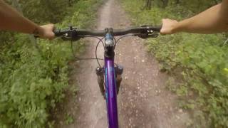
Found at the upper end of the Mtn Shadows Trail system, Cliffside offers some technical riding, some whoops, and a full view of the Columbia Valley. Although rated a black diamond, there are only a few challenging techy bits and one whoops. This is a shared-use trail; watch for trials riders.

The trail rides well in either direction. It is fairly well signed, but due to the number of trials bike trails in the area, it can be a little confusing (particularly in the north to south direction). When riding north to south, try to keep high and not take any branches dropping down to the right. If you do this properly then you should reach the junction with Magic Dragon. The trail requires a little more endurance when ridden north to south.

Trail Supporters
Local Trail Association
Traditionally Indigenous Territory

Recent Activity on Trail

Past Week
  • 0 rides
  •  
6 Months
  • 17 rides
  • 8 miles avg distance
All
  • 231 rides
  • Last: Jun 28, 2026
c1c2c3c4
January
February
March
April
May
June
July
August
September
October
November
December
update trails status or condition

Cliff Side Trail Reports

statusdatedescription
Apr 11, 2026 @ 8:25am (America/Edmonton)
Apr 11, 2026
reporter
Mar 30, 2026 @ 7:57pm (America/Edmonton)
Mar 30, 2026
reporter
Apr 3, 2025 @ 4:12pm
Apr 3, 2025
reporter
Mar 12, 2025 @ 12:19pm
Mar 12, 2025
reporter Even though it feels like the start of the riding season the trails are still not good to go. Even the sunny slopes have sections with snow and...
May 19, 2024 @ 1:58am
May 19, 2024
more »
Status:
on Apr 11, 2026
Variable
Avg: 4.1 (13 votes)
Your vote: 0

view (1,879)
close
3D
Trail Conditions
  • Unknown
  • Snow Groomed
  • Snow Packed
  • Snow Covered
  • Snow Cover Partial
  • Freeze/thaw Cycle
  • Icy
  • Prevalent Mud
  • Wet
  • Variable
  • Ideal
  • Dry
  • Very Dry
Trail Flow (Ridden Direction)
Trailforks scans users ridelogs to determine the most popular direction each trail is ridden. A good flowing trail network will have most trails flowing in a single direction according to their intension.
The colour categories are based on what percentage of riders are riding a trail in its intended direction.
  • > 96%
  • > 90%
  • > 80%
  • > 70%
  • > 50%
  • < 50%
  • bi-directional trail
  • no data
Trail Last Ridden
Trailforks scans ridelogs to determine the last time a trail was ridden.
  • < 2 days
  • < 1 week
  • < 2 weeks
  • < 1 month
  • < 6 months
  • > 6 months
Trail Ridden Direction
The intended direction a trail should be ridden.
  • Downhill Only
  • Downhill Primary
  • Both Directions
  • Uphill Primary
  • Uphill Only
  • One Direction
Contribute Details
Colors indicate trail is missing specified detail.
  • Description
  • Photos
  • Description & Photos
  • Videos
Trail Popularity ?
Trailforks scans ridelogs to determine which trails are ridden the most in the last 9 months. Trails are compared with nearby trails in the same city region with a possible 25 colour shades. Think of this as a heatmap, more rides = more kinetic energy = warmer colors.
  • most popular
  • popular
  • less popular
  • not popular
ATV/ORV/OHV Filter
Max Vehicle Width
inches
US Cell Coverage
Legend
cell carrier legend

Radar Time
Activity Recordings
Trailforks uses anonymized public activity data. ?
Activity Recordings
Trailforks uses anonymized public activity data. ?
Personal Heatmap
Activity Types
all / none
Options
2
Date range month
Winter Trails
Warning A routing network for winter maps does not exist. Selecting trails using the winter trails layer has been disabled.
Missing Trails
Most Popular
Least Popular
Trails are colored based on popularity. The more popular a trail is, the more red. Less popular trails trend towards green.
Jump Magnitude Heatmap
Heatmap of where riders jump on trails. Zoom in to see individual jumps, click circles to view jump details.
BC Backroad Status

Service Road Atlas is a free to use, community-driven service for viewing and creating reports on the numerous back-country service roads around B.C. and Alberta.

map legend
Slope Aspect
Direction the slope faces
Flat N NE E SE S SW W NW
Trails Deemphasized
Trails are shown in grey.
disable
Only show trails with no bike usage.
Enable
Suggested Layers
Based on selected activity type

    Save the current map location and zoom level as your default home location whenever this page is loaded.

    Save
        Directions to cliff-side trailhead (51.284970, -116.933250)

        Photos

        2 more »
        249 |
        Jan 27, 2021 @ 10:09am
        Jan 27, 2021
        307 |
        Jul 20, 2019 @ 5:50pm
        Jul 20, 2019

        Videos

        1 more »
        Ride Golden Like A Girl
        8:50 | 982 | Aug 31, 2018 , Golden

        Routes with this trail

        27 miles 5,887 ft 13
        Choose your own adventure down from the Summit of Mt 7.... we recommend taking the Schacher, but do...
        3.0 6 miles 1,016 ft 12
        9 km loop to get to in the Mountain Shadows area.

        Reviews / Comments

        No reviews yet, be the first to write a review or ask a question.
        Use trail reports to comment on trail conditions.


        We hope you've been enjoying Trailforks!

        Create a FREE account to view trail comments and much more.

        • By canadakaTF Pro Trailforks & contributors
        • #3470 - 5,005 views

        Frequently Asked Questions About Cliff Side

        Where is Cliff Side located?
        Cliff Side is located in Mountain Shadows, Golden, British Columbia, Canada. It is part of the Mountain Shadows trail network. The trailhead is located at coordinates 51.28497, -116.93325.
        How hard is Cliff Side?
        Cliff Side is rated as Black Diamond difficulty. The physical rating is Hard. The average grade is 7.1%.
        What is the elevation gain for Cliff Side?
        Cliff Side has 448 ft of elevation gain. The trail has 142 ft of elevation descent. The elevation ranges from 3,051 ft to 3,358 ft.
        Is Cliff Side a point to point trail?
        Cliff Side is not a point to point trail. The direction is Both Directions. The trail type is singletrack.

        Hit the Trail

        Open in App

        Get this trail on your phone instantly.
        open trail in app

        Download Trail

        Save to wishlist, Garmin & download.
        save the trail

        Find Related Routes

        Find routes and users activities that include this trail.
        find routes for this trail

        You must enter a description before submitting.