more stats
2.4 miles
Distance
195 ft
Climb
-371 ft
Descent
00:18:15
Avg time
-177 ft
Altitude change
1,616 ft
Altitude min
1,899 ft
Altitude max
1,796 ft
Altitude start
1,621 ft
Altitude end
-1.4%
Grade
-27.9%
Grade max
30.4%
Grade min
4,498 ft
Distance climb
1 mile
Distance down
535 ft
Distance flat
00:18:15
Avg time

Dynamite Details

  • Activities
    • Mountain Bike
    • E-Bike
    • Horse
    • Hike
    • Trail Running
  • Riding Area
    San Tan Mountain Regional Park
    Queen Creek, Arizona
  • Difficulty Rating
  • Voted Difficulty
    Blue (1 vote)
  • Local Popularity
    80 in Mountain Biking heatmap [+]
    • 75 in E-Biking
    • 95 in Trail Running
    • 90 in Hiking
    • 85 in Horseback
  • Global Ranking
    #62445 in Mountain Biking [+]
    • #102052 in E-Biking
    • #69623 in Trail Running
    • #79127 in Hiking
    • #862 in Horseback
  • State Ranking
    #814 in Mountain Biking · Arizona [+]
    • #545 in E-Biking
    • #979 in Trail Running
    • #1,506 in Hiking
    • #99 in Horseback
  • Trail Type
    Singletrack
  • Direction
    Both Directions
  • Dogs Allowed
    Yes
  • eBike Allowed
    Yes up to Class 1

Enjoy a thrilling journey as you explore the Goldmine Mountain range, known for its mining history . The trail connects to the Goldmine Trail near the Goldmine Trailhead and winds you along the mountain side to the San Tan Trail near
the central part of the park.

Tags

Trail Supporters

  • BLM
    BLM
    Land Manager

Local Trail Association

Traditionally Indigenous Territory

Recent Activity on Trail

Past Week
  • 6 rides
  • 13 miles average
6 Months
  • 76 rides
  • 13 miles avg distance
All
  • 1,587 rides
  • Last: Nov 12, 2026
c1c2c3c4
January
February
March
April
May
June
July
August
September
October
November
December
update trails status or condition

Dynamite Trail Reports

Status:
on Jun 1, 2026
Ideal
Avg: 4.39 (25 votes)
Your vote: 0

view (18,368)
close
      Directions to dynamite trailhead (33.171890, -111.652960)

      Photos

      43 more »
      mtb
      255 |
      Apr 14, 2019 @ 7:37am
      Apr 14, 2019
      mtb
      52 |
      Dec 7, 2024 @ 5:10pm
      Dec 7, 2024
      mtb
      84 |
      Aug 25, 2024 @ 9:12am
      Aug 25, 2024
      mtb
      70 |
      Aug 25, 2024 @ 9:12am
      Aug 25, 2024

      Videos

      3 more »
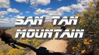
      youtuber San Tan Mountain Trails | Phoenix Metro...
      mtb
      7:14 | 809 | Apr 6, 2021 , Queen Creek
      Explorando San Tan mountains en Arizona
      mtb
      19:38 | 938 | Jun 18, 2018 , Queen Creek
      San Tan - Dynamite Trail - South side descent
      mtb
      2:51 | 973 | Apr 27, 2018 , Queen Creek

      Routes with this trail

      more »
      231 miles • 14,197 ft • 56 • Loop •
      This is a 5 day - 4 night 230 mile bikepacking route encompassing the popular trails of the East Valley...
      ★ 4.0 • 16 miles • 1,479 ft • 99 • Loop •
      This is a lollipop loop through San Tan Regional Park.This is a fun, hilly, non-technical ride that avoids...
      231 miles • 14,195 ft • 58 • Loop •
      This is a 5 day - 4 night 230 mile bikepacking route encompassing the popular trails of the East Valley...
      4.5 ★★★★★
      25 Ratings
      5 ★ 56%
      4 ★ 36%
      3 ★ 8%
      2 ★
      1 ★

      9 Reviews & Comments

      Creamcorn1
      Beware of hikers! Trail is very rocky but not to many loose rocks. It can be accessed from the North and south side of park. I recommend it
      Tj90
      Will be closed 3/20/23 - 3/27/23 due to trail maintenance
      Creamcorn1
      Fun flower ride. Rocky. Best with full suspension. Watch out for hikers. Equip your ride with a bell. Don't want to loose privilege of riding this trail due to complaints. Great views.

      We hope you've been enjoying Trailforks!

      Create a FREE account to view all trail reviews and much more.

      • By toddTF Pro Trailforks & contributors
      • #15241 - 5,561 views

      Frequently Asked Questions

      ▼ Where is Dynamite located?
      Dynamite is located in San Tan Mountain Regional Park, Queen Creek, Arizona, United States. It is part of the San Tan Mountain Regional Park trail network. The trailhead is located at coordinates 33.17189, -111.65296.
      ▼ How hard is Dynamite?
      Dynamite is rated as Blue difficulty. The average grade is 1.4%.
      ▼ What is the elevation gain for Dynamite?
      Dynamite has 195 ft of elevation gain. The trail has 371 ft of elevation descent. The elevation ranges from 1,616 ft to 1,899 ft.
      ▼ Is Dynamite a point to point trail?
      Dynamite is not a point to point trail. The direction is Both Directions. The trail type is singletrack.
      ▼ How long is Dynamite?
      Dynamite is 2.4 miles long. The trail type is singletrack.
      ▼ Are dogs allowed on Dynamite?
      Yes, dogs are allowed on Dynamite. Please keep dogs on a leash where required and clean up after them.
      ▼ How do I access Dynamite? Where is the closest parking trailhead?
      The closest parking and trailhead locations to Dynamite are: View all parking locations in the area.
      ▼ How long does it take to ride Dynamite?
      Based on recorded activities, it takes an average of 18 minutes to ride Dynamite. The trail is 2.4 miles long. Actual times will vary based on fitness level, conditions, and pace. View recent activity logs for more details.
      ▼ How busy is Dynamite?
      Dynamite is a very popular trail. There have been 17,060 recorded activities on this trail. The trail has received 18,368 check-ins. View recent activity on this trail.

      Hit the Trail

      Open in App

      Get this trail on your phone instantly.

      open trail in app

      Download Trail

      Save to wishlist, Garmin & download.
      save the trail

      Find Related Routes

      Find routes and users activities that include this trail.
      find routes for this trail

      You must enter a description before submitting.