


more stats
2.2 miles
Distance
127 ft
Climb
-239 ft
Descent
00:23:34
Avg time
-112 ft
Altitude change
4,042 ft
Altitude min
4,281 ft
Altitude max
4,281 ft
Altitude start
4,170 ft
Altitude end
-0.9%
Grade
-22.1%
Grade max
18.7%
Grade min
1,588 ft
Distance climb
3,681 ft
Distance down
1 mile
Distance flat
00:23:34
Avg time

Easy Breezy Details

  • Activities
    • Mountain Bike
    • Horse
    • Hike
    • Trail Running
  • Riding Area
    Cathedral
    Village Of Oak Creek, Arizona
  • Difficulty Rating
  • Voted Difficulty
    Blue (6 votes)
  • Local Popularity
    65 in Mountain Biking [+]
    • 35 in Trail Running
    • 35 in Hiking
    • 5 in Horseback
  • Global Ranking
    #52385 in Mountain Biking [+]
    • #144061 in Trail Running
    • #153004 in Hiking
    • #3191 in Horseback
  • State Ranking
    #692 in Mountain Biking · Arizona [+]
    • #2,556 in Trail Running
    • #3,284 in Hiking
    • #163 in Horseback
  • Trail Type
    Singletrack
  • Direction
    Both Directions
    Popular In Reverse
  • Dogs Allowed
    Yes
  • eBike Allowed

Beginner 10%, intermediate 70 % and advanced 20%, 2.62 mile MTB trail which is a bi-directional combination singletrack and dry wash ride that is twisty, up and down, with numerous technical rocky wash crossings and steep slickrock descents. Along the route there are many unique rocky wash sections that many riders have never previously experienced before. The trail tread is a lot of packed dirt mixed with rocks, a significant amount of gravel rocky rock washes mixed in with some solid slickrock climbing and descending playgrounds. There is no preferred direction and the trail is a great connector for several fun loops.

Tags
Rock slabsTight and twisty

Trail Supporters

Local Trail Association

Recent Activity on Trail

Past Week
  • 3 rides
  • 11 miles average
6 Months
  • 55 rides
  • 12 miles avg distance
All
  • 825 rides
  • Last: Nov 3, 2026
c1c2c3c4
January
February
March
April
May
June
July
August
September
October
November
December
update trails status or condition

Easy Breezy Trail Reports

statusdatedescription
Nov 3, 2026 @ 1:34pm (America/Phoenix)
2 days
Deep erosion
Nov 3, 2026 @ 1:25pm (America/Phoenix)
2 days
Nov 3, 2026 @ 1:14pm (America/Phoenix)
2 days
Oct 27, 2026 @ 8:08pm (America/Phoenix)
Oct 27, 2026
May 13, 2026 @ 2:51pm (America/Phoenix)
May 13, 2026
Overgrown vegetation - trail is narrow already and in several places there are branches that really need pruning
more »
Status:
on Nov 3, 2026
Avg: 4.13 (42 votes)
Your vote: 0

view (3,087)
close
      Directions to easy-breezy trailhead (34.809660, -111.766040)

      Photos

      22 more »
      mtb
      297 |
      Dec 9, 2019 @ 1:44pm
      Dec 9, 2019
      mtb
      538 |
      Aug 7, 2016 @ 7:13am
      Aug 7, 2016
      mtb
      8 |
      Oct 27, 2026 @ 8:08pm
      Oct 27, 2026
      mtb
      13 |
      Oct 27, 2026 @ 8:08pm
      Oct 27, 2026

      Videos

      14 more »
      Starting Off My MTB Severance Shred Road Trip...
      mtb
      27:11 | 29 | Aug 29, 2026 , Village Of Oak Creek
      youtuber Slim Shady and Easy Breezy
      mtb
      9:57 | 412 | Nov 25, 2022 , Village Of Oak Creek
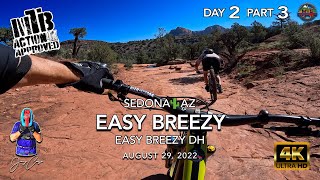
      youtuber MTB Riding Easy Breezy | SedonaAZ | August 29,...
      mtb
      11:14 | 332 | Sep 18, 2022 , Village Of Oak Creek
      'Easy Breezy DH! And Alternate Waterfall Drop...
      mtb
      2:35 | 604 | Jan 16, 2022 , Village Of Oak Creek

      Routes with this trail

      ★ 4.2 • 14 miles • 1,401 ft • 6 • Loop •
      This route gives you a little taste of the VOC (Village of Oak Creek). There are many more great trails in...
      ★ 4.0 • 10 miles • 1,317 ft • 12 • Loop •
      Hiline trail is a "must do" bucket list ride for the experienced rider. Even if you have to walk the...
      ★ 5.0 • 3 miles • 193 ft • 7 •
      This is a great directional route that offers the best introductory trails to Sedona. Great Views. Nice...
      4.1 ★★★★★
      42 Ratings
      5 ★ 36%
      4 ★ 48%
      3 ★ 12%
      2 ★ 2%
      1 ★ 2%

      14 Reviews & Comments

      Geegee6519 Geegee6519
      I’d have to say I have mixed feelings. For one, there are about 10 large wide river crossings (it was dry Oct 26) so you have alot of very loose huge boulders, rocks you just have to zoom across then up up up the other side. Don’t MTN bike if it’s rained recently those crossings wouldn’t be fun. In 2.3 miles you have lots of ROCK, chunky down not so bad climbing it sucks - LOL
      AndrewApnGjE
      No that fun except for the rock/slab sections at the top
      jayjaygur
      Both directions are great. Better than the east side of the road where it's all hikers

      We hope you've been enjoying Trailforks!

      Create a FREE account to view all trail reviews and much more.

      Nearby Trails

      • By toddTF Pro Trailforks & contributors
      • #14993 - 9,445 views

      Frequently Asked Questions

      ▼ Where is Easy Breezy located?
      Easy Breezy is located in Cathedral, Village Of Oak Creek, Arizona, United States. It is part of the Cathedral trail network. The trailhead is located at coordinates 34.80966, -111.76604.
      ▼ How hard is Easy Breezy?
      Easy Breezy is rated as Blue difficulty. The average grade is 0.9%.
      ▼ What is the elevation gain for Easy Breezy?
      Easy Breezy has 127 ft of elevation gain. The trail has 239 ft of elevation descent. The elevation ranges from 4,042 ft to 4,281 ft.
      ▼ Is Easy Breezy a point to point trail?
      Easy Breezy is not a point to point trail. The direction is Both Directions. The trail type is singletrack.
      ▼ How long is Easy Breezy?
      Easy Breezy is 2.2 miles long. The trail type is singletrack.
      ▼ Are dogs allowed on Easy Breezy?
      Yes, dogs are allowed on Easy Breezy. Please keep dogs on a leash where required and clean up after them.
      ▼ When is the best time of year to ride Easy Breezy?
      Based on activity log data, the most popular months to ride Easy Breezy are:
      • April (73 activities)
      • March (62 activities)
      • November (55 activities)
      Check the reports page for current trail conditions.
      ▼ How do I access Easy Breezy? Where is the closest parking trailhead?
      The closest parking and trailhead locations to Easy Breezy are: View all parking locations in the area.
      ▼ How long does it take to ride Easy Breezy?
      Based on recorded activities, it takes an average of 24 minutes to ride Easy Breezy. The trail is 2.2 miles long. Actual times will vary based on fitness level, conditions, and pace. View recent activity logs for more details.
      ▼ How busy is Easy Breezy?
      Easy Breezy is a moderately popular trail. There have been 3,009 recorded activities on this trail. The trail has received 3,087 check-ins. View recent activity on this trail.

      Hit the Trail

      Open in App

      Get this trail on your phone instantly.

      open trail in app

      Download Trail

      Save to wishlist, Garmin & download.
      save the trail

      Find Related Routes

      Find routes and users activities that include this trail.
      find routes for this trail

      You must enter a description before submitting.