2.2 miles
Distance
995 ft
Climb
-13 ft
Descent
00:30:48
Avg time
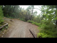
Gold Creek Details
-
Activities
- Mountain Bike
- E-Bike
- Horse
- Hike
- Trail Running
- Dirtbike/Moto
-
Riding AreaGreen Mountain
Bremerton, Washington -
Difficulty Rating
-
Voted DifficultyBlue (1 vote)
-
Trail TypeSingletrack
-
DirectionBoth DirectionsPopular in reverse
-
Climb DifficultyBlue
-
Physical RatingHard
-
Dogs AllowedYes
-
eBike AllowedYes up to Class 1
-
TTFs on TrailRock Garden
-
Global Ranking
-
Local Popularity95 in Mountain Biking [+]
- 95 in E-Biking
- 90 in Trail Running
- 100 in Hiking
- 45 in Dirtbiking
- 5 in Horseback
GREAT RIDE as an out and back Long, technical climb, but SUPER fun and fast coming back down!
Access Info
Park at Gold Creek trail head, proceed down trail in north end of parking lot, over first bridge look for turn up the hill before the second bridge, and get those pedaling legs ready!
Local Trail Association
-

-

-
Please consider joining or donating to the local trail association to supportdonate to earn trail karma!
trail development & maintenance.
Traditionally Indigenous Territory
More Stats for Gold Creek multi-use trail trail
-
Altitude change982 ft
-
Altitude min667 ft
-
Altitude max1,649 ft
-
Altitude start667 ft
-
Altitude end1,650 ft
-
Grade8.3%
-
Grade max-4.5%
-
Grade min27.2%
-
Distance climb2 miles
-
Distance down820 ft
-
Distance flat610 ft
-
Avg time00:30:48
-
Avg reverse time07:43:35
- view trail stats
close
-
Layers w
- Map Content
- More Layers
- Pro
- Pro
- Pro
- Pro
- Pro
- Pro
- Pro
- Pro
-
Upgrade to

3D
Trail Conditions
- Unknown
- Snow Groomed
- Snow Packed
- Snow Covered
- Snow Cover Partial
- Freeze/thaw Cycle
- Icy
- Prevalent Mud
- Wet
- Variable
- Ideal
- Dry
- Very Dry
Trail Flow (Ridden Direction)
Trailforks scans users ridelogs to determine the most popular direction each trail is ridden. A good flowing trail network will have most trails flowing in a single direction according to their intension.
The colour categories are based on what percentage of riders are riding a trail in its intended direction.
The colour categories are based on what percentage of riders are riding a trail in its intended direction.
- > 96%
- > 90%
- > 80%
- > 70%
- > 50%
- < 50%
- bi-directional trail
- no data
Trail Last Ridden
Trailforks scans ridelogs to determine the last time a trail was ridden.
- < 2 days
- < 1 week
- < 2 weeks
- < 1 month
- < 6 months
- > 6 months
Trail Ridden Direction
The intended direction a trail should be ridden.
- Downhill Only
- Downhill Primary
- Both Directions
- Uphill Primary
- Uphill Only
- One Direction
Contribute Details
Colors indicate trail is missing specified detail.
- Description
- Photos
- Description & Photos
- Videos
Trail Popularity ?
Trailforks scans ridelogs to determine which trails are ridden the most in the last 9 months.
Trails are compared with nearby trails in the same city region with a possible 25 colour shades.
Think of this as a heatmap, more rides = more kinetic energy = warmer colors.
- most popular
- popular
- less popular
- not popular
ATV/ORV/OHV Filter
Max Vehicle Width
inches
US Cell Coverage
Legend

Radar Time
x
Activity Recordings
Trailforks users anonymized public ridelogs from the past 6 months.
- mountain biking recent
- mountain biking (>6 month)
- hiking (1 year)
- moto (1 year)
Activity Recordings
Trailforks users anonymized public skilogs from the past 12 months.
- Downhill Ski
- Backcountry Ski
- Nordic Ski
- Snowmobile
Winter Trails
Warning
A routing network for winter maps does not exist. Selecting trails using the winter trails layer has been disabled.
x
Missing Trails
Most Popular
Least Popular
Trails are colored based on popularity. The more popular a trail is, the more red. Less popular trails trend towards green.
Jump Magnitude Heatmap
Heatmap of where riders jump on trails. Zoom in to see individual jumps, click circles to view jump details.
Trails Deemphasized
Trails are shown in grey.
Only show trails with NO bikes.
Save the current map location and zoom level as your default home location whenever this page is loaded.
Save
Directions to gold-creek trailhead
(47.551920, -122.826730)
update trails status or condition
Gold Creek Trail Reports
view all reports »
Recent Ridelog Activity on Trail
Past Week
- 0 rides
6 Months
- 31 rides
- 10 miles avg distance
All
- 489 rides
- Last: May 9, 2024


Photos
more »
Routes with this trail
Trail Products
5 Reviews & Comments
We hope you've been enjoying Trailforks!
Create a FREE account to view trail comments and much more.
Videos
more »

14:29 |
106 |
Jul 1, 2023 , Bremerton
5:46 |
789 |
Oct 30, 2012 , Bremerton

23:32 |
517 |
Aug 14, 2012 , Bremerton
Nearby Trails
- Tin Mine 3 ft
- Davis Trail 4,206 ft
- Tasi Connector 1 mile
- Plummer 2 miles
- Wildcat Trail 2 miles
- By travisdiller & contributors
- #60601 - 3,873 views
- follow/subscribe
- login to download gpx or kml files.
You must enter a description before submitting.