more stats
1.1 miles
Distance
89 ft
Climb
-93 ft
Descent
00:10:31
Avg time
-3 ft
Altitude change
731 ft
Altitude min
790 ft
Altitude max
763 ft
Altitude start
761 ft
Altitude end
-12.8%
Grade max
11.8%
Grade min
2,116 ft
Distance climb
2,182 ft
Distance down
1,401 ft
Distance flat
00:10:31
Avg time

Hacksaw Details

  • Activities
    • Mountain Bike
    • Hike
    • Trail Running
  • Riding Area
    Baileys Trail System
    Athens, Ohio
  • Difficulty Rating
  • Local Popularity
    65 in Mountain Biking [+]
    • 80 in Trail Running
    • 100 in Hiking
  • Global Ranking
    #140832 in Mountain Biking [+]
    • #122810 in Trail Running
    • #89353 in Hiking
  • State Ranking
    #364 in Mountain Biking · Ohio [+]
    • #958 in Trail Running
    • #927 in Hiking
  • Hiking SAC Scale
    T1 Hiking
  • Trail Type
    Singletrack
  • Bike Type
    AM, XC
  • Direction
    Both Directions
  • Climb Difficulty
    Blue
  • Physical Rating
    Hard
  • Trail Visibility
    Always easy to follow
  • Season
    April - December
  • Dogs Allowed
    Yes
  • eBike Allowed
  • Year Opened
    2020
  • Land Owner
  • OSM Way

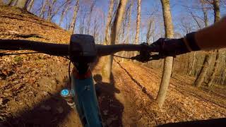
The first advanced (difficult) trail of the Baileys. Hacksaw is aptly named, as this trail is carved into the hillside with no shortage of tight, technical sections. Expect a very narrow trail tread full of roots, short steep pitches, and trees hugging the trail.

Access Info

On its west end, the trail connects to West Bailey Road near the bottom of Knights Labor Trail, to the east it connects near the bottom of Wild Turkey Trail to form a nice loop off of the north side of West Bailey Rd.

Tags
Trail Supporters
Local Trail Association

Recent Activity on Trail

Past Week
  • 0 rides
  •  
6 Months
  • 10 rides
  • 12 miles avg distance
All
  • 82 rides
  • Last: Sep 12, 2026
c1c2c3c4
January
February
March
April
May
June
July
August
September
October
November
December
update trails status or condition

Hacksaw Trail Reports

statusdatedescription
Oct 2, 2026 @ 12:39pm (America/New_York)
Oct 2, 2026
Massive rootball. Not difficult to navigate around but will require significant work to fix trail.
Jul 20, 2026 @ 4:48pm (America/New_York)
Jul 20, 2026
A few spots with overgrown vegetation.
Jun 5, 2026 @ 2:02pm (America/New_York)
Jun 5, 2026
Root ball tore out a section of trail. it's possible to ride through, but the gap in the canopy has left this area significantly brushy.
Apr 6, 2026 @ 12:58pm (America/New_York)
Apr 6, 2026
reporter The Baileys trail system is now OPEN to cyclists. Please be cautious of potentially wet conditions during spring weather.
Feb 23, 2026 @ 5:10pm (America/New_York)
Feb 23, 2026
Cleared numerous small branches. Trail tread in good shape, although still snow covered in spots on the backside by Wild Turkey. Some small seeps...
more »
Status:
on Oct 2, 2026
Avg: 2.81 (10 votes)
Your vote: 0

view (318)
close
      Directions to hacksaw trailhead (39.422990, -82.152500)

      Photos

      12 more »
      mtb
      54 |
      Apr 21, 2025 @ 8:14am
      Apr 21, 2025
      mtb
      56 |
      Oct 29, 2024 @ 10:56am
      Oct 29, 2024
      mtb
      185 |
      Dec 1, 2022 @ 6:46am
      Dec 1, 2022
      mtb
      148 |
      Dec 1, 2022 @ 6:46am
      Dec 1, 2022

      Videos

      1 more »
      Baileys - Hacksaw
      mtb
      4:22 | 836 | Apr 24, 2021 , Athens
      2.1 ★★★★★
      10 Ratings
      5 ★
      4 ★ 30%
      3 ★
      2 ★ 20%
      1 ★ 50%

      5 Reviews & Comments

      drainpipe drainpipe
      If you like technical problem solving on the fly, this is a fun trail. I did not have very much fun, but I can see how a tech trail masochist might.
      Danish8999
      This is my favorite trail of the 15mi i rode today. A masterclass in benching and using trees as gates and erosion protection.
      Elduder714
      This is one of the few here I don't really like. It is more dodging trees rather than skimming by them.

      We hope you've been enjoying Trailforks!

      Create a FREE account to view all trail reviews and much more.

      • By MaxLOLumeTF Pro & contributors
      • #347357 - 1,524 views

      Frequently Asked Questions

      ▼ Where is Hacksaw located?
      Hacksaw is located in Baileys Trail System, Athens, Ohio, United States. It is part of the Baileys Trail System trail network. The trailhead is located at coordinates 39.42299, -82.1525.
      ▼ How hard is Hacksaw?
      Hacksaw is rated as Black Diamond difficulty. The physical rating is Hard. The climb difficulty is rated Blue.
      ▼ What is the elevation gain for Hacksaw?
      Hacksaw has 89 ft of elevation gain. The trail has 93 ft of elevation descent. The elevation ranges from 731 ft to 790 ft.
      ▼ Is Hacksaw a point to point trail?
      Hacksaw is not a point to point trail. The direction is Both Directions. The trail type is singletrack.
      ▼ How long is Hacksaw?
      Hacksaw is 1.1 miles long. The trail type is singletrack.
      ▼ Are dogs allowed on Hacksaw?
      Yes, dogs are allowed on Hacksaw. Please keep dogs on a leash where required and clean up after them.
      ▼ When is the best time of year to ride Hacksaw?
      Hacksaw is best visited during: April - December.
      ▼ How do I access Hacksaw? Where is the closest parking trailhead?
      The closest parking and trailhead locations to Hacksaw are: View all parking locations in the area.
      ▼ How long does it take to ride Hacksaw?
      Based on recorded activities, it takes an average of 11 minutes to ride Hacksaw. The trail is 1.1 miles long. Actual times will vary based on fitness level, conditions, and pace. View recent activity logs for more details.
      ▼ How busy is Hacksaw?
      Hacksaw is a moderately popular trail. There have been 320 recorded activities on this trail. The trail has received 318 check-ins. View recent activity on this trail.

      Hit the Trail

      Open in App

      Get this trail on your phone instantly.

      open trail in app

      Download Trail

      Save to wishlist, Garmin & download.
      save the trail

      Find Related Routes

      Find routes and users activities that include this trail.
      find routes for this trail

      You must enter a description before submitting.