Supporters, Builders, Maintainers & Land Managers of Howler (mid) Trail
- Zander StrathearnBuilder
Howler (mid) Details
-
Activities
- Mountain Bike
- E-Bike
- Hike
- Trail Running
-
Riding AreaWestside - Rainbow
Whistler, British Columbia -
Difficulty Rating
-
Trail TypeSingletrack
-
Bike TypeAM, XC
-
DirectionDownhill PrimaryPopular direction shown
-
Climb DifficultyBlack Diamond
-
Physical RatingHard
-
Trail VisibilityAlways easy to follow
-
SeasonJun-Oct
-
Dogs AllowedYes
-
eBike AllowedYes up to Class 1
-
TTFs on TrailRock Face
-
Ride in RainYes
-
Global Ranking
-
Local Popularity70 in Mountain Biking [+]
- 70 in E-Biking
- 60 in Trail Running
- 50 in Hiking
-
Year Opened2013
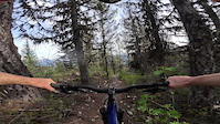
This section of the trail is located a long way up the flank trail, be prepared for a long sweaty climb. The midsection of Howler has many tight switchbacks but you can carry good speed if you take the high line into every corner. There are no major features, drops, or jumps, to catch you unawares. The rock up there, however, is sharp so bring spare tubes
Access Info
Starting from the very top of Alpine Way (no parking), climb Cultured Climb to Rick's Roost (name of the access road, not an actual trail) until you don't want to climb anymore. You will pass Cat Scratch Fever, Green Monster, and the Flank turn-off to Billy Epic. Keep going. Past the Flank, the trail mellows until you reach a big bridge over 19 mile creek. Shortly after the creek, you will pass the Skywalk Hiking trail on your left and you will see a motor-vehicle gate straight ahead, go through the gate and grind up the incredibly steep hill. Keep going until it mellows slightly and you see a large round boulder on the roadbed, the midsection of Howler starts from here on the right.
Local Trail Association
-
Please consider joining or donating to the local trail association to supportdonate to earn trail karma!
trail development & maintenance.
Traditionally Indigenous Territory
More Stats for Howler (mid) mountain bike trail trail
-
Altitude change-471 ft
-
Altitude min3,548 ft
-
Altitude max4,020 ft
-
Altitude start4,020 ft
-
Altitude end3,550 ft
-
Grade-23.1%
-
Grade max-50.9%
-
Grade min-5.8%
-
Distance down2,044 ft
-
Avg time00:06:36
-
Avg reverse time00:06:50
- view trail stats
- Unknown
- Snow Groomed
- Snow Packed
- Snow Covered
- Snow Cover Inadequate
- Freeze/thaw Cycle
- Icy
- Prevalent Mud
- Wet
- Variable
- Ideal
- Dry
- Very Dry
The colour categories are based on what percentage of riders are riding a trail in its intended direction.
- > 96%
- > 90%
- > 80%
- > 70%
- > 50%
- < 50%
- bi-directional trail
- no data
- < 2 days
- < 1 week
- < 2 weeks
- < 1 month
- < 6 months
- > 6 months
- Downhill Only
- Downhill Primary
- Both Directions
- Uphill Primary
- Uphill Only
- One Direction
- Description
- Photos
- Description & Photos
- Videos
- most popular
- popular
- less popular
- not popular
- mountain biking recent
- mountain biking (>6 month)
- hiking (1 year)
- moto (1 year)
- Downhill Ski
- Backcountry Ski
- Nordic Ski
- Snowmobile
Save the current map location and zoom level as your default home location whenever this page is loaded.
SaveHowler (mid) Trail Reports
Recent Ridelog Activity on Trail
Past Week
- 0 rides
6 Months
- 139 rides
- 13 miles avg distance
All
- 1,576 rides
- Last: Jun 28, 2022
Photos
Routes with this trail
Trail Products
-
WORCA Trail PassTrail Pass
3 Reviews & Comments
-
+ 1


Videos

Nearby Trails
- Rainbow-sproatt Flank 30 ft
- Howler (upper) 1,824 ft
- Howler (lower) 2,064 ft
- Prowler 4,544 ft
- North Flank Lookout 4,846 ft
- embed Howler (mid) trail on your website
- By HowlerContractingLimited
& contributors
- #236258 - 2,285 views
- subscribe
- login to download gpx or kml files.