
more stats
4.1 miles
Distance
1,644 ft
Climb
-57 ft
Descent
00:51:59
Avg time
1,588 ft
Altitude change
1,238 ft
Altitude min
2,854 ft
Altitude max
1,238 ft
Altitude start
2,825 ft
Altitude end
7.4%
Grade
-18.8%
Grade max
34.2%
Grade min
4 miles
Distance climb
1,496 ft
Distance down
794 ft
Distance flat
00:51:59
Avg time

King Castle Details

  • Activities
    • Mountain Bike
    • Adaptive Bike
    • Horse
    • Hike
    • Trail Running
  • Riding Area
    McKenzie River
    Eugene, Oregon
  • Ref Number
    #4326
  • Difficulty Rating
  • Voted Difficulty
    Blue (1 vote)
  • Local Popularity
    70 in Mountain Biking [+]
    • 65 in Trail Running
    • 5 in Hiking
    • 5 in Horseback
    • 5 in Adaptive Biking
  • Global Ranking
    #48105 in Mountain Biking [+]
    • #19879 in Trail Running
    • #22161 in Hiking
  • Trail Type
    Singletrack
  • Bike Type
    AM, XC, Adaptive MTB
  • Direction
    Both Directions
  • Climb Difficulty
    Black Diamond
  • Physical Rating
    Moderate
  • Season
    Spring - Fall
  • Dogs Allowed
    Yes
  • eBike Allowed
  • TTFs on Trail
    Berm, Rock Face
  • Land Owner
    USFS

Natural tread multiuse singletrack climbing or descending trail in the Willamette National Forest. Narrow bench cut singletrack at the top until the first road crossing at about the 1 mile point. Below that a newly-built section (as of 2016) with banked corners, armored roots and rocks covers most of the second mile of the trail. The remaining stretch of trail extends another 2.5 mi down to the lower trailhead, with stream crossings and a couple of rollable rock drops before it finally flattens out right at the trailhead. ***This trails wet weather resiliency is rapidly declining due to the repetitive use/abuse by shuttlers. Please DO NOT ride the trail in heavy rain, or right after. Heavy rutting and prevalent mud are now a regular thing during wet periods. It needs time to drain and dry out.*** Please stay on the trail and do not create new lines Camping at the trail heads is PROHIBITED AND POSTED! ***

Access Info

Access the top of the trail from Castle Rock above the USFS 480 Rd. The trail also crosses the USFS 480 Rd in its first mile. Access the bottom of the trail from E King Rd on the south side of the McKenzie River, just east of the covered bridge crossing in Rainbow.

Disclaimer

This trails wet weather resiliency is rapidly declining due to the repetitive use/abuse. Please DO NOT ride the trail in heavy rain, or right after. It needs time to drain and dry out. Please stay on the trail and do not create new lines. ***

Adaptive Bike Info
aMTB Black Rating: Advanced obstacles exist, some trail obstructions.

Plenty of exposed sidehill where adaptive riders will need support. Rock roll near bottom may require spotter. See aMTB3 recommended route.

Trail Supporters

  • USFS
    Land Manager
Local Trail Association
Traditionally Indigenous Territory

Recent Activity on Trail

Past Week
  • 1 rides
  • 22 miles average
6 Months
  • 23 rides
  • 16 miles avg distance
All
  • 168 rides
  • Last: Sep 12, 2026
c1c2c3c4
January
February
March
April
May
June
July
August
September
October
November
December
update trails status or condition

King Castle Trail Reports

statusdatedescription
Sep 13, 2026 @ 10:20am (America/Los_Angeles)
Sep 13, 2026
Aug 22, 2026 @ 5:05pm (America/Los_Angeles)
Aug 22, 2026
Jul 17, 2026 @ 10:29am (America/Boise)
Jul 17, 2026
Surface was perfect IMO, two days after a rain and things were great shape. Went as far as road, steep in some sections but overall a nice honest...
Apr 28, 2026 @ 2:22pm (America/Los_Angeles)
Apr 28, 2026
Running perfect.
Mar 22, 2026 @ 1:52pm (America/Boise)
Mar 22, 2026
more »
Status:
on Sep 13, 2026
Wet
Avg: 4.16 (25 votes)
Your vote: 0

view (1,135)
close
      Directions to king-castle trailhead (44.167810, -122.225260)

      Photos

      30 more »
      mtb
      751 |
      May 23, 2020 @ 9:09pm
      May 23, 2020
      mtb
      585 |
      Jun 21, 2018 @ 9:12am
      Jun 21, 2018
      mtb
      434 |
      May 23, 2020 @ 9:05pm
      May 23, 2020
      mtb
      487 |
      May 23, 2020 @ 9:06pm
      May 23, 2020

      Videos

      5 more »
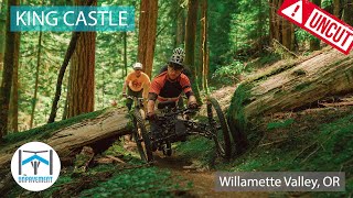
      King Castle UNCUT - Adaptive MTB
      mtb
      41:14 | 142 | Jan 16, 2025 , Eugene
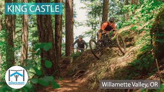
      King Castle - Adaptive MTB - Willamette Valley, OR
      mtb
      6:30 | 151 | Jan 16, 2025 , Eugene
      King Castle - Castle Rock - Rainbow, Oregon
      mtb
      23:17 | 695 | Mar 31, 2022 , Eugene
      King Castle | Rainbow, OR
      mtb
      7:41 | 454 | Nov 7, 2021 , Eugene

      Routes with this trail

      5.0 26 miles 6,191 ft 4 Loop
      This ride is the burly, backcountry loop with a short road connection to start. The O'Leary Trail Loop...
      4.0 17 miles 2,114 ft 4 Shuttled
      This is an alternate start to the North put-in and South put-in (Pat Saddle) for , to get you to O'Leary...
      10 miles 1,579 ft 2 Loop
      This route is intended for adaptive riders, but anyone can do it. It skips the first section of trail...
      4.2
      25 Ratings
      5 56%
      4 20%
      3 16%
      2 4%
      1 4%

      12 Reviews & Comments

      h2olove h2olove
      It’s a treasure trail. Such a beautiful place to be. As of March 7, 2025 there was about 7 down trees in the flow zone, some were small’ish. Tread was excellent the entire length of trail.
      Oldschool55 Oldschool55
      Really great downhill through stunning forest. Highly recommend starting at the trailhead and taking the pavement to Leary and getting to the top for a very satisfying loop.
      J50005 J50005
      Super fun PEDAL through old growths. I love to shuttle but this place is awful for it as there are plenty of uptight hikers and equestrians for even pedaling...it sucks for everyone if you shuttle. There's a few berms and side hits, no jumps or drops.

      We hope you've been enjoying Trailforks!

      Create a FREE account to view all trail reviews and much more.

      • By canadakaTF Pro Trailforks & contributors
      • #3384 - 12,665 views

      Frequently Asked Questions

      Where is King Castle located?
      King Castle is located in McKenzie River, Eugene, Oregon, United States. It is part of the McKenzie River trail network. The trailhead is located at coordinates 44.16781, -122.22526.
      How hard is King Castle?
      King Castle is rated as Blue difficulty. The physical rating is Moderate. The average grade is 7.4%. The climb difficulty is rated Black Diamond.
      What is the elevation gain for King Castle?
      King Castle has 1,644 ft of elevation gain. The trail has 57 ft of elevation descent. The elevation ranges from 1,238 ft to 2,854 ft.
      Is King Castle a point to point trail?
      King Castle is not a point to point trail. The direction is Both Directions. The trail type is singletrack.
      How long is King Castle?
      King Castle is 4.1 miles long. The trail type is singletrack.
      Are dogs allowed on King Castle?
      Yes, dogs are allowed on King Castle. Please keep dogs on a leash where required and clean up after them.
      When is the best time of year to ride King Castle?
      King Castle is best visited during: Spring - Fall.
      How do I access King Castle? Where is the closest parking trailhead?
      The closest parking and trailhead locations to King Castle are: View all parking locations in the area.
      How long does it take to ride King Castle?
      Based on recorded activities, it takes an average of 42 minutes to ride King Castle. The trail is 4.1 miles long. Actual times will vary based on fitness level, conditions, and pace. View recent activity logs for more details.
      How busy is King Castle?
      King Castle is a very popular trail. There have been 1,085 recorded activities on this trail. The trail has received 1,135 check-ins. View recent activity on this trail.

      Hit the Trail

      Open in App

      Get this trail on your phone instantly.

      open trail in app

      Download Trail

      Save to wishlist, Garmin & download.
      save the trail

      Find Related Routes

      Find routes and users activities that include this trail.
      find routes for this trail

      You must enter a description before submitting.