more stats
1,457 ft
Distance
-140 ft
Descent
00:03:46
Avg time
-140 ft
Altitude change
980 ft
Altitude min
1,120 ft
Altitude max
1,120 ft
Altitude start
981 ft
Altitude end
-9.6%
Grade
-40.7%
Grade max
-1.9%
Grade min
7 ft
Distance climb
1,378 ft
Distance down
69 ft
Distance flat
00:03:46
Avg time

King of the Shore Details

  • Activities
    • Mountain Bike
    • E-Bike
    • Hike
    • Trail Running
  • Riding Area
    Mount Fromme
    North Vancouver, British Columbia
  • Difficulty Rating
  • Voted Difficulty
    Green (1 vote)
  • Local Popularity
    95 in Mountain Biking [+]
    • 90 in E-Biking
    • 80 in Trail Running
    • 80 in Hiking
  • Global Ranking
    #17059 in Mountain Biking [+]
    • #3061 in E-Biking
    • #36372 in Trail Running
    • #36761 in Hiking
  • Trail Type
    Singletrack
  • Bike Type
    DH, AM
  • Direction
    Both Directions
    Popular In Reverse
  • Climb Difficulty
    Green
  • Physical Rating
    Easy
  • Dogs Allowed
    Yes
  • eBike Allowed
  • TTFs on Trail
    Bridge
  • Ride in Rain
    Yes
  • Land Owner
    District of North Vancouver

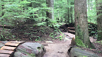
Another older trail with some bridging again mostly for making the trail easier. This trail can also be ridden up.

Access Info

Accessed from the water tower, it ends on Lower Griffon.

Trail Supporters
Local Trail Association

Recent Activity on Trail

Past Week
  • 26 rides
  • 9 miles average
6 Months
  • 786 rides
  • 9 miles avg distance
All
  • 6,641 rides
  • Last: Sep 22, 2026
c1c2c3c4
January
February
March
April
May
June
July
August
September
October
November
December
Status:
on Sep 21, 2026
Avg: 3.51 (35 votes)
Your vote: 0

view (37,540)
close
      Directions to king-shore trailhead (49.360690, -123.034430)

      Photos

      53 more »
      mtb
      297 |
      May 20, 2020 @ 7:07pm
      May 20, 2020
      mtb
      248 |
      Jun 12, 2018 @ 8:44pm
      Jun 12, 2018
      mtb
      46 |
      Jan 30, 2026 @ 9:59am
      Jan 30, 2026
      mtb
      48 |
      Jan 30, 2026 @ 9:59am
      Jan 30, 2026

      Videos

      3 more »
      King of the Shore & the MEC Grant
      mtb
      2530 | Sep 19, 2011 , North Vancouver
      Rock Roll
      mtb
      0:12 | 310 | Apr 16, 2022 , North Vancouver
      King of the shore fromme
      mtb
      2:05 | 541 | Aug 2, 2020 , North Vancouver

      Routes with this trail

      5.0 61 miles 9,228 ft 77 Loop
      NOW REPLACED WITH A BETTER VERSION AFTER A TEST RIDE...
      5.0 3 miles 740 ft 7 Loop
      This would be my daily work out...
      3.0 57 miles 9,062 ft 100 Loop
      A figure 8 loop trail with nearly 100km and nearly 10,000' (3048m) climbing in less than 10 hours 100...
      3.5
      35 Ratings
      5 9%
      4 37%
      3 43%
      2 11%
      1

      2 Reviews & Comments

      vepos
      Big black bear was on the trail last night. He was not keen to move on so be careful riding in this area.
      adove adove
      A good amount of work was done on October 26th by the Lynn Valley Bikes/NSMBA TAP volunteers at the bottom intersection with Lower Griffen. Very nice for climbing now!

      We hope you've been enjoying Trailforks!

      Create a FREE account to view all trail reviews and much more.

      • By canadakaTF Pro Trailforks & contributors
      • #145 - 17,497 views

      Frequently Asked Questions

      Where is King of the Shore located?
      King of the Shore is located in Mount Fromme, North Vancouver, British Columbia, Canada. It is part of the Mount Fromme trail network. The trailhead is located at coordinates 49.36069, -123.03443.
      How hard is King of the Shore?
      King of the Shore is rated as Green difficulty. The physical rating is Easy. The average grade is 9.6%. The climb difficulty is rated Green.
      What is the elevation gain for King of the Shore?
      The trail has 140 ft of elevation descent. The elevation ranges from 980 ft to 1,120 ft.
      Is King of the Shore a point to point trail?
      King of the Shore is not a point to point trail. The direction is Both Directions. The trail type is singletrack.
      How long is King of the Shore?
      King of the Shore is 1,457 ft long. The trail type is singletrack.
      Are dogs allowed on King of the Shore?
      Yes, dogs are allowed on King of the Shore. Please keep dogs on a leash where required and clean up after them.
      How do I access King of the Shore? Where is the closest parking trailhead?
      The closest parking and trailhead locations to King of the Shore are: View all parking locations in the area.
      How long does it take to ride King of the Shore?
      Based on recorded activities, it takes an average of 4 minutes to ride King of the Shore. The trail is 1,457 ft long. Actual times will vary based on fitness level, conditions, and pace. View recent activity logs for more details.
      How busy is King of the Shore?
      King of the Shore is a very popular trail. There have been 36,744 recorded activities on this trail. The trail has received 37,540 check-ins. View recent activity on this trail.

      Hit the Trail

      Open in App

      Get this trail on your phone instantly.

      open trail in app

      Download Trail

      Save to wishlist, Garmin & download.
      save the trail

      Find Related Routes

      Find routes and users activities that include this trail.
      find routes for this trail

      You must enter a description before submitting.