more stats
1,614 ft
Distance
-252 ft
Descent
00:05:22
Avg time
-252 ft
Altitude change
582 ft
Altitude min
834 ft
Altitude max
834 ft
Altitude start
581 ft
Altitude end
-15.6%
Grade
-64.5%
Grade max
-4.7%
Grade min
1,614 ft
Distance down
00:05:22
Avg time

Popper Details

  • Activities
    • Mountain Bike
    • E-Bike
    • Hike
    • Trail Running
  • Riding Area
    Cumberland trail network
    Cumberland, British Columbia
  • Difficulty Rating
  • Voted Difficulty
    Secondary Access Road/Trail (2 votes)
  • Local Popularity
    25 in Mountain Biking [+]
    • 30 in E-Biking
    • 35 in Trail Running
    • 45 in Hiking
  • Global Ranking
    #123758 in Mountain Biking [+]
    • #95950 in E-Biking
    • #123692 in Trail Running
    • #112980 in Hiking
  • Trail Type
    Singletrack
  • Direction
    Downhill Only
    Popular Direction Shown
  • Dogs Allowed
    Yes
  • eBike Allowed

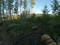
A fun downhill connector with some short steep pieces and bench cuts all connected with some nice twisty trail. Great way to get to Ogopogo from Fiscal Cliff. Also a great way to come of Nikkei Mtn combining Upper Rhizome/Banzai/Woodcutter Connector/Fiscal Cliff/Popper.

Local Trail Association

Recent Activity on Trail

Past Week
  • 0 rides
  •  
6 Months
  • 8 rides
  • 13 miles avg distance
All
  • 96 rides
  • Last: Jun 17, 2026
c1c2c3c4
January
February
March
April
May
June
July
August
September
October
November
December
update trails status or condition

Popper Trail Reports

statusdatedescription
Jun 17, 2026 @ 2:34pm (America/Vancouver)
Jun 17, 2026
Pretty brush
Mar 20, 2026 @ 3:32pm (America/Vancouver)
Mar 20, 2026
Mar 4, 2026 @ 3:02pm (America/Vancouver)
Mar 4, 2026
Trail is clear but take care on the lower steeps. Very very greasy
Apr 13, 2025 @ 9:20am
Apr 13, 2025
May 28, 2024 @ 6:55pm
May 28, 2024
She’s riding perfect! Enjoy it now while it’s not too dry!
more »
Status:
on Jun 17, 2026
Dry
Avg: 3.78 (8 votes)
Your vote: 0

view (495)
close
3D
Trail Conditions
  • Unknown
  • Snow Groomed
  • Snow Packed
  • Snow Covered
  • Snow Cover Partial
  • Freeze/thaw Cycle
  • Icy
  • Prevalent Mud
  • Wet
  • Variable
  • Ideal
  • Dry
  • Very Dry
Trail Flow (Ridden Direction)
Trailforks scans users ridelogs to determine the most popular direction each trail is ridden. A good flowing trail network will have most trails flowing in a single direction according to their intension.
The colour categories are based on what percentage of riders are riding a trail in its intended direction.
  • > 96%
  • > 90%
  • > 80%
  • > 70%
  • > 50%
  • < 50%
  • bi-directional trail
  • no data
Trail Last Ridden
Trailforks scans ridelogs to determine the last time a trail was ridden.
  • < 2 days
  • < 1 week
  • < 2 weeks
  • < 1 month
  • < 6 months
  • > 6 months
Trail Ridden Direction
The intended direction a trail should be ridden.
  • Downhill Only
  • Downhill Primary
  • Both Directions
  • Uphill Primary
  • Uphill Only
  • One Direction
Contribute Details
Colors indicate trail is missing specified detail.
  • Description
  • Photos
  • Description & Photos
  • Videos
Trail Popularity ?
Trailforks scans ridelogs to determine which trails are ridden the most in the last 9 months. Trails are compared with nearby trails in the same city region with a possible 25 colour shades. Think of this as a heatmap, more rides = more kinetic energy = warmer colors.
  • most popular
  • popular
  • less popular
  • not popular
ATV/ORV/OHV Filter
Max Vehicle Width
inches
US Cell Coverage
Legend
cell carrier legend

Radar Time
Activity Recordings
Trailforks uses anonymized public activity data. ?
Activity Recordings
Trailforks uses anonymized public activity data. ?
Personal Heatmap
Activity Types
all / none
Options
2
Date range month
Winter Trails
Warning A routing network for winter maps does not exist. Selecting trails using the winter trails layer has been disabled.
Missing Trails
Most Popular
Least Popular
Trails are colored based on popularity. The more popular a trail is, the more red. Less popular trails trend towards green.
Jump Magnitude Heatmap
Heatmap of where riders jump on trails. Zoom in to see individual jumps, click circles to view jump details.
BC Backroad Status

Service Road Atlas is a free to use, community-driven service for viewing and creating reports on the numerous back-country service roads around B.C. and Alberta.

map legend
Slope Aspect
Direction the slope faces
Flat N NE E SE S SW W NW
Trails Deemphasized
Trails are shown in grey.
disable
Only show trails with no bike usage.
Enable
Suggested Layers
Based on selected activity type

    Save the current map location and zoom level as your default home location whenever this page is loaded.

    Save
        Directions to popper trailhead (49.600670, -125.003360)

        Photos

        16 more »
        56 |
        Jun 16, 2023 @ 2:38pm
        Jun 16, 2023
        82 |
        Jun 16, 2023 @ 2:38pm
        Jun 16, 2023
        107 |
        Dec 18, 2020 @ 4:10pm
        Dec 18, 2020
        136 |
        Jun 22, 2020 @ 1:43am
        Jun 22, 2020

        Videos

        4 more »
        Popper (dbl black)
        5:14 | 103 | Aug 3, 2025 , Cumberland
        Popper
        4:57 | 76 | Mar 18, 2025 , Cumberland
        Popper
        3:29 | 714 | Mar 10, 2021 , Cumberland
        Popper
        3:28 | | Mar 10, 2021 , Cumberland

        Trail Lists

        Routes with this trail

        13 miles 2,218 ft 40
        fun littler looper around cumberlander

        3 Reviews & Comments


        We hope you've been enjoying Trailforks!

        Create a FREE account to view trail comments and much more.

        • By canadakaTF Pro Trailforks & contributors
        • #32655 - 3,009 views

        Frequently Asked Questions About Popper

        Where is Popper located?
        Popper is located in Cumberland trail network, Cumberland, British Columbia, Canada. It is part of the Cumberland trail network trail network. The trailhead is located at coordinates 49.60067, -125.00336.
        How hard is Popper?
        Popper is rated as Double Black Diamond difficulty. The average grade is 15.6%.
        What is the elevation gain for Popper?
        The trail has 252 ft of elevation descent. The elevation ranges from 582 ft to 834 ft.
        Is Popper a point to point trail?
        Yes, Popper is a point to point trail. The direction is Downhill Only. The trail type is singletrack.

        Hit the Trail

        Open in App

        Get this trail on your phone instantly.
        open trail in app

        Download Trail

        Save to wishlist, Garmin & download.
        save the trail

        Find Related Routes

        Find routes and users activities that include this trail.
        find routes for this trail

        You must enter a description before submitting.