

more stats
3,665 ft
Distance
66 ft
Climb
-79 ft
Descent
00:06:46
Avg time
-13 ft
Altitude change
396 ft
Altitude min
470 ft
Altitude max
409 ft
Altitude start
397 ft
Altitude end
-0.3%
Grade
-18.9%
Grade max
6%
Grade min
2,326 ft
Distance climb
932 ft
Distance down
407 ft
Distance flat
00:06:46
Avg time

Serra's Details

  • Activities
    • Mountain Bike
    • Gravel Bike
    • Horse
    • Hike
    • Trail Running
  • Riding Area
    Lower Seymour Conservation Reserve
    North Vancouver, British Columbia
  • Difficulty Rating
  • Local Popularity
    80 in Mountain Biking [+]
    • 90 in Trail Running
    • 75 in Hiking
    • 90 in Horseback
    • 95 in Gravel Biking
  • Global Ranking
    #125476 in Mountain Biking [+]
    • #53206 in Trail Running
    • #92859 in Hiking
    • #623 in Horseback
    • #5858 in Gravel Biking
  • Provincial Ranking
    #6,492 in Mountain Biking · British Columbia [+]
    • #2,920 in Trail Running
    • #4,949 in Hiking
    • #28 in Horseback
    • #412 in Gravel Biking
  • Trail Type
    Doubletrack
  • Bike Type
    XC, Gravel
  • Direction
    Both Directions[+]
    • Both Directions for Gravel Biking
  • Physical Rating
    Easy
  • Dogs Allowed
    Yes
  • TTFs on Trail
    Bridge
  • Land Owner

This used to be a rooty & muddle single track. But in 2013 it was gravelled over to become a multi-use trail. The difficulty is very beginner now.

Tags
BridgesRooty

Local Trail Association

Recent Activity on Trail

Past Week
  • 4 rides
  • 14 miles average
6 Months
  • 90 rides
  • 16 miles avg distance
All
  • 576 rides
  • Last: Oct 23, 2026
c1c2c3c4
January
February
March
April
May
June
July
August
September
October
November
December
update trails status or condition

Serra's Trail Reports

statusdatedescription
Mar 20, 2026 @ 2:41pm (America/Vancouver)
Mar 20, 2026
Tree down
Mar 7, 2026 @ 2:41pm (America/Vancouver)
Mar 7, 2026
Aug 3, 2025 @ 4:56pm
Aug 3, 2025
reporter Shout out to whoever added some rocks and dirt so you can easily get on and off the wood bridge
Jan 4, 2025 @ 10:44am
Jan 4, 2025
Tree
Sep 15, 2024 @ 6:05pm
Sep 15, 2024
Small tree down across trail, can ride over or around
more »
Status:
on Mar 20, 2026
Avg: 3.43 (10 votes)
Your vote: 0

view (5,793)
close
      Directions to serras trailhead (49.326430, -123.016640)

      Photos

      20 more »
      mtb
      113 |
      Aug 15, 2024 @ 10:57am
      Aug 15, 2024
      mtb
      131 |
      Aug 15, 2024 @ 10:57am
      Aug 15, 2024
      mtb
      117 |
      Aug 15, 2024 @ 10:57am
      Aug 15, 2024
      mtb
      72 |
      Aug 15, 2024 @ 10:57am
      Aug 15, 2024

      Videos

      1 more »
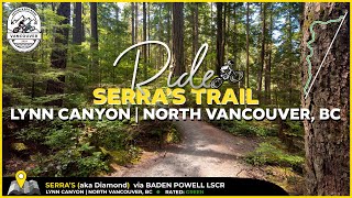
      Serra's XC Trail in North Vancouver.
      mtb
      9:30 | 124 | Aug 15, 2024 , North Vancouver

      Routes with this trail

      ★ 3.5 • 28 miles • 2,658 ft • 17 •
      Annual Group Ride Goes Solo For the past 4 years out of our house we have hosted friends for coffee,...
      26 miles • 2,409 ft • 23 • Loop •
      Time for the 8th annual CXMAS50! The "weather-can't-be-worse-than-last-year" edition. It is a longer group...
      2 miles • 269 ft • 2 •
      A nice loop to practice foundation skills on.
      3.1 ★★★★★
      10 Ratings
      5 ★
      4 ★ 30%
      3 ★ 50%
      2 ★ 20%
      1 ★

      6 Reviews & Comments

      Metric-MrShades
      Looks like they are in the process of upgrading this trail just like the Baden Powel LSCR section which connects to the north parking lot. Just one 30meter section of the original root & rock trail remains. Not a big deal to walk the bike if you need to.
      fasrides fasrides
      Our favourite starter trail. Beautiful scenery and smooth riding with some basic features to build kid/s confidence. Easier to double back on the trail than it is to ride up to north entrance on the road.
      bramski bramski
      Beautiful gravel double to single track. Some nice bridges too. Great for riding with your kids. Smoooooth.

      We hope you've been enjoying Trailforks!

      Create a FREE account to view all trail reviews and much more.

      • By canadakaTF Pro Trailforks & contributors
      • #2843 - 7,448 views

      Frequently Asked Questions

      ▼ Where is Serra's located?
      Serra's is located in Lower Seymour Conservation Reserve, North Vancouver, British Columbia, Canada. It is part of the Lower Seymour Conservation Reserve trail network. The trailhead is located at coordinates 49.32643, -123.01664.
      ▼ How hard is Serra's?
      Serra's is rated as White difficulty. The physical rating is Easy. The average grade is 0.3%.
      ▼ What is the elevation gain for Serra's?
      Serra's has 66 ft of elevation gain. The trail has 79 ft of elevation descent. The elevation ranges from 396 ft to 470 ft.
      ▼ Is Serra's a point to point trail?
      Serra's is not a point to point trail. The direction is Both Directions. The trail type is doubletrack.
      ▼ How long is Serra's?
      Serra's is 3,665 ft long. The trail type is doubletrack.
      ▼ Are dogs allowed on Serra's?
      Yes, dogs are allowed on Serra's. Please keep dogs on a leash where required and clean up after them.
      ▼ When is the best time of year to ride Serra's?
      Based on activity log data, the most popular months to ride Serra's are:
      • June (39 activities)
      • May (38 activities)
      • July (38 activities)
      Check the reports page for current trail conditions.
      ▼ How do I access Serra's? Where is the closest parking trailhead?
      The closest parking and trailhead locations to Serra's are: View all parking locations in the area.
      ▼ How long does it take to ride Serra's?
      Based on recorded activities, it takes an average of 7 minutes to ride Serra's. The trail is 3,665 ft long. Actual times will vary based on fitness level, conditions, and pace. View recent activity logs for more details.
      ▼ How busy is Serra's?
      Serra's is a very popular trail. There have been 5,435 recorded activities on this trail. The trail has received 5,793 check-ins. View recent activity on this trail.

      Hit the Trail

      Open in App

      Get this trail on your phone instantly.

      open trail in app

      Download Trail

      Save to wishlist, Garmin & download.
      save the trail

      Find Related Routes

      Find routes and users activities that include this trail.
      find routes for this trail

      You must enter a description before submitting.