more stats
1.6 miles
Distance
211 ft
Climb
-211 ft
Descent
00:11:51
Avg time
850 ft
Altitude min
925 ft
Altitude max
850 ft
Altitude start
850 ft
Altitude end
-22.2%
Grade max
19%
Grade min
3,573 ft
Distance climb
3,127 ft
Distance down
1,988 ft
Distance flat
00:11:51
Avg time

SW Loop Details

  • Activities
    • Mountain Bike
    • Hike
    • Trail Running
  • Riding Area
    Theodore Wirth Park
    Minneapolis, Minnesota
  • Difficulty Rating
  • Local Popularity
    90 in Mountain Biking [+]
    • 25 in Trail Running
    • 70 in Hiking
  • Global Ranking
    #51312 in Mountain Biking [+]
    • #125663 in Trail Running
    • #89687 in Hiking
  • Trail Type
    Singletrack
  • Bike Type
    AM
  • Direction
    One Direction
  • Climb Difficulty
    Blue
  • Physical Rating
    Moderate
  • Dogs Allowed
    Yes

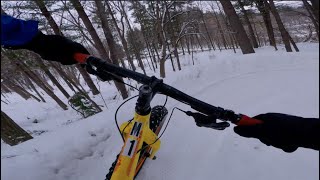
This is my favorite trail in the park. It starts off with some easy climbing and little whoops. Once to the top you drop down some big berms with great speed, and you have a couple optional little senders. The trail is well used so plenty of width but great singletrack and does not get overgrown as it is deep in the big pine trees. Perfect trail to do hotlaps.

Local Trail Association
Traditionally Indigenous Territory

Recent Activity on Trail

Past Week
  • 15 rides
  • 10 miles average
6 Months
  • 77 rides
  • 11 miles avg distance
All
  • 991 rides
  • Last: Jun 8, 2026
c1c2c3c4
January
February
March
April
May
June
July
August
September
October
November
December
update trails status or condition

SW Loop Trail Reports

Status:
on Jun 2, 2026
Ideal
Avg: 4.25 (14 votes)
Your vote: 0

view (13,237)
close
3D
Trail Conditions
  • Unknown
  • Snow Groomed
  • Snow Packed
  • Snow Covered
  • Snow Cover Partial
  • Freeze/thaw Cycle
  • Icy
  • Prevalent Mud
  • Wet
  • Variable
  • Ideal
  • Dry
  • Very Dry
Trail Flow (Ridden Direction)
Trailforks scans users ridelogs to determine the most popular direction each trail is ridden. A good flowing trail network will have most trails flowing in a single direction according to their intension.
The colour categories are based on what percentage of riders are riding a trail in its intended direction.
  • > 96%
  • > 90%
  • > 80%
  • > 70%
  • > 50%
  • < 50%
  • bi-directional trail
  • no data
Trail Last Ridden
Trailforks scans ridelogs to determine the last time a trail was ridden.
  • < 2 days
  • < 1 week
  • < 2 weeks
  • < 1 month
  • < 6 months
  • > 6 months
Trail Ridden Direction
The intended direction a trail should be ridden.
  • Downhill Only
  • Downhill Primary
  • Both Directions
  • Uphill Primary
  • Uphill Only
  • One Direction
Contribute Details
Colors indicate trail is missing specified detail.
  • Description
  • Photos
  • Description & Photos
  • Videos
Trail Popularity ?
Trailforks scans ridelogs to determine which trails are ridden the most in the last 9 months. Trails are compared with nearby trails in the same city region with a possible 25 colour shades. Think of this as a heatmap, more rides = more kinetic energy = warmer colors.
  • most popular
  • popular
  • less popular
  • not popular
ATV/ORV/OHV Filter
Max Vehicle Width
inches
US Cell Coverage
Legend
cell carrier legend

Radar Time
Activity Recordings
Trailforks uses anonymized public activity data. ?
Activity Recordings
Trailforks uses anonymized public activity data. ?
Personal Heatmap
Activity Types
all / none
Options
2
Date range month
Winter Trails
Warning A routing network for winter maps does not exist. Selecting trails using the winter trails layer has been disabled.
Missing Trails
Most Popular
Least Popular
Trails are colored based on popularity. The more popular a trail is, the more red. Less popular trails trend towards green.
Jump Magnitude Heatmap
Heatmap of where riders jump on trails. Zoom in to see individual jumps, click circles to view jump details.
BC Backroad Status

Service Road Atlas is a free to use, community-driven service for viewing and creating reports on the numerous back-country service roads around B.C. and Alberta.

map legend
Slope Aspect
Direction the slope faces
Flat N NE E SE S SW W NW
Trails Deemphasized
Trails are shown in grey.
disable
Only show trails with no bike usage.
Enable
Suggested Layers
Based on selected activity type

    Save the current map location and zoom level as your default home location whenever this page is loaded.

    Save
        Directions to sw-loop trailhead (44.977600, -93.326220)

        Photos

        10 more »
        31 |
        May 8, 2026 @ 7:34pm
        May 8, 2026
        30 |
        May 8, 2026 @ 7:33pm
        May 8, 2026
        227 |
        Aug 17, 2020 @ 9:31am
        Aug 17, 2020
        189 |
        Aug 26, 2018 @ 10:55am
        Aug 26, 2018

        Videos

        5 more »
        youtuber Sunrise and singletrack | Glenwood, SW Wirth...
        8:08 | 440 | Mar 4, 2020 , Minneapolis
        Fall ride on the Glenwood & Southwest...
        7:03 | 118 | Jun 6, 2023 , Minneapolis
        Fat/Snow Biking at Theodore Wirth Park...
        26:06 | 146 | Mar 3, 2023 , Minneapolis
        Theodore Wirth - SW Loop (Night Edition)
        12:24 | 190 | Feb 27, 2022 , Minneapolis

        Reviews / Comments

        No reviews yet, be the first to write a review or ask a question.
        Use trail reports to comment on trail conditions.


        We hope you've been enjoying Trailforks!

        Create a FREE account to view trail comments and much more.

        • By ZTBurton & contributors
        • #32105 - 4,260 views

        Frequently Asked Questions About SW Loop

        Where is SW Loop located?
        SW Loop is located in Theodore Wirth Park, Minneapolis, Minnesota, United States. It is part of the Theodore Wirth Park trail network. The trailhead is located at coordinates 44.9776, -93.32622.
        How hard is SW Loop?
        SW Loop is rated as Blue difficulty. The physical rating is Moderate. The climb difficulty is rated Blue.
        What is the elevation gain for SW Loop?
        SW Loop has 211 ft of elevation gain. The trail has 211 ft of elevation descent. The elevation ranges from 850 ft to 925 ft.
        Is SW Loop a point to point trail?
        Yes, SW Loop is a point to point trail. The direction is One Direction. The trail type is singletrack.

        Hit the Trail

        Open in App

        Get this trail on your phone instantly.
        open trail in app

        Download Trail

        Save to wishlist, Garmin & download.
        save the trail

        Find Related Routes

        Find routes and users activities that include this trail.
        find routes for this trail

        You must enter a description before submitting.