close
-
Layers w
- Weather Layers
- Pro
- Pro
- Pro
- Pro
- Pro
- Pro
- More Layers
- Pro
- Pro
- Pro
- Pro
-
Upgrade to

3D
Trail Conditions
- Unknown
- Snow Groomed
- Snow Packed
- Snow Covered
- Snow Cover Partial
- Freeze/thaw Cycle
- Icy
- Prevalent Mud
- Wet
- Variable
- Ideal
- Dry
- Very Dry
Trail Flow (Ridden Direction)
Trailforks scans users ridelogs to determine the most popular direction each trail is ridden. A good flowing trail network will have most trails flowing in a single direction according to their intension.
The colour categories are based on what percentage of riders are riding a trail in its intended direction.
The colour categories are based on what percentage of riders are riding a trail in its intended direction.
- > 96%
- > 90%
- > 80%
- > 70%
- > 50%
- < 50%
- bi-directional trail
- no data
Trail Last Ridden
Trailforks scans ridelogs to determine the last time a trail was ridden.
- < 2 days
- < 1 week
- < 2 weeks
- < 1 month
- < 6 months
- > 6 months
Trail Ridden Direction
The intended direction a trail should be ridden.
- Downhill Only
- Downhill Primary
- Both Directions
- Uphill Primary
- Uphill Only
- One Direction
Contribute Details
Colors indicate trail is missing specified detail.
- Description
- Photos
- Description & Photos
- Videos
Trail Popularity ?
Trailforks scans ridelogs to determine which trails are ridden the most in the last 9 months.
Trails are compared with nearby trails in the same city region with a possible 25 colour shades.
Think of this as a heatmap, more rides = more kinetic energy = warmer colors.
- most popular
- popular
- less popular
- not popular
ATV/ORV/OHV Filter
Max Vehicle Width
inches
US Cell Coverage
Legend

Radar Time
Activity Recordings
Trailforks uses anonymized public activity data.
?
Activity Recordings
Trailforks uses anonymized public activity data.
?
Personal Heatmap
▶
Activity Types
all
/
none
▶
Options
2
Date range
month
–
Winter Trails
Warning
A routing network for winter maps does not exist. Selecting trails using the winter trails layer has been disabled.
Missing Trails
Most Popular
Least Popular
Trails are colored based on popularity. The more popular a trail is, the more red. Less popular trails trend towards green.
Jump Magnitude Heatmap
Heatmap of where riders jump on trails. Zoom in to see individual jumps, click circles to view jump details.
BC Backroad Status
![map legend]()
Service Road Atlas is a free to use, community-driven service for viewing and creating reports on the numerous back-country service roads around B.C. and Alberta.

Slope Aspect
Direction the slope faces
Trails Deemphasized
Trails are shown in grey.
Only show trails with no bike usage.
Suggested Layers
Based on selected activity type
Save the current map location and zoom level as your default home location whenever this page is loaded.
SavePopular Trail Networks
view all areas »
No description for Austin has been added yet!
Login or register to submit one.
Activities Click to view
- Mountain Bike
1,159 trails
- E-Bike
1,148 trails
- Gravel Bike
106 trails
- Adaptive Bike
70 trails
- Horse
123 trails
- Hike
1,159 trails
- Trail Running
1,154 trails
- Dirtbike/Moto
49 trails
Region Details
- 53
- 247
- 452
- 305
- 51
Region Status
Open as of 3 daysStats
- Avg Trail Rating
- Trails (view details)
- 1,146
- Trails Mountain Bike
- 1,162
- Trails E-Bike
- 1,148
- Trails Gravel Bike
- 106
- Trails Adaptive Bike
- 70
- Trails Horse
- 123
- Trails Hike
- 1,159
- Trails Trail Running
- 1,154
- Trails Dirtbike/Moto
- 49
- Total Distance
- 485 miles
- Total Descent
- 28,467 ft
- Total Vertical
- 705 ft
- Highest Trailhead
- 1,124 ft
- Reports
- 4,607
- Photos
- 877
- Ridden Counter
- 191,240
Articles

Must Watch: The 30-Year History of Austin’s Most Iconic DIY Trails in '9th Street'
Mar 18, 2026 from pinkbike.com
Featuring Taj Mihelich, Chase Hawk, Joe Rich, and more, this award-winning documentary tracks the blood, sweat, and beers behind one of BMX's...
Sub Regions
-
Barkley Meadows Park
- 9
-
Barton Creek Greenbelt
- 4
- 12
- 21
- 10
-
Bauerle Ranch
- 12
- 7
-
Boggy Creek Greenbelt
- 5
- 1
-
Bull Creek Greenbelt
- 24
-
Copperfield Park
- 3
- 6
-
Country Club Creek Greenbelt
- 1
- 2
- 2
-
Dominion at Great Hills Park
- 11
-
East Boggy Creek Greenbelt
- 6
- 2
-
East Williamson Creek Greenbelt
- 1
- 2
-
Easton Park
- 40
- 1
-
Emma Long Metropolitan Park
- 4
- 8
-
Great Hills Neighborhood Park
- 7
-
Jester
- 30
- 1
-
Kendra Page Park
- 1
- 5
-
Lady Bird Lake
- 4
-
Little Walnut Creek Greenbelt
- 5
- 6
-
Mary Gay Maxwell Tract
- 1
-
Mary Moore Searight Metropolitan Park
- 8
- 13
- 6
- 3
-
McKinney Falls State Park
- 2
- 6
- 3
-
Mueller Parks Improved Trails
- 25
- 9
-
Onion Creek Metropolitan Park
- 4
- 85
- 3
-
Pace Bend
- 27
- 14
- 1
-
Red Bluffs Nature Preserve
- 2
- 20
-
Richard Moya Park
- 6
- 1
-
River Place
- 1
-
Roy G. Guerrero Colorado River Metro Park
- 9
- 4
-
South Austin Trail Network (SATN)
- 33
- 182
- 84
- 7
-
South Walnut Creek
- 6
- 8
- 4
-
St. Edwards Greenbelt
- 5
- 8
-
Steiner Ranch
- 12
- 14
- 3
-
Valburn
- 7
-
Walnut Creek Metropolitan Park
- 5
- 24
- 24
- 6
-
Waterloo Greenway
- 5
-
Yett Creek Neighborhood Park
- 1
- 5
Popular Austin Mountain Biking Trails
• 100 ★ 3.8 • 5,236 ft • 65 ft • 1,456 •
Popular blue difficulty singletrack. This multi-use trail can be used one direction. On average it takes 7 minutes to complete this trail.
• 100 ★ 4.6 • 1 mile • 62 ft • 1,446 •
The inner part of the trail is a nicely "bermed" easy to ride, well-packed dirt trail. It is great for a face-paced ride with lots of turns and very good cover from a hot Sun. The outer part has a few more rocks but is still mostly...
• 100 ★ 4.3 • 1 mile • 97 ft • 1,414 •
Highly rated popular blue difficulty singletrack. This multi-use trail can be used one direction. On average it takes 15 minutes to complete this trail.
• 100 ★ 4.0 • 640 ft • 0 ft • 1,412 •
Highly rated popular blue difficulty singletrack. This multi-use trail can be used both directions. On average it takes minutes to complete this trail.
• 100 ★ 3.5 • 1,647 ft • 5 ft • 1,338 •
Popular blue difficulty singletrack. This multi-use trail can be used both directions and has a moderate overall physical rating with a 5 ft blue climb. Trail visibility is always easy to follow. On average it takes 2 minutes to complete this trail.
• 100 ★ 4.0 • 2,854 ft • 15 ft • 1,334 •
Fast windy trail thru the trees. Very easy trail is good for new riders or kids. Watch for hikers and dogs because they have right of way. This trail is one of the slowest to dry out after a rain. Watch for large mud puddles in the flat...
• 80 ★ 3.7 • 3,366 ft • 52 ft • 1,297 •
Popular green difficulty singletrack. This multi-use trail can be used uphill primary. On average it takes 3 minutes to complete this trail.
Austin Mountain Bike Routes
★ 4.0 • 20 miles • 930 ft • 29 • Loop •
Chunky to smooth, climb to descend, this route has it all, including a few drops and jumps along the way,...
★ 2.0 • 10 miles • 571 ft • 10 • Loop •
This route starts and finishes at the main parking lot of the Walnut Creek Metropolitan Park. It is the...
★ 5.0 • 10 miles • 556 ft • 12 •
This loop hits the best of Pace Bend from to Tapework and Paleface. It also passes by the little skills...
★ 4.5 • 11 miles • 688 ft • 38 • Loop •
This popular intermediate route has almost no backtracking and is mostly all singletrack. All trails are...
★ 4.0 • 9 miles • 493 ft • 7 •
This is the official 2017 Enchilada Buffet Walnut Creek route.
★ 3.5 • 8 miles • 459 ft • 10 •
Route for ARR Cranksgiving at Pace Bend Park
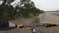
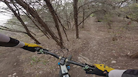
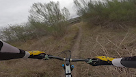
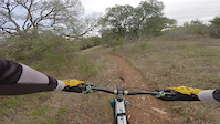
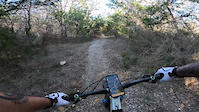
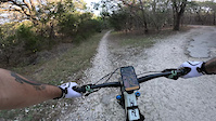
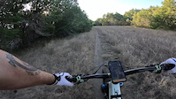
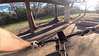
Photos of Austin Mountain Bike
Videos of Austin Mountain Bike
trail: Jungle Love
6:15 |
27 |
Dec 23, 2025
trail: Spine Drop & Step Up
0:09 |
14 |
Dec 23, 2025
trail: The Missing Link
2:17 |
2 |
Dec 23, 2025
trail: Bauerle Northside Climb
3:21 |
4 |
Dec 23, 2025
trail: Trail 18
0:34 |
5 |
Dec 23, 2025
trail: Mary's Gateway
0:48 |
8 |
Dec 23, 2025
trail: Paredes Middle School Trail
0:20 |
6 |
Dec 23, 2025
trail: Banco Rosado
0:28 |
2 |
Dec 23, 2025
Current Trail Warnings
| status | trail | date | condition | user | info |
|---|---|---|---|---|---|
| Chaparral Trail Loop | Jun 28, 2026 @ 10:34pm (America/Chicago) Jun 28, 2026 | Unknown | txmeowrider | Unable to reach | |
| Onion Bluff | Jun 28, 2026 @ 10:33pm (America/Chicago) Jun 28, 2026 | Unknown | txmeowrider | Overgrown weeds its not really rideable | |
| Ridge Bike Path | Jun 28, 2026 @ 8:47am (America/Chicago) Jun 28, 2026 | Unknown | txmeowrider | Was not able to access this route |
Recent Trail Reports
| status | trail | date | condition | info | user |
|---|---|---|---|---|---|
| Tangle of Trails Loop | Jul 5, 2026 @ 7:16pm (America/Chicago) 3 days | Unknown | txmeowrider | ||
| BMX Loop | Jul 5, 2026 @ 11:34am (America/Chicago) Jul 5, 2026 | Unknown | txmeowrider | ||
| Swim School | Jun 23, 2026 @ 9:49am (America/Chicago) Jun 23, 2026 | Unknown | Spidermap | ||
| Idiocracy | May 28, 2026 @ 1:17pm (America/Chicago) May 28, 2026 | Unknown | mikeEV | ||
| Terra 1 | May 20, 2026 @ 4:10pm (America/Chicago) May 20, 2026 | Dry | utanan01 | ||
| Ski Hill Flow Trail | May 18, 2026 @ 5:39pm (America/Matamoros) May 18, 2026 | Dry | cowboybradley | ||
| Detention Dam Trail | May 18, 2026 @ 5:39pm (America/Matamoros) May 18, 2026 | Dry | cowboybradley | ||
| Detention Dam Trail | May 18, 2026 @ 5:39pm (America/Matamoros) May 18, 2026 | Dry | cowboybradley | ||
| Powerline Flow Trail | May 18, 2026 @ 5:39pm (America/Matamoros) May 18, 2026 | Dry | cowboybradley | ||
| Detention Dam Trail | May 18, 2026 @ 5:39pm (America/Matamoros) May 18, 2026 | Dry | cowboybradley |
Activity Feed
| username | action | type | title | date |
|---|---|---|---|---|
| eladriank | wishlist | trail | activity #98732696 | Jul 8, 2026 @ 12:41pm 16 sec |
| utanan01 | ridden | trail | activity #98727284 and 4 more | Jul 8, 2026 @ 11:30am 1 hours |
| utanan01 | vote | trail | activity #98727281 and 4 more | Jul 8, 2026 @ 11:30am 1 hours |
| utanan01 | add | photo | activity #98726149 and 8 more | Jul 8, 2026 @ 11:15am 1 hours |
| mikeaycock1 | vote | trail | activity #98707388 | Jul 8, 2026 @ 6:05am 7 hours |
Recent Comments
| username | type | title | comment | date |
|---|---|---|---|---|
| report | boooo | Jul 6, 2026 @ 5:59pm 2 days | ||
| trail | Unkept trail, tried to ride it but its not... | Jun 27, 2026 @ 12:02pm Jun 27, 2026 | ||
| trail | I was not able to access this trail | Jun 27, 2026 @ 12:00pm Jun 27, 2026 | ||
| trail | There is a dog park along the north end of... | Jun 18, 2026 @ 11:52am Jun 18, 2026 | ||
| trail | This trail goes through a flood water tunnel... | Jun 2, 2026 @ 11:46am Jun 2, 2026 |
Local Badges
-

2021 SATN Lizardslayer4 awarded -

Completionist4 awarded -
Completionist2 awarded -
Completionist2 awarded -
Completionist0 awarded -
Completionist1 awarded
Bike & Skill Parks
| name | type | city | rating |
|---|---|---|---|
| Pump Track / Dirt Jumps | skill park | Austin | |
| Gaylord Sackler Memorial Skate Park | skill park | Austin | |
| The Austin Motocross Park | skill park | Austin | |
| Pace Bend Skills Area | skill park | Austin |
Activity Type Stats
| activitytype | trails | distance | descent | descent distance | total vertical | rating | global rank | state rank | photos | reports | routes | ridelogs |
|---|---|---|---|---|---|---|---|---|---|---|---|---|
| Mountain Bike | 1,159 | 463 miles | 26,503 ft | 148 miles | 705 ft | #26 | #8 | 740 | 4,611 | 80 | 187,813 | |
| E-Bike | 1,148 | 458 miles | 26,010 ft | 144 miles | 705 ft | #46 | #644 | 5 | 4,123 | 10 | 8,173 | |
| Gravel Bike | 106 | #13 | #610 | 53 | 39 | 3 | 1,308 | |||||
| Adaptive Bike | 70 | #92 | #1,407 | 8 | 1 | 9 | ||||||
| Horse | 123 | 21 miles | 528 ft | 4 miles | 292 ft | #256 | #441 | 11 | 780 | 2 | 3 | |
| Hike | 1,159 | 439 miles | 25,955 ft | 136 miles | 705 ft | #62 | #43 | 61 | 4,580 | 12 | 8,026 | |
| Trail Running | 1,154 | 439 miles | 25,804 ft | 136 miles | 705 ft | #71 | #40 | 3 | 4,580 | 9 | 14,796 | |
| Dirtbike/Moto | 49 | 26 miles | 1,883 ft | 11 miles | 407 ft | #446 | #158 | 770 | 25 |
Frequently Asked Questions About Austin
▼
What are the best places to ride in Austin?
Austin has 38 areas to explore for mountain biking. The top rated areas are:
▼
What are the highest rated mountain biking trails in Austin?
The highest rated mountain biking trails in Austin are:
- Inner Log Loops (4.4/5)
- Thumper Trail (4.4/5)
- Mark's Art (4.3/5)
- Access (4.3/5)
- E Spank (4.3/5)
▼
What is the best time of the year to ride in Austin?
Based on ride log data, the most popular months to ride in Austin are:
- July (1,446 activities)
- October (1,139 activities)
- August (1,043 activities)
▼
Where can I park to ride in Austin?
There are 72 parking locations listed in Austin. The most popular parking spots are: View all parking and trailhead locations on the map to plan your visit.
Activities
Trails
- By Larsacus
 TRAILFORKS & contributors
 - Admins: ARR, mtbatx
- #3704 - 73,871 views
- austin activity log | embed map of Austin mountain bike trails | austin mountain biking points of interest polygons
Downloading of trail gps tracks in kml & gpx formats is enabled for Austin.
You must login to download files.