


more stats
1.3 miles
Distance
3 ft
Climb
-678 ft
Descent
00:10:24
Avg time
-677 ft
Altitude change
834 ft
Altitude min
1,514 ft
Altitude max
1,511 ft
Altitude start
833 ft
Altitude end
-10.2%
Grade
-30%
Grade max
3%
Grade min
128 ft
Distance climb
1 mile
Distance down
433 ft
Distance flat
00:10:24
Avg time

Double D Details

  • Activities
    • Mountain Bike
    • E-Bike
  • Riding Area
    Mount Tzouhalem
    Duncan, British Columbia
  • Difficulty Rating
  • Voted Difficulty
    Blue (2 votes)
  • Local Popularity
    100 in Mountain Biking [+]
    • 100 in E-Biking
  • Global Ranking
    #185 in Mountain Biking [+]
    • #1622 in E-Biking
  • Trail Type
    Singletrack
  • Bike Type
    AM
  • Direction
    Downhill Only
    Popular Direction Shown
  • Physical Rating
    Moderate
  • Trail Visibility
    Always easy to follow
  • Dogs Allowed
    Yes
  • eBike Allowed
    Yes up to Class 1
  • TTFs on Trail
    Berm, Bridge, Jump, Gap Jump
  • Ride in Rain
    Yes
  • Land Owner
    Municipality of North Cowichan

DD is one of the finest flow trails on the island. Bike park smooth for the most part, there are a few steep gnar sections and rooty corners that will keep you honest. I counted about 34 bermed or built up turns, at least 12 booters, and 2 bridges. You can maintain the flow about 50m past the bridge at the trail end with a left turn onto a new-ish flow trail that goes all the way down to the main parking lot.
Props to Dom and his team who made this trail happen.

Local Trail Association

Recent Activity on Trail

Past Week
  • 10 rides
  • 9 miles average
6 Months
  • 557 rides
  • 10 miles avg distance
All
  • 4,936 rides
  • Last: Sep 19, 2026
c1c2c3c4
January
February
March
April
May
June
July
August
September
October
November
December
update trails status or condition

Double D Trail Reports

statusdatedescription
Sep 4, 2026 @ 2:56pm (America/Vancouver)
Sep 4, 2026
reporter Thanks CTSS for starting work on rebuilding the berms after a long summer drought
Aug 17, 2026 @ 10:37am (America/Vancouver)
Aug 17, 2026
Bombed out.
Aug 15, 2026 @ 11:43am (America/Vancouver)
Aug 15, 2026
Trust me save your time. It’s so destroyed and has huge pot holes
Aug 11, 2026 @ 7:48pm (America/Vancouver)
Aug 11, 2026
Clapped. Crazy bomb holes.
Aug 3, 2026 @ 3:23pm (America/Vancouver)
Aug 3, 2026
more »
Status:
on Sep 4, 2026
Dry
Avg: 4.57 (104 votes)
Your vote: 0

view (23,818)
close
      Directions to double-d trailhead (48.780170, -123.618090)

      Photos

      108 more »
      mtb
      1,387 |
      Feb 4, 2015 @ 9:15am
      Feb 4, 2015
      mtb
      1,015 |
      Feb 14, 2015 @ 9:07am
      Feb 14, 2015
      mtb
      707 |
      Apr 27, 2015 @ 9:45pm
      Apr 27, 2015
      mtb
      111 |
      Sep 3, 2025 @ 11:20am
      Sep 3, 2025

      Videos

      83 more »
      youtuber Double D &  Axe Hole -- Mt. Tzouhalem -...
      mtb
      5:15 | 1203 | Mar 12, 2022 , Duncan
      youtuber The Best Flow Trail on Vancouver Island?  (Day...
      mtb
      14:40 | 144 | Aug 14, 2025 , Duncan
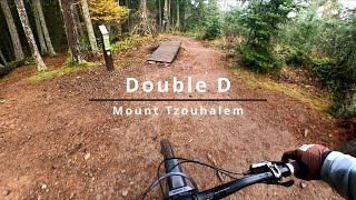
      DOUBLE D | My FAVORITE Trail at Mt Tzouhalem
      mtb
      4:45 | 324 | Nov 29, 2025 , Duncan
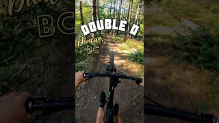
      Double D - Duncan, BC - MTB TRAIL...
      mtb
      0:56 | 207 | Aug 24, 2025 , Duncan

      Trail Lists

      Routes with this trail

      3.5 30 miles 4,492 ft 21
      part one of 2 sections. Tzouhalem flow is the most singletrack climbing with the fastest enduro style...
      4.3 15 miles 3,238 ft 23
      BCBR 2025 Stage 3 Mt Tzouhalem. A grand tour of a locals classic here on the rock.
      5.0 13 miles 3,058 ft 14
      Start: Nevilane Parking Lot: Stage 1: to Stage 2: Full Finality Stage 3: Full Showtime to Middle Stage 4:...
      4.6
      103 Ratings
      5 76%
      4 16%
      3 4%
      2 3%
      1 2%

      11 Reviews & Comments

      tdeems tdeems
      I imagine it rips when in good shape, but in August it was clapped. Good berms for the first half, then you get a few jumps. Never have I seen a caution sign for a rollable table. And then no sign for a blind takeoff.
      BriOctane78 BriOctane78
      Was open below M-One 3 days ago, Oct 3 2024
      Clairestar
      Bottom half of double d is under trail maintenance

      We hope you've been enjoying Trailforks!

      Create a FREE account to view all trail reviews and much more.

      • By Tekmisfit & contributors
      • #2541 - 28,572 views

      Frequently Asked Questions

      Where is Double D located?
      Double D is located in Mount Tzouhalem, Duncan, British Columbia, Canada. It is part of the Mount Tzouhalem trail network. The trailhead is located at coordinates 48.78017, -123.61809.
      How hard is Double D?
      Double D is rated as Blue difficulty. The physical rating is Moderate. The average grade is 10.2%.
      What is the elevation gain for Double D?
      Double D has 3 ft of elevation gain. The trail has 678 ft of elevation descent. The elevation ranges from 834 ft to 1,514 ft.
      Is Double D a point to point trail?
      Yes, Double D is a point to point trail. The direction is Downhill Only. The trail type is singletrack.
      How long is Double D?
      Double D is 1.3 miles long. The trail type is singletrack.
      Are dogs allowed on Double D?
      Yes, dogs are allowed on Double D. Please keep dogs on a leash where required and clean up after them.
      When is the best time of year to ride Double D?
      Based on activity log data, the most popular months to ride Double D are:
      • July (283 activities)
      • June (274 activities)
      • May (246 activities)
      Check the reports page for current trail conditions.
      How do I access Double D? Where is the closest parking trailhead?
      The closest parking and trailhead locations to Double D are: View all parking locations in the area.
      How long does it take to ride Double D?
      Based on recorded activities, it takes an average of 10 minutes to ride Double D. The trail is 1.3 miles long. Actual times will vary based on fitness level, conditions, and pace. View recent activity logs for more details.
      How busy is Double D?
      Double D is a very popular trail. There have been 20,947 recorded activities on this trail. The trail has received 23,818 check-ins. View recent activity on this trail.

      Hit the Trail

      Open in App

      Get this trail on your phone instantly.

      open trail in app

      Download Trail

      Save to wishlist, Garmin & download.
      save the trail

      Find Related Routes

      Find routes and users activities that include this trail.
      find routes for this trail

      You must enter a description before submitting.