
close
3D
Trail Conditions
- Unknown
- Snow Groomed
- Snow Packed
- Snow Covered
- Snow Cover Partial
- Freeze/thaw Cycle
- Icy
- Prevalent Mud
- Wet
- Variable
- Ideal
- Dry
- Very Dry
Trail Flow (Ridden Direction)
Trailforks scans users activity logs to determine the most popular direction each trail is ridden. A good flowing trail network will have most trails flowing in a single direction according to their intension.
The colour categories are based on what percentage of users are riding a trail in its intended direction.
The colour categories are based on what percentage of users are riding a trail in its intended direction.
- > 96%
- > 90%
- > 80%
- > 70%
- > 50%
- < 50%
- bi-directional trail
- no data
Trail Last Used
Trailforks scans activity logs to determine the last time a trail was ridden.
- < 2 days
- < 1 week
- < 2 weeks
- < 1 month
- < 6 months
- > 6 months
Trail Ridden Direction
The intended direction a trail should be ridden.
- Downhill Only
- Downhill Primary
- Both Directions
- Uphill Primary
- Uphill Only
- One Direction
Contribute Details
Colors indicate trail is missing specified detail.
- Description
- Photos
- Description & Photos
- Videos
Trail Popularity ?
Trailforks scans activity logs to determine which trails are ridden the most in the last 9 months.
Trails are compared with nearby trails in the same city region with a possible 25 colour shades.
Think of this as a heatmap, more activities = more kinetic energy = warmer colors.
- most popular
- popular
- less popular
- not popular
ATV/ORV/OHV Filter
Max Vehicle Width
inches
US Cell Coverage
Legend

Radar Time
Activity Recordings
Trailforks uses anonymized public activity data.
?
Activity Recordings
Trailforks uses anonymized public activity data.
?
Winter Trails
Warning
A routing network for winter maps does not exist. Selecting trails using the winter trails layer has been disabled.
Missing Trails
Most Popular
Least Popular
Trails are colored based on popularity. The more popular a trail is, the more red. Less popular trails trend towards green.
Jump Magnitude Heatmap
Heatmap of where users jump on trails. Zoom in to see individual jumps, click circles to view jump details.
BC Backroad Status
![map legend]()
Service Road Atlas is a free to use, community-driven service for viewing and creating reports on the numerous back-country service roads around B.C. and Alberta.

Slope Aspect
Direction the slope faces
Trails Deemphasized
Trails are shown in grey.
Only show trails with no bike usage.
Suggested Layers
Based on selected activity type
Save the current map location and zoom level as your default home location whenever this page is loaded.
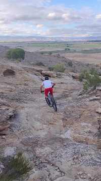
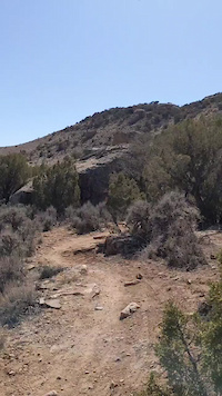
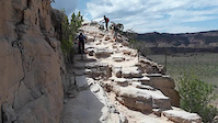
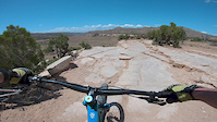
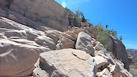
SaveLoma trails and routes are listed on Trailforks with interactive trail maps, difficulty ratings, photos, and user-reported trail conditions. The Trailforks community has shared hundreds of photos from this region. Supported activity types include Hiking, Trail Running, Mountain Biking, Adaptive Biking, Gravel Biking and Winter Fat Biking. Trails here are often flowy, hike-a-bike in places and exposed. Scenery includes views and ridgelines. Common trail features include berms, drops and rock slabs. Popular destinations include Kokopelli Loops.
This is an auto-generated description of Loma.
Login or register to submit a custom description.
Trail info last updated
Activities Click to view
- Mountain Bike
46 trails
- Gravel Bike
20 trails
- Adaptive Bike
23 trails
- Winter Fat Bike
7 trails
- Hike
47 trails
- Trail Running
47 trails
Region Details
- 10
- 1
- 11
- 16
- 6
- 2
Region Status
Open as of Oct 27, 2026Stats
- Avg Trail Rating
- Trails (view details)
- 47
- Trails Mountain Bike
- 46
- Trails Gravel Bike
- 20
- Trails Adaptive Bike
- 23
- Trails Winter Fat Bike
- 7
- Trails Horse
- 2
- Trails Hike
- 47
- Trails Trail Running
- 47
- Total Distance
- 66 miles
- Total Descent
- 7,965 ft
- Total Vertical
- 1,301 ft
- Highest Trailhead
- 5,730 ft
- Reports
- 1,097
- Photos
- 520
- Completed Counter
- 25,338
Articles
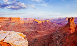
Why Moab Is Even Better Than You’ve Heard
Sep 10, 2025 from outsideonline.com
Visiting Moab is an adventurer’s rite of passage. Here’s how to make the most of a trip to Utah’s adventure wonderland

Video: Attempting the Kokopelli & White Rim Trails in A Single 310 Mile Ride with 25,000 Feet of Climbing
Oct 22, 2024 from pinkbike.com
310 miles, 25,000 feet of climbing, one ride, what could go wrong... Ryan Standish takes on two iconic trails.
Sub Regions
-
Kokopelli Loops
- 1
- 11
- 16
- 6
- 2
Popular Loma Mountain Biking Trails
• 90 ★ 4.6 • 4 miles • 482 ft • 6,232 •
This trail is a must for riding at the Kokopelli trails. The descent from Mary’s is typically hike-a-bike, or a super-challenge for you downhill junkies. Drop down onto the single track and experience fast-flowy riding with several...
• 80 ★ 3.8 • 344 ft • 0 ft • 5,469 •
The Horsetheif drop is a classic terror ride, if you choose to ride it- most don't. It's a rigorous dive from the canyon rim down to the bench, with 2-4 ft vertical drops. Is it worth the hike down to ride the bench trail? Unequivocally...
• 90 ★ 3.0 • 1,201 ft • 31 ft • 5,295 •
Popular blue difficulty singletrack. This mountain bike primary trail. Adaptive MTB rating: amtb green. On average it takes 1 minutes to complete this trail.
• 80 ★ 4.3 • 1 mile • 112 ft • 4,302 •
This section of Mary's sports fun single-track along the rim, providing excellent views if you can handle stopping to see them! Be aware of the gate, short but steep climbs, and hand-build rock obstacles intended to challenge even the...
• 100 ★ 4.1 • 3 miles • 315 ft • 3,894 •
A short but tough climb up Mary’s will take you to some fast double-track followed by fun single track. Awesome views of the Colorado River greet you whether you’re doing an out-and-back or connecting to Horsethief , Steve’s or...
• 90 ★ 4.5 • 4 miles • 292 ft • 3,595 •
Rustler’s Loop is a fantastic ride for all skill levels. Intended to be rideable for beginners there are several technique-education signs along the route. But don’t be dissuaded if you feel your skills might be wasted on an...
• 75 ★ 3.8 • 3 miles • 430 ft • 2,832 •
For the majority of Wrangler and its various connectors you'll experience fast-flat and sandy single-track. Only the farthest-west section offers significant challenges. Use Wrangler as a fun connector to Mary's, or as an add-on for...
• 70 ★ 3.4 • 4,350 ft • 254 ft • 2,689 •
This beautiful section of trail climbs from Mary's loop to Steve's, both scenic to the extreme. There is at least one built obstacle that might distract you from the beauty. The single-track is well-packed, easy to follow and provides...
Loma Mountain Bike Routes
Kokopelli (More Singletrack Route) Featured
★ 3.4 • 138 miles • 15,334 ft • 8 • Point to Point •
The Kokopelli Trail is a classic route from the Kokopelli Trail system in Fruita Colorado to the famous...
★ 3.7 • 22 miles • 2,714 ft • 7 • Loop •
The Kokopelli trail network has a little bit of everything from slow tech to fast flow and now thanks to...
★ 4.5 • 14 miles • 1,440 ft • 9 •
Pack lots of snacks for this ride. Much of this route is on fast and flowy singletrack, but don't be...
★ 5.0 • 7 miles • 679 ft • 6 •
This route is intended for adaptive riders. There is a turnaround when things get tight on Mary's and is...
18 miles • 2,231 ft • 5 • Loop •
18 miles, moderately strenuous, catches Horsethief Bench and Hawkeye
Photos of Loma Mountain Bike
Videos of Loma Mountain Bike


Recent Trail Reports
| status | trail | date | condition | info | user |
|---|---|---|---|---|---|
| Wrangler | Oct 27, 2026 @ 11:59am (America/Denver) Oct 27, 2026 | Unknown | klholub | ||
| Wrangler Connector | Oct 27, 2026 @ 11:41am (America/Denver) Oct 27, 2026 | Unknown | klholub | ||
| Marys | Oct 27, 2026 @ 11:29am (America/Denver) Oct 27, 2026 | Unknown | klholub | ||
| Hawkeye | May 21, 2026 @ 9:38am (America/Denver) May 21, 2026 | Dry | J4m3z420 SCoMBA | ||
| Mack Ridge (Center) | May 21, 2026 @ 9:38am (America/Denver) May 21, 2026 | Dry | J4m3z420 SCoMBA | ||
| Mack Ridge (West) | May 21, 2026 @ 9:38am (America/Denver) May 21, 2026 | Dry | J4m3z420 SCoMBA | ||
| Troy Built Upper | May 21, 2026 @ 9:38am (America/Denver) May 21, 2026 | Dry | J4m3z420 SCoMBA | ||
| Troy Built | May 21, 2026 @ 9:38am (America/Denver) May 21, 2026 | Dry | J4m3z420 SCoMBA | ||
| Access | May 21, 2026 @ 9:38am (America/Denver) May 21, 2026 | Dry | J4m3z420 SCoMBA | ||
| Saddle Down | Apr 25, 2026 @ 10:00am (America/Denver) Apr 25, 2026 | Dry | jt3mtb |
Activity Feed
| username | action | type | title | date |
|---|---|---|---|---|
| ilovebabasperogies | wishlist | region | activity #107634279 | Nov 11, 2026 @ 5:09pm 2 days |
| Ec9291 | wishlist | region | activity #107609256 | Nov 11, 2026 @ 10:59am 3 days |
| lanemajors | vote | trail | activity #107605450 | Nov 11, 2026 @ 10:04am 3 days |
| lanemajors | ridden | trail | activity #107564715 and 2 more | Nov 10, 2026 @ 3:24pm Nov 10, 2026 |
| jeremystclair | wishlist | route | activity #107539807 | Nov 10, 2026 @ 7:38am Nov 10, 2026 |
Recent Comments
| username | type | title | comment | date |
|---|---|---|---|---|
| trail | Why not? Because it is hard? Lion's... | Oct 21, 2026 @ 9:02am Oct 21, 2026 | ||
| trail | Kind of a grind, nice views though | Oct 19, 2026 @ 6:45pm Oct 19, 2026 | ||
| trail | Not the best way up. Where is the best way up?... | Oct 19, 2026 @ 6:43pm Oct 19, 2026 | ||
| report | Nbb zhdzzz di | Oct 17, 2026 @ 12:09pm Oct 17, 2026 | ||
| trail | One of the only trails in the whole valley... | Oct 5, 2026 @ 10:17am Oct 5, 2026 |

Activity Type Stats
| activitytype | trails | distance | descent | descent distance | total vertical | rating | global rank | state rank | photos | reports | routes | activity logs |
|---|---|---|---|---|---|---|---|---|---|---|---|---|
| Mountain Bike | 46 | 62 miles | 7,595 ft | 26 miles | 955 ft | #526 | #16 | 518 | 1,093 | 24 | 34,401 | |
| Gravel Bike | 20 | 24 miles | 2,211 ft | 11 miles | 886 ft | #2,280 | #59 | 123 | 188 | |||
| Adaptive Bike | 23 | 30 miles | 2,910 ft | 13 miles | 886 ft | #2,039 | #30 | 2 | 433 | 1 | 3 | |
| Winter Fat Bike | 7 | 5 miles | 433 ft | 2 miles | 751 ft | #3,115 | #35 | 182 | 2 | |||
| Horse | 2 | 9 miles | 1,083 ft | 5 miles | 584 ft | 209 | 3 | |||||
| Hike | 47 | 66 miles | 7,966 ft | 27 miles | 1,302 ft | #4,205 | #90 | 1,089 | 2 | 550 | ||
| Trail Running | 47 | 66 miles | 7,966 ft | 27 miles | 1,302 ft | #3,524 | #77 | 1,089 | 3 | 436 |
Frequently Asked Questions
▼
What are the best places to ride in Loma?
Loma has 1 areas to explore for mountain biking. The top rated areas are:
▼
What are the highest rated mountain biking trails in Loma?
The highest rated mountain biking trails in Loma are:
- Horsethief Bench (4.5/5)
- Rustlers Loop (4.4/5)
- Mary's Loop (4.2/5)
- Hawkeye (4.2/5)
- Steves Loop (4.2/5)
▼
Where can I park to ride in Loma?
There are 9 parking locations listed in Loma. The most popular parking spots are: View all parking and trailhead locations on the map to plan your visit.
▼
What is the longest trail in Loma?
The longest trail in Loma is Moore Fun at 4.5 miles. View all trails sorted by distance.
▼
What are the best & highest rated hiking trails in Loma?
The best hiking trails in Loma are: View all hiking trails sorted by popularity score.
▼
What are the best & highest rated trail running trails in Loma?
The best trail running trails in Loma are: View all trail running trails sorted by popularity score.
▼
How many trails are in Loma?
Loma has a total of 47 trails. Of those, 46 are designated for mountain biking. Browse top mountain biking trails in Loma to find detailed information including difficulty ratings, distances, and trail conditions.
▼
Which trail has the most elevation gain in Loma?
The trail with the most elevation gain in Loma is Moore Fun with 906 ft of elevation gain. View all trails sorted by elevation gain.
▼
Which trail has the most elevation descent in Loma?
The trail with the most elevation descent in Loma is Steves Loop with 719 ft of elevation descent. View all trails sorted by elevation descent.
▼
What activities are most popular in Loma?
Loma supports the following activities: Mountain Biking, Gravel Biking, Adaptive Biking, Winter Fat Biking, Hiking, Trail Running.
▼
What are the steepest mountain biking trails in Loma?
The steepest mountain biking trail in Loma is Mack Ridge (East) with an average grade of 6.6%. View all trails sorted by grade.
▼
Are there any trails with scenic viewpoints in Loma?
Yes, there are 3 scenic viewpoints marked along trails in Loma. Some popular viewpoints include: Explore more points of interest to find trails with the best views.
▼
What trails have the biggest jumps in Loma?
The trails with the biggest jumps in Loma are: Browse all mountain bike trails to find trails with jumps and technical features.
▼
Are the trails open in Loma?
Out of 40 trails:
- Clear / Green: 37
- Minor Issue / Yellow: 2
- Significant Issue / Amber: 1
▼
What are the most popular mountain biking routes in Loma?
The most popular mountain biking routes in Loma are: View all mountain biking routes in Loma.
▼
What are the most popular Strava Segments in Loma?
The most popular Strava segments in Loma are:
- One Trick Pony (30,034 athletes)
- Whuppin Time (30,005 athletes)
- Horses Temple (29,968 athletes)
▼
What are some popular technical trail features in Loma?
There are 2 technical trail features (TTFs) in Loma. Some popular features include: View all technical trail features in Loma.
▼
Are there accessible or adaptive trails in Loma?
Yes, there are 24 accessible/adaptive trails in Loma. View all adaptive trails in Loma for specific accessibility information.
▼
Are there local clubs or events in Loma?
There are 1 upcoming events in Loma. View upcoming events.
▼
What are the most popular mountain biking trails in Loma?
The most popular mountain biking trails in Loma are: View all mountain biking trails sorted by popularity.
▼
What are the best beginner ride trails in Loma?
The best beginner mountain biking trails in Loma are:
- Saddle Up (5/5)
- Rustlers Loop (4.5/5)
- Marys (4.1/5)
Activities
Trails
Points of Interest
- By inchmile
 & contributors
- Admins: COPMOBA-GVT
- #28955 - 4,655 views
- loma activity log | embed map of Loma mountain bike trails | loma mountain biking points of interest
Downloading of trail gps tracks in kml & gpx formats is enabled for Loma.
You must login to download files.
