
close
3D
Trail Conditions
- Unknown
- Snow Groomed
- Snow Packed
- Snow Covered
- Snow Cover Partial
- Freeze/thaw Cycle
- Icy
- Prevalent Mud
- Wet
- Variable
- Ideal
- Dry
- Very Dry
Trail Flow (Ridden Direction)
Trailforks scans users activity logs to determine the most popular direction each trail is ridden. A good flowing trail network will have most trails flowing in a single direction according to their intension.
The colour categories are based on what percentage of users are riding a trail in its intended direction.
The colour categories are based on what percentage of users are riding a trail in its intended direction.
- > 96%
- > 90%
- > 80%
- > 70%
- > 50%
- < 50%
- bi-directional trail
- no data
Trail Last Used
Trailforks scans activity logs to determine the last time a trail was ridden.
- < 2 days
- < 1 week
- < 2 weeks
- < 1 month
- < 6 months
- > 6 months
Trail Ridden Direction
The intended direction a trail should be ridden.
- Downhill Only
- Downhill Primary
- Both Directions
- Uphill Primary
- Uphill Only
- One Direction
Contribute Details
Colors indicate trail is missing specified detail.
- Description
- Photos
- Description & Photos
- Videos
Trail Popularity ?
Trailforks scans activity logs to determine which trails are ridden the most in the last 9 months.
Trails are compared with nearby trails in the same city region with a possible 25 colour shades.
Think of this as a heatmap, more activities = more kinetic energy = warmer colors.
- most popular
- popular
- less popular
- not popular
ATV/ORV/OHV Filter
Max Vehicle Width
inches
US Cell Coverage
Legend

Radar Time
Activity Recordings
Trailforks uses anonymized public activity data.
?
Activity Recordings
Trailforks uses anonymized public activity data.
?
Winter Trails
Warning
A routing network for winter maps does not exist. Selecting trails using the winter trails layer has been disabled.
Missing Trails
Most Popular
Least Popular
Trails are colored based on popularity. The more popular a trail is, the more red. Less popular trails trend towards green.
Jump Magnitude Heatmap
Heatmap of where users jump on trails. Zoom in to see individual jumps, click circles to view jump details.
BC Backroad Status
![map legend]()
Service Road Atlas is a free to use, community-driven service for viewing and creating reports on the numerous back-country service roads around B.C. and Alberta.

Slope Aspect
Direction the slope faces
Trails Deemphasized
Trails are shown in grey.
Only show trails with no bike usage.
Suggested Layers
Based on selected activity type
Save the current map location and zoom level as your default home location whenever this page is loaded.
SavePopular Trail Networks
view all areas »Truckee trails and routes are listed on Trailforks with interactive trail maps, difficulty ratings, photos, and user-reported trail conditions. The Trailforks community has mapped thousands of trails and shared thousands of photos in this region. Supported activity types include Mountain Biking, Hiking, Trail Running, Horseback, E-Biking, Gravel Biking, Skiing, Winter Fat Biking, Nordic Skiing, Adaptive Biking, Dirtbiking, ATVing/Offroading, Observed Trials, Backcountry Skiing, Snowshoeing and Snowmobiling. Trails here are often faint trail, flowy and rocky. Scenery includes creeks, views and lakes. Common trail features include jumps, berms and rock gardens. Many trails are family friendly. Amenities include huts and picnic spots. Popular destinations include Northstar at Tahoe Resort, Tahoe Donner and Sugar Bowl.
This is an auto-generated description of Truckee.
Login or register to submit a custom description.
Trail info last updated
Activities Click to view
- Mountain Bike
706 trails
- E-Bike
396 trails
- Gravel Bike
365 trails
- Adaptive Bike
116 trails
- Winter Fat Bike
198 trails
- Horse
444 trails
- Hike
672 trails
- Trail Running
669 trails
- Dirtbike/Moto
92 trails
- Observed Trials
23 trails
- ATV/ORV/OHV
65 trails
- Snowmobile
14 trails
- Snowshoe
21 trails
- Downhill Ski
309 trails
- Backcountry Ski
22 trails
- Nordic Ski
188 trails
Region Details
- 257
- 27
- 134
- 196
- 75
- 16
- 1
Region Status
Caution as of 18 hours
Stats
- Avg Trail Rating
- Trails (view details)
- 1,249
- Trails Mountain Bike
- 706
- Trails E-Bike
- 396
- Trails Gravel Bike
- 365
- Trails Adaptive Bike
- 116
- Trails Winter Fat Bike
- 198
- Trails Horse
- 444
- Trails Hike
- 672
- Trails Trail Running
- 669
- Trails Dirtbike/Moto
- 92
- Trails Observed Trials
- 23
- Trails ATV/ORV/OHV
- 65
- Trails Snowmobile
- 14
- Trails Snowshoe
- 21
- Trails Downhill Ski
- 309
- Trails Backcountry Ski
- 22
- Trails Nordic Ski
- 188
- Total Distance
- 1,022 miles
- Total Descent
- 234,047 ft
- Total Vertical
- 4,724 ft
- Highest Trailhead
- 9,189 ft
- Reports
- 6,031
- Photos
- 2,093
- Completed Counter
- 361,936
Articles
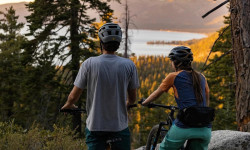
North Lake Tahoe Is a Cycling Paradise
Sep 27, 2023 from pinkbike.com
From cruising through town to shredding in the mountains. [I]Presented by North Lake Tahoe.[/I]
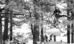
Video & Report: Racing and Slopestyle for All at the Little Big Bike Festival
Oct 23, 2019 from pinkbike.com
Blue slope courses and loads of kids' events make the Little Big Bike Festival suitable for everyone.

Video: Melamed, Gauvin, Lanthier Nadeau & Ostroski Take on America in Episode 5 of 'The Jank Files'
Sep 6, 2019 from pinkbike.com
The combination of moon dust and boulders at Northstar meant staying upright was a gamble on every stage.

Video: WynTV Post Race Interviews - EWS Northstar
Aug 28, 2019 from pinkbike.com
Wyn interviews the survivors of Gnar-Star
Sub Regions
-
16 Acre Forest
-
Armstrong Urban Trails
- 1
- 5
-
Big Chief
- 3
- 4
-
Boreal Mountain Resort
- 4
- 1
- 1
-
Canyon Springs
-
Castle Peak
- 3
- 15
- 1
-
Coldstream Canyon
- 1
- 8
- 2
-
Donkey Town
- 4
-
Donner Memorial State Park
- 3
- 4
- 1
-
Donner Summit
- 1
- 4
- 5
- 2
-
Elizabethtown Meadows
- 1
-
Five Creeks
- 4
- 1
-
Glenshire Neighborhood Trails
- 2
- 13
- 11
-
Independence Lake Preserve
- 2
-
Johnson Canyon
- 4
-
Lower Carpenter Valley
- 4
-
Northstar at Tahoe Resort
- 4
- 18
- 16
- 11
-
Prosser Hill
- 13
- 19
- 6
-
Royal Gorge
- 15
- 20
- 6
-
Sawtooth
- 16
- 21
-
Sugar Bowl
- 7
- 5
-
Summit Lakes
- 1
-
Tahoe Donner
- 10
- 41
- 10
-
Truckee Bike Park
- 1
- 2
- 1
-
Truckee River Canyon
- 6
-
Truckee Urban Trails
- 22
- 8
- 1
- 2
- 1
-
Waddle Ranch Preserve
- 7
- 14
- 1
Popular Truckee Mountain Biking Trails
• 100 ★ 4.9 • 1,837 ft • 42 ft • 2,588 •
Loop to the top of Jackass Point with berms and jumps. Makeshift rest area at top. The loop strongly runs clockwise.
• 90 ★ 4.2 • 2,661 ft • 0 ft • 2,328 •
The main way down from mid mountain to the village. It has a bunch of fun jumps and wooden burms to ride. At the top Easy rider (a green) splits off to the left. Half way down Lift line (blue) heads off on the left and Woods (blue) to...
• 95 ★ 4.8 • 2 miles • 16 ft • 2,309 •
New Gypsy was made during the 2013 season. It is now mostly wooden features with the occasional jump and some rocks. A very technical riding trail.
• 100 ★ 4.7 • 2 miles • 7 ft • 2,279 •
Northstar's signature jump trail. ADAPTIVE MTB INFO Rating: aMTB1 - No Obstacles Exist - Expert Only This is a fast DH trail with features, including off-camber berms
• 80 ★ 4.4 • 2,497 ft • 0 ft • 1,994 •
Just barely harder than Mineshaft and very short. ADAPTIVE MTB INFO Rating: aMTB1 - No Obstacles Exist If accessing from Mineshaft, fork left to stay on Mineshaft and access Liftline trailhead from fire road to avoid tight tree dilemma
• 100 ★ 4.6 • 4,708 ft • 303 ft • 1,907 •
More of a quick, straight shot than Donkey Town Trail with a couple technical sections throughout. While uphill traffic is allowed, this is primarily a downhill "feature" trail and climbing is strongly discouraged - local ethic is to...
• 100 ★ 4.3 • 2,431 ft • 130 ft • 1,784 •
Connector trail from parking area along CA 89 to Donkey Town trails While uphill traffic is allowed, this section of trail runs fast and is extremely busy - climbing is strongly discouraged
Truckee Mountain Bike Routes
★ 4.5 • 13 miles • 1,190 ft • 11 • Loop •
This is a great loop that gets you all the goods Sawtooth ridge has to offer. Starting off at the Thelin...
★ 4.5 • 4 miles • 701 ft • 3 • Loop •
The standard jackass loop route for the 2020 season.
★ 3.6 • 8 miles • 999 ft • 22 • Loop •
I discovered that this sequence (Motherlode > Fool's Gold > Sidewinder) gives an incredible series...
★ 4.2 • 16 miles • 2,194 ft • 8 •
Hole In The Ground loop. Start and FInish at Boreal parking lot.
★ 4.0 • 15 miles • 1,946 ft • 2 • Loop •
Climb road drop trail. Mostly drop but definitely pedally and a little climbing on the "descent". Although...
Photos of Truckee Mountain Bike
Videos of Truckee Mountain Bike


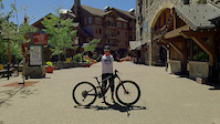
Current Trail Warnings
| status | trail | date | condition | user | info |
|---|---|---|---|---|---|
| Mount Lola Trail (Lower North) | Oct 7, 2026 @ 9:04am (America/Los_Angeles) Oct 7, 2026 | Dry | mjsinclair02 | About a half dozen or so downed trees... | |
| 2 Beavers & a Bear | Oct 3, 2026 @ 1:56pm (America/Los_Angeles) Oct 3, 2026 | Unknown | panderings | Lots of tree clearing, trail is... | |
| Pines To Mines Alignment s5-8 | Sep 28, 2026 @ 7:38pm (America/Los_Angeles) Sep 28, 2026 | Unknown | Redhawk BONC | not built yet |
Recent Trail Reports
Activity Feed
| username | action | type | title | date |
|---|---|---|---|---|
| martin308 | add | report | activity #106240775 and 5 more | Oct 19, 2026 @ 6:37pm 16 hours |
| Kent0z9WHi | wishlist | trail | activity #106204908 and 1 more | Oct 19, 2026 @ 8:14am 1 day |
| Kent0z9WHi | wishlist | route | activity #106204803 | Oct 19, 2026 @ 8:11am 1 day |
| RFD62MTB | wishlist | route | activity #106157884 | Oct 18, 2026 @ 12:37pm 2 days |
| SagarIv7dwE | wishlist | trail | activity #106120218 | Oct 18, 2026 @ 4:42am 2 days |
Recent Comments
| username | type | title | comment | date |
|---|---|---|---|---|
| trail | It’s fun up and down. Running good... | Oct 18, 2026 @ 12:09am 2 days | ||
| trail | Really fun workout for the pedal, it’s... | Oct 18, 2026 @ 12:02am 2 days | ||
| trail | This is not blue, it’s very green. All of TD... | Oct 15, 2026 @ 12:33pm Oct 15, 2026 | ||
| trail | more fun going down this than the shorter rim... | Oct 12, 2026 @ 8:38pm Oct 12, 2026 | ||
| trail | Top is fun. Rocky and technical. | Sep 21, 2026 @ 6:01pm Sep 21, 2026 |
Local Badges
-

Completionist0 awarded -
Completionist0 awarded -
Completionist0 awarded -
Completionist0 awarded -
Completionist0 awarded -
Completionist0 awarded
Bike & Skill Parks
| name | type | city | rating |
|---|---|---|---|
| Northstar at Tahoe Resort | bike park | Truckee | |
| Boreal Mountain Resort | bike park | Truckee | |
| Sugar Bowl | bike park | Truckee | |
| Donner Ski Ranch | bike park | Truckee | |
| Tahoe Donner Ski Area | bike park | Truckee |




Local Products
Activity Type Stats
| activitytype | trails | distance | descent | descent distance | total vertical | rating | global rank | state rank | photos | reports | routes | activity logs |
|---|---|---|---|---|---|---|---|---|---|---|---|---|
| Mountain Bike | 706 | 716 miles | 109,209 ft | 333 miles | 4,724 ft | #30 | #1 | 1,859 | 5,985 | 80 | 127,544 | |
| E-Bike | 396 | 468 miles | 74,003 ft | 221 miles | 3,996 ft | #44 | #53 | 42 | 5,151 | 11 | 13,172 | |
| Gravel Bike | 365 | 415 miles | 41,250 ft | 161 miles | 3,701 ft | #31 | #2 | 904 | 5 | 542 | ||
| Adaptive Bike | 116 | 135 miles | 14,386 ft | 62 miles | 3,507 ft | #37 | #3 | 752 | 1 | 12 | ||
| Winter Fat Bike | 198 | 202 miles | 19,583 ft | 77 miles | 4,131 ft | #21 | #3 | 470 | 10 | |||
| Horse | 444 | 487 miles | 64,065 ft | 204 miles | 4,245 ft | #9 | #27 | 2,262 | 6 | 39 | ||
| Hike | 672 | 737 miles | 102,697 ft | 329 miles | 4,724 ft | #32 | #4 | 156 | 5,880 | 19 | 12,354 | |
| Trail Running | 669 | 731 miles | 100,741 ft | 325 miles | 4,724 ft | #38 | #4 | 2 | 5,847 | 15 | 15,348 | |
| Dirtbike/Moto | 92 | 183 miles | 20,463 ft | 73 miles | 3,356 ft | #22 | #1 | 19 | 1,153 | 1 | 485 | |
| Observed Trials | 23 | 62 miles | 7,234 ft | 29 miles | 2,969 ft | #6 | #1 | 211 | 105 | |||
| ATV/ORV/OHV | 65 | 138 miles | 11,601 ft | 49 miles | 3,356 ft | #30 | #2 | 9 | 1,044 | 1 | 55 | |
| Snowmobile | 14 | 42 miles | 4,331 ft | 18 miles | 2,454 ft | #28 | #1 | 177 | 1 | 15 | ||
| Snowshoe | 21 | 49 miles | 4,665 ft | 20 miles | 2,454 ft | #39 | #1 | 136 | 1 | 1,048 | ||
| Downhill Ski | 309 | 112 miles | 92,740 ft | 106 miles | 2,802 ft | #5 | #1 | 2 | 67 | 11,100 | ||
| Backcountry Ski | 22 | 29 miles | 8,602 ft | 11 miles | 2,776 ft | #42 | #1 | 96 | 5,670 | |||
| Nordic Ski | 188 | 119 miles | 13,445 ft | 54 miles | 2,021 ft | #11 | #1 | 2 | 122 | 10,662 |
Frequently Asked Questions
▼
What are the best places to ride in Truckee?
Truckee has 36 areas to explore for mountain biking. The top rated areas are:
▼
What are the highest rated mountain biking trails in Truckee?
The highest rated mountain biking trails in Truckee are:
- Woodsplitter Jump Trail (4.6/5)
- Donkey Town Trail (aka "Jackass") (4.6/5)
- Gypsy (4.6/5)
- Livewire (4.6/5)
- Jackass Point (4.6/5)
▼
What is the best time of the year to ride in Truckee?
Based on activity log data, the most popular months to ride in Truckee are:
- July (2,808 activities)
- August (2,621 activities)
- June (2,297 activities)
▼
Where can I park to ride in Truckee?
There are 66 parking locations listed in Truckee. The most popular parking spots are: View all parking and trailhead locations on the map to plan your visit.
▼
What is the longest trail in Truckee?
The longest trail in Truckee is Pines To Mines Alignment s5-8 at 17.5 km. View all trails sorted by distance.
▼
What are the best & highest rated hiking trails in Truckee?
The best hiking trails in Truckee are: View all hiking trails sorted by popularity score.
▼
What are the best & highest rated trail running trails in Truckee?
The best trail running trails in Truckee are:
- Rowton Peak Trail
- PCT - Mount Judah
- Tompkins Memorial Trail (Meadow Loop)
- PCT - Judah to Tinker Knob
- PCT - Tinker Knob to Granite Chief
▼
What are the best & highest rated dirtbiking trails in Truckee?
The best dirtbiking trails in Truckee are: View all dirtbiking trails sorted by popularity score.
▼
How many trails are in Truckee?
Truckee has a total of 1,249 trails. Of those, 706 are designated for mountain biking. Browse top mountain biking trails in Truckee to find detailed information including difficulty ratings, distances, and trail conditions.
▼
Which trail has the most elevation gain in Truckee?
The trail with the most elevation gain in Truckee is Pole Creek Road with 507 m of elevation gain. View all trails sorted by elevation gain.
▼
Which trail has the most elevation descent in Truckee?
The trail with the most elevation descent in Truckee is Pines To Mines Alignment s5-8 with 759 m of elevation descent. View all trails sorted by elevation descent.
▼
What activities are most popular in Truckee?
Truckee supports the following activities: Mountain Biking, E-Biking, Gravel Biking, Adaptive Biking, Winter Fat Biking, Horseback, Hiking, Trail Running, Dirtbiking, Observed Trials, ATVing/Offroading, Snowmobiling, Snowshoeing, Skiing, Backcountry Skiing, Nordic Skiing.
▼
What bike services are there in Truckee?
The following bike services are available in Truckee:
- Bike Shop (7)
- Trail Association (4)
- Coaching & Camps (2)
- Other (2)
- Race Team (1)
- Guides & Tours (1)
- Shuttle Service (1)
- Club (1)
- Land Managers (1)
▼
What are the steepest mountain biking trails in Truckee?
The steepest mountain biking trail in Truckee is Castle Peak West Trail with an average grade of 19.9%. View all trails sorted by grade.
▼
Are there any trails with scenic viewpoints in Truckee?
Yes, there are 24 scenic viewpoints marked along trails in Truckee. Some popular viewpoints include: Explore more points of interest to find trails with the best views.
▼
What trails have the biggest jumps in Truckee?
The trails with the biggest jumps in Truckee are: Browse all mountain bike trails to find trails with jumps and technical features.
▼
Are the trails open in Truckee?
The overall region status for Truckee is Minor Issue / Yellow. Out of 594 trails:
- Clear / Green: 471
- Minor Issue / Yellow: 33
- Significant Issue / Amber: 14
- Closed: 76
▼
What are the trail conditions in Truckee?
Based on trail reports from the past week in Truckee:
- Very Dry: 10 trails
- Dry: 2 trails
- Ideal: 2 trails
▼
Can I ride an ebike in Truckee?
Yes, Truckee supports e-bike riding. There are 331 trails in Truckee that allow e-bikes. Check the e-bike trails listing for specific trail access details and any local regulations.
▼
What are the most popular mountain biking routes in Truckee?
The most popular mountain biking routes in Truckee are: View all mountain biking routes in Truckee.
▼
What type of bike is most common in Truckee?
Based on activity log data, the most common bike types used in Truckee are:
- AM (1,175 activities)
- XC (135 activities)
- Fat (48 activities)
- DH (33 activities)
- RD (28 activities)
▼
What is the highest summit in Truckee?
The highest summit in Truckee is Mount Lola at 2,785 m elevation.
▼
What are the most popular Strava Segments in Truckee?
The most popular Strava segments in Truckee are:
- Jackass - Post Jollipop Climb (13,706 athletes)
- Zephyr Express Lift (12,929 athletes)
- Jackass Enduro (12,779 athletes)
▼
What are some popular technical trail features in Truckee?
There are 39 technical trail features (TTFs) in Truckee. Some popular features include:
- Rock Gap (Rock Garden)
- Uphill Rock (Rock Face)
- Creek Crossing (Rock Garden)
- Little Jumpy (Gap Jump)
- Hades (Rock Garden)
▼
What trails are closed in Truckee?
There are currently 76 closed trails in Truckee. The breakdown of all trail statuses is:
- Clear / Green: 471
- Minor Issue / Yellow: 33
- Significant Issue / Amber: 14
- Closed: 76
▼
Are there accessible or adaptive trails in Truckee?
Yes, there are 114 accessible/adaptive trails in Truckee. View all adaptive trails in Truckee for specific accessibility information.
▼
Are there local clubs or events in Truckee?
There are 7 local clubs or associations listed in the Truckee directory. Browse the local directory for details.
▼
Are there any mountain biking guiding or tour operators in Truckee?
Yes, there are mountain biking guiding and tour operators in Truckee: Browse all guiding and tour operators in Truckee.
▼
What are the most popular mountain biking trails in Truckee?
The most popular mountain biking trails in Truckee are:
- Flying Squirrel
- Woodsplitter Jump Trail
- Donkey Town Trail (aka "Jackass")
- Compass Skills Lower Loop
- Hole in the Ground
▼
What are the best beginner ride trails in Truckee?
The best beginner mountain biking trails in Truckee are:
- Compass Skills Lower Loop (4.5/5)
- Compass Skills Upper Loop (4.4/5)
- Green XC Loop (0/5)
Activities
- Truckee Mountain Biking Trails
- Truckee E-Biking Trails
- Truckee Gravel Biking Trails
- Truckee Adaptive Biking Trails
- Truckee Winter Fat Biking Trails
- Truckee Horseback Trails
- Truckee Hiking Trails
- Truckee Trail Running Trails
- Truckee Dirtbiking Trails
- Truckee Observed Trials Trails
- Truckee ATVing/Offroading Trails
- Truckee Snowmobiling Trails
- Truckee Snowshoeing Trails
- Truckee Skiing Trails
- Truckee Backcountry Skiing Trails
- Truckee Nordic Skiing Trails
Trails
Points of Interest
- Lyles Lookout Viewpoint
- Auburn Ski Club Lodge
- Wildy Hut Cabin
- Devil's Outlook Hut Cabin
- Royal Gorge Cross Country Ski Resort Lodge
- West End Hut Cabin
- Merrill Family Hut Cabin
- Bogus Basin Hut Cabin
- Bill & Flora's Point Viewpoint
- Hellman Hut Cabin
- Mount Lola (2,785 m)
- Castle Peak (2,773 m)
- Basin Peak (2,749 m)
- By chrisclifford
 & contributors
- Admins: BONC, TTF, TDLT, DPMR, erikhillard, elikat715, Redhawk, limbolizard, Petewick, allisonbriney
- #4174 - 88,279 views
- truckee activity log | embed map of Truckee mountain bike trails | truckee mountain biking points of interest polygons
Downloading of trail gps tracks in kml & gpx formats is enabled for Truckee.
You must login to download files.
