
close
3D
Trail Conditions
- Unknown
- Snow Groomed
- Snow Packed
- Snow Covered
- Snow Cover Partial
- Freeze/thaw Cycle
- Icy
- Prevalent Mud
- Wet
- Variable
- Ideal
- Dry
- Very Dry
Trail Flow (Ridden Direction)
Trailforks scans users activity logs to determine the most popular direction each trail is ridden. A good flowing trail network will have most trails flowing in a single direction according to their intension.
The colour categories are based on what percentage of users are riding a trail in its intended direction.
The colour categories are based on what percentage of users are riding a trail in its intended direction.
- > 96%
- > 90%
- > 80%
- > 70%
- > 50%
- < 50%
- bi-directional trail
- no data
Trail Last Used
Trailforks scans activity logs to determine the last time a trail was ridden.
- < 2 days
- < 1 week
- < 2 weeks
- < 1 month
- < 6 months
- > 6 months
Trail Ridden Direction
The intended direction a trail should be ridden.
- Downhill Only
- Downhill Primary
- Both Directions
- Uphill Primary
- Uphill Only
- One Direction
Contribute Details
Colors indicate trail is missing specified detail.
- Description
- Photos
- Description & Photos
- Videos
Trail Popularity ?
Trailforks scans activity logs to determine which trails are ridden the most in the last 9 months.
Trails are compared with nearby trails in the same city region with a possible 25 colour shades.
Think of this as a heatmap, more activities = more kinetic energy = warmer colors.
- most popular
- popular
- less popular
- not popular
ATV/ORV/OHV Filter
Max Vehicle Width
inches
US Cell Coverage
Legend

Radar Time
Activity Recordings
Trailforks uses anonymized public activity data.
?
Activity Recordings
Trailforks uses anonymized public activity data.
?
Winter Trails
Warning
A routing network for winter maps does not exist. Selecting trails using the winter trails layer has been disabled.
Missing Trails
Most Popular
Least Popular
Trails are colored based on popularity. The more popular a trail is, the more red. Less popular trails trend towards green.
Jump Magnitude Heatmap
Heatmap of where users jump on trails. Zoom in to see individual jumps, click circles to view jump details.
BC Backroad Status
![map legend]()
Service Road Atlas is a free to use, community-driven service for viewing and creating reports on the numerous back-country service roads around B.C. and Alberta.

Slope Aspect
Direction the slope faces
Trails Deemphasized
Trails are shown in grey.
Only show trails with no bike usage.
Suggested Layers
Based on selected activity type
Save the current map location and zoom level as your default home location whenever this page is loaded.
SavePopular Trail Networks
view all areas »
Snow & Rain 3D forecastPRO
See where it will snow, sleet or rain on Tirol hour by hour, on 3D terrain.
View 3D snow forecast
Tirol trails and routes are listed on Trailforks with interactive trail maps, difficulty ratings, photos, and user-reported trail conditions. The Trailforks community has mapped thousands of trails and shared thousands of photos in this region. Supported activity types include Skiing, Hiking, Trail Running, Mountain Biking, E-Biking, Snowshoeing, Nordic Skiing, Backcountry Skiing, Gravel Biking, Adaptive Biking, Winter Fat Biking, Horseback, Observed Trials, Snowmobiling, Dirtbiking and ATVing/Offroading. Trails here are often flowy, faint trail and tight and twisty. Scenery includes alpine terrain, views and meadows. Common trail features include jumps, berms and bridges. Many trails are family friendly and lit for night riding. Amenities include huts and water sources. Popular destinations include Sölden, Brixen im Thale and Innsbruck.
This is an auto-generated description of Tirol.
Login or register to submit a custom description.
AKA: Tyrol
This region uses the Uk/Euro style trail grading system.
Trail info last updated
Region Details
- 139
- 34
- 96
- 76
- 30
- 4
- 2
Stats
- Avg Trail Rating
- Trails (view details)
- 3,192
- Trails Mountain Bike
- 382
- Trails E-Bike
- 342
- Trails Gravel Bike
- 183
- Trails Adaptive Bike
- 98
- Trails Winter Fat Bike
- 82
- Trails Horse
- 8
- Trails Hike
- 478
- Trails Trail Running
- 476
- Trails Dirtbike/Moto
- 2
- Trails Observed Trials
- 7
- Trails ATV/ORV/OHV
- 2
- Trails Snowmobile
- 5
- Trails Snowshoe
- 310
- Trails Downhill Ski
- 2,050
- Trails Backcountry Ski
- 199
- Trails Nordic Ski
- 304
- Total Distance
- 2,937 miles
- Total Descent
- 1,720,003 ft
- Total Vertical
- 9,763 ft
- Highest Trailhead
- 11,279 ft
- Reports
- 4,484
- Photos
- 2,012
- Completed Counter
- 223,061
Articles
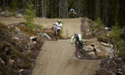
Bike Republic Sölden Expands for 2026 with New Lines & Smart Connections
May 12, 2026 from pinkbike.com
Get the first look at the redesigned Traien and Ohn Lines ahead of the BRS Festival and season kickoff on June 4.
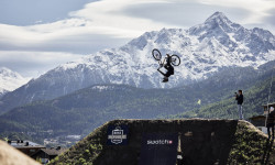
Rasoulution Shares Details on BRS Festival, Including Swatch Nines, World Records, & Parties
Aug 8, 2025 from pinkbike.com
The world’s best slopestyle and freeride athletes return to the flowy alpine nation to once again push the limits of MTB.
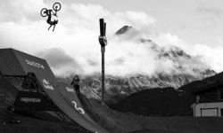
Video: 'Riders of the Storm' - Official 26-Minute Swatch Nines Documentary
Sep 19, 2024 from pinkbike.com
Rain, mud, sun, snow and a whole lot of send.
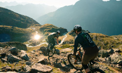
Details Announced for Bike Republic Sölden 2024 Opening
May 14, 2024 from pinkbike.com
Bikes can roll in Sölden from June 7.
Sub Regions
- Außerfern (48)
- Ehrwald (9)
- Lermoos (22)
- Reutte (7)
- Trailarea Urisee (5)
- Tannheim (4)
- Tannheimer Tal (1)
- Weißenbach am Lech (0)
- Zöblen (3)
- Mühlwaldtrails (3)
- Bike Park Zugspitze (3)
- Ehrwald (9)
- Imst (56)
- Haiming (0)
- Jerzens (0)
- Längenfeld (1)
- Nassereith (3)
- Oetz (7)
- Sölden (37)
- Bike Republic Sölden (35)
- Pitztal (4)
- Haiming (0)
- Innsbruck (53)
- Innsbruck (56)
- Bichl Trails (12)
- Bikepark Katzenkopf Leutasch (4)
- Innsbruck (19)
- Innsbruck (56)
- Innsbruck-Land (28)
- Absam (7)
- Neustift (10)
- Seefeld (1)
- Steinach am Brenner (4)
- Bikepark Tirol (2)
- Wattens (0)
- Zirl (1)
- Stubaital (0)
- Kitzbühel (51)
- Brixen im Thale (4)
- Fieberbrunn (10)
- Bike Area Streuböden (10)
- Kirchberg in Tirol (12)
- Kitzbühel (3)
- Oberndorf in Tirol (5)
- OD Trails (5)
- St.johann in tirol (5)
- KitzBike - 360° Flow Trails Kitzbühel Kirchberg (12)
- Brixen im Thale (4)
- Kufstein District (7)
- Landeck (95)
- Fendels (1)
- Galtür (11)
- Silva Trails (11)
- Ischgl (29)
- Landeck (0)
- Nauders (0)
- Prutz (0)
- Serfaus-Fiss-Ladis (25)
- St. Anton am Arlberg (3)
- 3-Länder Enduro Trails (26)
- Fendels (1)
- Osttirol (18)
- Kals am Großglockner (10)
- Großglockner Resort (10)
- Lienz (8)
- Bikepark Lienz (6)
- Kals am Großglockner (10)
- Schwaz District (23)
- Finkenberg (0)
- Fügen (1)
- Gerlos (8)
- Mayrhofen (4)
- Pertisau (6)
- Zillertal Arena Singletrails (4)
- Finkenberg (0)
- Hall in Tirol (0)
- St. Leonhard im Pitztal (0)
- Pitztal (0)
- Steinberg Am Rofan (0)
Popular Tirol Mountain Biking Trails
• 100 ★ 4.3 • 3,117 ft • 0 ft • 2,404 •
Highly rated popular red difficulty singletrack. This mountain bike primary trail. Trail visibility is always easy to follow. On average it takes 2 minutes to complete this trail.
• 85 ★ 4.1 • 1 mile • 57 ft • 2,069 •
Nice transfer trail over the Plamort area to the Bunker trail.
• 100 ★ 2.9 • 1 mile • 0 ft • 2,041 •
It is a quite eas and fun-filled line, also thanks to varied Fun Elements.
• 95 ★ 4.1 • 1 mile • 2 ft • 1,889 •
Probably the most flowy trail: "Eebme Line" - open from 18.06.2016 - is one of this season's new attractions of the Bike Republic! Starting close to the Gaislachkogl Middle Station, it makes a perfect training area right amidst the huge...
• 100 ★ 3.9 • 571 ft • 0 ft • 1,853 •
A short trail just off the side of Broate Line.
• 90 ★ 3.1 • 1 mile • 0 ft • 1,830 •
HARBE LINE is an about 2.2 km long blue line starting right at the top station of Giggijoch Mountain Gondola. The short track down to Hochsölden features some 180 meters of altitude difference. HARBE LINE is open from the 2017 summer,...
• 95 ★ 4.3 • 3 miles • 449 ft • 1,828 •
The "Teäre Line" opened only in 2015, has become a legendary trail within a few months - and only by word-of-mouth recommendation. What is so special about it? This unrivaled Flow Trail starts right at the Gaislachkogl Middle Station...
Tirol Mountain Bike Routes
★ 4.0 • 48 miles • 17,916 ft • 24 • Loop •
I started at Schönebenbahn. But you can start the Route at any Lift you want to. Have fun
184 miles • 33,780 ft • 5 • Out & Back •
English Version below: Die siebentägige MTB-Tour Bike Everest Tirol holt den höchsten Berg der Erde in...
31 miles • 8,752 ft • 4 • Loop •
The tour starts in Ischgl and utilizes the Silvrettabahn to reach Idalp followed by the Flimjochbahn to...
28 miles • 8,636 ft • 9 •
3-Länder-Enduro Rennen Training Tag 1
52 miles • 19,214 ft • 27 • Loop •
This is my improved version of 3 (actually 2) Länder Enduro circle. The original one is buggy and...
13 miles • 4,023 ft • 6 • Loop •
This is a "small loop" version from The original complete loop
Photos of Tirol Mountain Bike
Videos of Tirol Mountain Bike
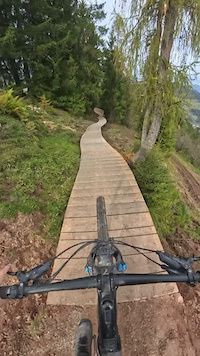
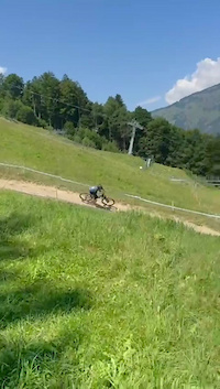
mtb
0:05 |
19 |
Nov 26, 2024
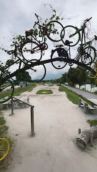
mtb
0:23 |
4 |
Jan 18, 2024
Current Trail Warnings
| status | trail | date | condition | user | info |
|---|---|---|---|---|---|
| Elven Trail 3-Länder Enduro Trails | Oct 17, 2026 @ 11:05am (Europe/Vaduz) Oct 17, 2026 | Unknown | trudybike | ||
| Sonnenrast Trail KitzBike - 360° Flow Trails Kitzbühel Kirchberg | Oct 15, 2026 @ 12:20pm (Europe/Vienna) Oct 15, 2026 | Ideal | 360FlowTrails | Fleckalmbahn & Sonnenrastbahn... |
Recent Trail Reports
National Scenic Trails & Official Routes
-
Trans-Altarezia Bike #32
- Mountain Bike
- E-Bike

Activity Feed
| username | action | type | title | date |
|---|---|---|---|---|
| lines | add | video | activity #107588191 and 9 more | Nov 11, 2026 @ 4:48am 3 days |
| lines | add | video | activity #107556829 | Nov 10, 2026 @ 12:59pm Nov 10, 2026 |
| mtbrajder | add | video | activity #107553511 and 3 more | Nov 10, 2026 @ 11:57am Nov 10, 2026 |
| dantho | ridden | trail | activity #107491551 | Nov 9, 2026 @ 8:43am Nov 9, 2026 |
| ktm-boy-69 | update | trail | activity #107402372 | Nov 8, 2026 @ 1:17am Nov 8, 2026 |
Recent Comments
| username | type | title | comment | date |
|---|---|---|---|---|
| trail | this is a common uphill route to hungerburg trail. | Nov 7, 2026 @ 1:37pm Nov 7, 2026 | ||
| skillpark | Pumptrack Wintertrophy von der Austrian... | Nov 2, 2026 @ 11:56pm Nov 2, 2026 | ||
| trail | Auch wieder so ein Negativbeispiel wo... | Oct 30, 2026 @ 1:46am Oct 30, 2026 | ||
| trail | Update 2026: Schwierigkeit auf "Rot" geändert... | Oct 16, 2026 @ 2:08am Oct 16, 2026 | ||
| report | Ich finde, der Park hat nicht übermässig... | Oct 12, 2026 @ 2:04am Oct 12, 2026 |
Local Badges
-

Epic Ride Descent 2k25 awarded -

Descent 10k Badge3 awarded -
Descent 10k Badge15 awarded -
Epic Ride Descent 2k72 awarded -
Descent 10k Badge3 awarded -
Epic Ride Descent 2k34 awarded
Bike & Skill Parks
| name | type | city | rating |
|---|---|---|---|
| Innsbruck | bike park | Innsbruck | |
| 3-Länder Enduro Trails | bike park | Nauders | |
| Bike Republic Sölden | bike park | Sölden | |
| Bike Serfaus-Fiss-Ladis | bike park | Serfaus-Fiss-Ladis | |
| Bikepark Lienz | bike park | Lienz |
Upcoming Local Events



Local Products
Activity Type Stats
| activitytype | trails | distance | descent | descent distance | total vertical | rating | global rank | state rank | photos | reports | routes | activity logs |
|---|---|---|---|---|---|---|---|---|---|---|---|---|
| Mountain Bike | 382 | 780 miles | 215,850 ft | 357 miles | 7,615 ft | 1,921 | 4,449 | 22 | 92,345 | |||
| E-Bike | 342 | 725 miles | 192,060 ft | 330 miles | 7,615 ft | 21 | 4,010 | 8 | 12,465 | |||
| Gravel Bike | 183 | 562 miles | 52,569 ft | 154 miles | 7,434 ft | 124 | 1 | 1,104 | ||||
| Adaptive Bike | 98 | 392 miles | 35,925 ft | 120 miles | 7,434 ft | 414 | 1 | 6 | ||||
| Winter Fat Bike | 82 | 291 miles | 39,806 ft | 111 miles | 7,434 ft | 453 | ||||||
| Horse | 8 | 40 miles | 4,777 ft | 17 miles | 4,393 ft | 3 | 325 | 7 | ||||
| Hike | 478 | 944 miles | 365,381 ft | 448 miles | 8,835 ft | 21 | 3,834 | 5 | 18,903 | |||
| Trail Running | 476 | 940 miles | 365,262 ft | 448 miles | 8,835 ft | 3,834 | 4 | 2,079 | ||||
| Dirtbike/Moto | 2 | 7 miles | 1,309 ft | 1 mile | 3,264 ft | 303 | 1 | |||||
| Observed Trials | 7 | 12 miles | 2,464 ft | 2 miles | 4,619 ft | 1 | 2 | |||||
| ATV/ORV/OHV | 2 | 7 miles | 1,309 ft | 1 mile | 3,264 ft | 1 | 303 | 6 | ||||
| Snowmobile | 5 | 18 miles | 1,417 ft | 2 miles | 4,291 ft | 1 | 1 | |||||
| Snowshoe | 310 | 299 miles | 24,501 ft | 127 miles | 6,421 ft | 20 | 134 | |||||
| Downhill Ski | 2,050 | 1,171 miles | 1,125,476 ft | 1,079 miles | 9,154 ft | 22 | 26,916 | |||||
| Backcountry Ski | 199 | 427 miles | 88,245 ft | 92 miles | 8,970 ft | 21 | 7,869 | |||||
| Nordic Ski | 304 | 280 miles | 23,891 ft | 126 miles | 4,291 ft | 19 | 4,179 |
Activities
- Tirol Mountain Biking Trails
- Tirol E-Biking Trails
- Tirol Gravel Biking Trails
- Tirol Adaptive Biking Trails
- Tirol Winter Fat Biking Trails
- Tirol Horseback Trails
- Tirol Hiking Trails
- Tirol Trail Running Trails
- Tirol Observed Trials Trails
- Tirol Snowmobiling Trails
- Tirol Skiing Trails
- Tirol Backcountry Skiing Trails
Trails
Points of Interest
- Chairlift Drop-Off (Langeggbahn) Other
- Chairlift Drop-Off (Sonnalmbahn Berwang) Other
- Cableway Drop-Off (Almkopfbahn Bichlbach) Other
- Cableway Pick-Up (Almkopfbahn Bichlbach) Other
- Cableway Drop-Off (Dias-Kabinenbahn) Other
- Cableway Pick-Up (Dias-Kabinenbahn) Other
- Cableway Pick-Up (Fendels-Ried-Bahn) Other
- Cableway Drop-Off (Fendels-Ried-Bahn) Other
- Cableway Drop-Off (Galzigbahn) Other
- Cableway Pick-Up (Galzigbahn) Other
- Hofmannspitze (12,031 ft)
- Teufelshorn (11,978 ft)
- Kleinglockner (11,722 ft)
- By brenthillier
 NSMBA TRAILFORKS & contributors
- Admins: ktm-boy-69, mpecsi, lines, larry81541, PatrickMeraner
- #9911 - 15,770 views
- tirol activity log | embed map of Tirol mountain bike trails | tirol mountain biking points of interest polygons
Downloading of trail gps tracks in kml & gpx formats is enabled for Tirol.
You must login to download files.
