
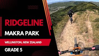
From the carpark, climb to the summit via the iconic suspension bridge using Koru, Sally Alley, Upswing and Aratihi (or for a more challenging ride, after Sally Alley, head down Missing Link and up Aratihi). From the summit head along Ridgeline where you will be faced with a couple of technical pinch climbs amidst spectacular views before heading down a techy, rocky singletrack. Continue the fun descent via Ridgeline Extension, keeping an eye out for a couple of short expert lines. Either head down the fun Grade 4 Starfish or make your way around to the Skills Area and dive down Live Wires, again keeping an eye out for the expert lines.

Route Supporters

Makara Peak MTB Park SupportersMaintainer
Local Trail Association
Makara Peak MTB Park Supporters (www.makarapeak.org)Stats
-
Distance6 miles
-
Avg time1 hr 6 min
-
Altitude min442 ft
-
Altitude start446 ft
-
Altitude end449 ft
-
Climb1,563 ft
-
Descent-1,561 ft
-
Grade max-56.7%
-
Grade min49.2%
-
Distance climb3 miles
-
Distance down2 miles
-
Distance flat1 mile
7 Reviews & Comments
We hope you've been enjoying Trailforks!
Create a FREE account to view all route reviews and much more.

Trails in Route
| 469 ft | |||||
| 3,904 ft | |||||
| 1,181 ft | |||||
| 3,796 ft | |||||
| 4,226 ft |
Details
-
Riding area
-
Primary ActivityMountain Bike
-
Other Activities
- E-Bike
-
Difficulty ratingBlack Diamond
-
Route TypeLoop
-
eBike Allowed
-
Bike typeAM, XC
-
DirectionOne Direction
-
Physical ratingHard
-
Activity Logs
Directions
- Walk west on Koru.
- Continue for 400 meters.
- Keep left to stay on Koru.
- Continue for 2 kilometers.
- Turn left onto Sally Alley.
- Continue for 800 meters.
- Turn right to stay on Sally Alley.
- Continue for 500 meters.
- Make a sharp right onto Tower 18 Connector.
- Continue for 40 meters.
- Turn left onto Three Brothers (Part 1).
- Continue for 400 meters.
- Unknown
- Snow Groomed
- Snow Packed
- Snow Covered
- Snow Cover Partial
- Freeze/thaw Cycle
- Icy
- Prevalent Mud
- Wet
- Variable
- Ideal
- Dry
- Very Dry
The colour categories are based on what percentage of users are riding a trail in its intended direction.
- > 96%
- > 90%
- > 80%
- > 70%
- > 50%
- < 50%
- bi-directional trail
- no data
- < 2 days
- < 1 week
- < 2 weeks
- < 1 month
- < 6 months
- > 6 months
- Downhill Only
- Downhill Primary
- Both Directions
- Uphill Primary
- Uphill Only
- One Direction
- Description
- Photos
- Description & Photos
- Videos
- most popular
- popular
- less popular
- not popular
Service Road Atlas is a free to use, community-driven service for viewing and creating reports on the numerous back-country service roads around B.C. and Alberta.
Save the current map location and zoom level as your default home location whenever this page is loaded.
Save- Singletrack
Photos
Videos
Recent Trail Reports Along Route
- By Coopsnz
MPS MP Trail Crew & contributors - #55938 - 482 views
