

Open in App
Get this route on your phone instantly.
Try on your own risk!
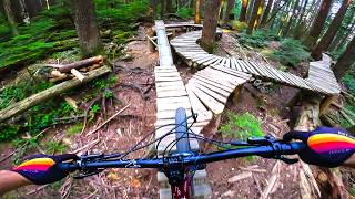
Mount Fromme Epic. Line up all trails off of Mountain Highway This all day adventure for those looking for a challenge! can you do it?



We hope you've been enjoying Trailforks!
Create a FREE account to view all route reviews and much more.
| 2 miles | |||||
| 673 ft | |||||
| 2 miles | |||||
| 3,261 ft | |||||
| 167 ft | |||||
| 1 mile | |||||
| 2,224 ft | |||||
| 820 ft | |||||
| 167 ft | |||||
| 1 mile | |||||
| 1,558 ft | |||||
| 2,060 ft | |||||
| 3,278 ft | |||||
| 10 ft | |||||
| 1,299 ft | |||||
| 3,084 ft | |||||
| 1,299 ft | |||||
| 997 ft | |||||
| 1,503 ft | |||||
| 545 ft | |||||
| 1,624 ft | |||||
| 2,598 ft | |||||
| 2,123 ft | |||||
| 3,127 ft | |||||
| 2,421 ft | |||||
| 1,299 ft | |||||
| 997 ft | |||||
| 1,503 ft | |||||
| 545 ft | |||||
| 1,624 ft | |||||
| 2,598 ft | |||||
| 2,415 ft | |||||
| 968 ft | |||||
| 2,352 ft | |||||
| 1 mile | |||||
| 2 miles | |||||
| 673 ft | |||||
| 2,388 ft | |||||
| 4,213 ft | |||||
| 5,020 ft | |||||
| 2 miles | |||||
| 673 ft | |||||
| 1,680 ft | |||||
| 3,904 ft | |||||
| 2,986 ft | |||||
| 2 miles | |||||
| 673 ft | |||||
| 1,558 ft | |||||
| 3,714 ft | |||||
| 1,591 ft | |||||
| 2 miles | |||||
| 118 ft | |||||
| 1,736 ft | |||||
| 1,421 ft | |||||
| 2,165 ft | |||||
| 2,316 ft | |||||
| 4,498 ft | |||||
| 1,594 ft | |||||
| 610 ft | |||||
| 807 ft |

Service Road Atlas is a free to use, community-driven service for viewing and creating reports on the numerous back-country service roads around B.C. and Alberta.
Save the current map location and zoom level as your default home location whenever this page is loaded.
Save & contributors