


more stats
3,619 ft
Distance
142 ft
Climb
-166 ft
Descent
00:12:17
Avg time
-25 ft
Altitude change
4,410 ft
Altitude min
4,509 ft
Altitude max
4,451 ft
Altitude start
4,426 ft
Altitude end
-0.7%
Grade
-23.9%
Grade max
20.1%
Grade min
1,473 ft
Distance climb
1,654 ft
Distance down
489 ft
Distance flat
00:12:17
Avg time

Chapel Details

  • Activities
    • Mountain Bike
    • Hike
    • Trail Running
  • Riding Area
    Broken Arrow
    Sedona, Arizona
  • Difficulty Rating
  • Voted Difficulty
    Black Diamond (2 votes)
  • Local Popularity
    60 in Mountain Biking [+]
    • 80 in Trail Running
    • 90 in Hiking
  • Global Ranking
    #146337 in Mountain Biking [+]
    • #115441 in Trail Running
    • #73513 in Hiking
  • State Ranking
    #2,275 in Mountain Biking · Arizona [+]
    • #1,874 in Trail Running
    • #1,404 in Hiking
  • Trail Type
    Singletrack
  • Direction
    Both Directions
  • Dogs Allowed
    Yes
  • eBike Allowed

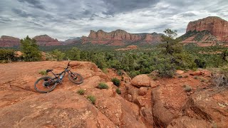
Intermediate 50% and advanced 50%, .68 mile MTB trail which is a bi-directional singletrack that is a total tech fest in the uphill direction from the Chapel. The trail consists of crossing a deep wash, climbing rock infested narrow single track, railing though off camber steep rock sections and ripping through a huge slickrock trail section. There is no preferred direction but east to west is definitely easier to clean if that is your goal. The trail serves as a good connector for several other loops.

Tags
Rock slabs
Trail Supporters
Local Trail Association

Recent Activity on Trail

Past Week
  • 3 rides
  • 9 miles average
6 Months
  • 39 rides
  • 12 miles avg distance
All
  • 431 rides
  • Last: Sep 29, 2026
c1c2c3c4
January
February
March
April
May
June
July
August
September
October
November
December
update trails status or condition

Chapel Trail Reports

Status:
on Aug 29, 2025
Dry
Avg: 3.17 (18 votes)
Your vote: 0

view (3,182)
close
      Directions to chapel trailhead (34.832040, -111.765670)

      Photos

      13 more »
      mtb
      509 |
      Mar 27, 2016 @ 6:32pm
      Mar 27, 2016
      mtb
      516 |
      Mar 27, 2016 @ 6:32pm
      Mar 27, 2016
      mtb
      45 |
      May 4, 2025 @ 5:08pm
      May 4, 2025
      mtb
      49 |
      May 4, 2025 @ 5:07pm
      May 4, 2025

      Videos

      4 more »
      On part de la chapelle de the holy cross à...
      mtb
      9:37 | 52 | May 12, 2025 , Sedona
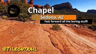
      Chapel - Sedona, AZ - MTB Trail Preview
      mtb
      0:20 | 208 | Mar 20, 2025 , Sedona
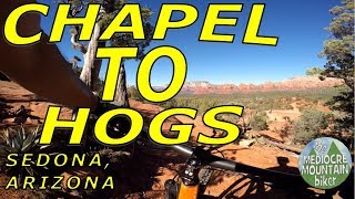
      Chapel to Hogs - Sedona, AZ
      mtb
      10:15 | 489 | Jul 16, 2020 , Sedona
      Sedona - Slim Shady & Hogs - 05/19/2019
      mtb
      16:34 | 269 | Dec 9, 2019 , Sedona

      Routes with this trail

      ★ 3.0 • 12 miles • 1,301 ft • 12 •
      to to
      1 mile • 214 ft • 2 • Out & Back •
      A relatively easy, albeit rocky, out-and-back hike popular with visitors looking for a short walk. Can be...
      16 miles • 1,860 ft • 21 • Loop •
      Long loop from trail which rides and .
      2.9 ★★★★★
      18 Ratings
      5 ★
      4 ★ 28%
      3 ★ 39%
      2 ★ 28%
      1 ★ 6%

      4 Reviews & Comments

      rageify rageify
      Weird trail. Fun either direction after halfway point. Not fun going up to that point.
      Ampfrog Ampfrog
      Rode eastbound. The very beginning is a bit hard to ride/clean due to losing momentum with all the out-a-little-bit-and-back walkers mixed with a couple steep uphill rocky sections, but it gets much better soon after and easier to get a groove going for the rest of the trail. Also not too long of a trail if you're not a fan of tech riding and just using it as a connector, I hit Little Horse much sooner than expected.

      Note: don't park within the gates, they will make you move if you start pulling a bike out (there's an obvious sign next to the trail, but not along the lower road near the gate where I tried to park). Park along the road by Mystic to the west and save some time Smile
      brahhh brahhh
      I love tech, and I loved this trail! If you don't like tech, better pass on this one. I mean, you're in Sedona, either you like tech or you don't ride. Beware of hikers as well, very tight trail right by a chapel with a full parking lot a lot of the time.

      We hope you've been enjoying Trailforks!

      Create a FREE account to view all trail reviews and much more.

      Nearby Trails

      • By toddTF Pro Trailforks & contributors
      • #14555 - 4,368 views

      Frequently Asked Questions

      ▼ Where is Chapel located?
      Chapel is located in Broken Arrow, Sedona, Arizona, United States. It is part of the Broken Arrow trail network. The trailhead is located at coordinates 34.83204, -111.76567.
      ▼ How hard is Chapel?
      Chapel is rated as Black Diamond difficulty. The average grade is 0.7%.
      ▼ What is the elevation gain for Chapel?
      Chapel has 142 ft of elevation gain. The trail has 166 ft of elevation descent. The elevation ranges from 4,410 ft to 4,509 ft.
      ▼ Is Chapel a point to point trail?
      Chapel is not a point to point trail. The direction is Both Directions. The trail type is singletrack.
      ▼ How long is Chapel?
      Chapel is 3,619 ft long. The trail type is singletrack.
      ▼ Are dogs allowed on Chapel?
      Yes, dogs are allowed on Chapel. Please keep dogs on a leash where required and clean up after them.
      ▼ How do I access Chapel? Where is the closest parking trailhead?
      The closest parking and trailhead locations to Chapel are: View all parking locations in the area.
      ▼ How long does it take to ride Chapel?
      Based on recorded activities, it takes an average of 11 minutes to ride Chapel. The trail is 3,619 ft long. Actual times will vary based on fitness level, conditions, and pace. View recent activity logs for more details.
      ▼ How busy is Chapel?
      Chapel is a moderately popular trail. There have been 2,948 recorded activities on this trail. The trail has received 3,182 check-ins. View recent activity on this trail.

      Hit the Trail

      Open in App

      Get this trail on your phone instantly.

      open trail in app

      Download Trail

      Save to wishlist, Garmin & download.
      save the trail

      Find Related Routes

      Find routes and users activities that include this trail.
      find routes for this trail

      You must enter a description before submitting.