
more stats
2,610 ft
Distance
-590 ft
Descent
00:07:45
Avg time
-590 ft
Altitude change
877 ft
Altitude min
1,467 ft
Altitude max
1,467 ft
Altitude start
877 ft
Altitude end
-22.593%
Grade
-33.759%
Grade max
1.484%
Grade min
2,566 ft
Distance down
44 ft
Distance flat
00:07:45
Avg time

PBR Details

  • Activities
    • Mountain Bike
    • Hike
    • Trail Running
  • Riding Area
    Woodlot
    Maple Ridge, British Columbia
  • AKA
    Pabst Blue Ribbon
  • Difficulty Rating
  • Voted Difficulty
    Black Diamond (2 votes)
  • Local Popularity
    60 in Mountain Biking [+]
    • 100 in Trail Running
    • 80 in Hiking
  • Global Ranking
    #60066 in Mountain Biking [+]
    • #91130 in Trail Running
    • #115298 in Hiking
  • Provincial Ranking
    #2,934 in Mountain Biking · British Columbia [+]
    • #5,264 in Trail Running
    • #6,205 in Hiking
  • Trail Type
    Singletrack
  • Bike Type
    DH, AM
  • Direction
    Downhill Primary
    Popular Direction Shown
  • Dogs Allowed
    Yes
  • eBike Allowed

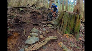
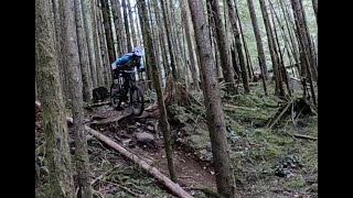
Also known as "Pabst Blue Ribbon". Beautiful forest ribbon trail. Keep your eye out for active and defunct gold mines in this area.

Access Info

Accessed off Goldmine/Cabin Trail near the second cabin or right off the skidder road before cabin trail.

Tags
Historic site

Local Trail Association

Traditionally Indigenous Territory

Recent Activity on Trail

Past Week
  • 4 rides
  • 7 miles average
6 Months
  • 16 rides
  • 13 miles avg distance
All
  • 363 rides
  • Last: Oct 19, 2026
update trails status or condition

PBR Trail Reports

statusdatedescription
Aug 8, 2026 @ 12:13pm (America/Vancouver)
Aug 8, 2026
Small tree down blocking the trail. It comes up kinda quick after a corner so I threw some warning branches ahead of the corner. A good handsaw...
Jun 9, 2026 @ 6:36pm (America/Vancouver)
Jun 9, 2026
The entrance to Goldmine is accessible and is not logged. However, the closer entrance to PBR is gone. Goldmine up to the PBR cross is rough, wet,...
Apr 17, 2026 @ 8:38pm (America/Vancouver)
Apr 17, 2026
Main entrance to Goldmine trail was logged, could not find access to the trail
Feb 1, 2026 @ 12:25pm (America/Vancouver)
Feb 1, 2026
reporter Re: Logging around PBR etc Here is an explanation of road and harvest works for the next 4 months.. Currently the licence holders...
Jan 25, 2026 @ 9:42pm (America/Vancouver)
Jan 25, 2026
Looks like active logging is in progress! Hopefully someone with full information can give us some idea on what will be the future of this trail!...
more »
Status:
on Aug 8, 2026
Dry
Avg: 4.27 (21 votes)
Your vote: 0

view (2,673)
close
      Directions to pbr trailhead (49.246200, -122.415170)

      Photos

      24 more »
      mtb
      PBR
      187 |
      Nov 13, 2018 @ 7:27pm
      Nov 13, 2018
      mtb
      PBR
      219 |
      Jun 17, 2018 @ 8:11pm
      Jun 17, 2018
      mtb
      PBR
      108 |
      Nov 28, 2023 @ 8:42pm
      Nov 28, 2023
      mtb
      PBR
      124 |
      Oct 22, 2023 @ 7:24am
      Oct 22, 2023

      Videos

      6 more »
      Pabst Blue Ribbon Woodlot Jan 2025
      mtb
      8:24 | 88 | Feb 6, 2025 , Maple Ridge
      PBR - The Woodlot, Maple Ridge, BC
      mtb
      639 | Aug 9, 2020 , Maple Ridge
      Rough trails in the Woodlot on hardtails
      mtb
      11:33 | 279 | May 8, 2020 , Maple Ridge
      1st time on PBR at the Woodlot
      mtb
      4:50 | 646 | Apr 13, 2020 , Maple Ridge

      Routes with this trail

      44 miles • 5,530 ft • 24 •
      A super long, tiring ride in the Fraser Valley.

      Trail Products

      4.3 ★★★★★
      21 Ratings
      5 ★ 62%
      4 ★ 14%
      3 ★ 14%
      2 ★ 10%
      1 ★

      8 Reviews & Comments

      beaumont66
      Exit to PBR very overgrown
      also tree down mid way
      jkor jkor
      Agree with coldcutt604's comment from Oct 2023--fun trail but I'm not sure anything would be worth that climb out
      Coldcutt604 Coldcutt604
      For those of thinking of pushing up the power line road from the bottom. It is a brutal steep and loose push that seems like it will never end. Learn from my mistakes and go another route, absolutely brutal push.. unless you’re into that sort of thing.

      We hope you've been enjoying Trailforks!

      Create a FREE account to view all trail reviews and much more.

      • By canadakaTF Pro Trailforks & contributors
      • #3039 - 6,991 views

      Frequently Asked Questions

      ▼ Where is PBR located?
      PBR is located in Woodlot, Maple Ridge, British Columbia, Canada. It is part of the Woodlot trail network. The trailhead is located at coordinates 49.2462, -122.41517.
      ▼ How hard is PBR?
      PBR is rated as Black Diamond difficulty. The average grade is 22.593%.
      ▼ What is the elevation gain for PBR?
      The trail has 590 ft of elevation descent. The elevation ranges from 877 ft to 1,467 ft.
      ▼ Is PBR a point to point trail?
      PBR is not a point to point trail. The direction is Downhill Primary. The trail type is singletrack.
      ▼ How long is PBR?
      PBR is 2,610 ft long. The trail type is singletrack.
      ▼ Are dogs allowed on PBR?
      Yes, dogs are allowed on PBR. Please keep dogs on a leash where required and clean up after them.
      ▼ How do I access PBR? Where is the closest parking trailhead?
      The closest parking and trailhead locations to PBR are: View all parking locations in the area.
      ▼ How long does it take to ride PBR?
      Based on recorded activities, it takes an average of 8 minutes to ride PBR. The trail is 2,610 ft long. Actual times will vary based on fitness level, conditions, and pace. View recent activity logs for more details.
      ▼ How busy is PBR?
      PBR is a moderately popular trail. There have been 2,616 recorded activities on this trail. The trail has received 2,673 check-ins. View recent activity on this trail.

      Hit the Trail

      Open in App

      Get this trail on your phone instantly.

      open trail in app

      Download Trail

      Save to wishlist, Garmin & download.
      save the trail

      Find Related Routes

      Find routes and users activities that include this trail.
      find routes for this trail

      You must enter a description before submitting.