more stats
4,058 ft
Distance
66 ft
Climb
-70 ft
Descent
00:07:19
Avg time
-2 ft
Altitude change
1,718 ft
Altitude min
1,772 ft
Altitude max
1,764 ft
Altitude start
1,762 ft
Altitude end
-0.1%
Grade
-11.2%
Grade max
10.6%
Grade min
1,099 ft
Distance climb
1,102 ft
Distance down
1,860 ft
Distance flat
00:07:19
Avg time

Zebedee Details

  • Activities
    • Mountain Bike
    • E-Bike
    • Hike
    • Trail Running
    • Snowshoe
  • Riding Area
    Green Mountain Trails
    Pittsfield, Vermont
  • Difficulty Rating
  • Local Popularity
    85 in Mountain Biking [+]
    • 100 in E-Biking
    • 5 in Trail Running
    • 100 in Hiking
    • 5 in Snowshoeing
  • Global Ranking
    #47012 in Mountain Biking [+]
    • #7871 in E-Biking
    • #308066 in Trail Running
    • #20375 in Hiking
    • #7780 in Snowshoeing
  • Hiking SAC Scale
    T1 Hiking
  • Trail Type
    Singletrack
  • Bike Type
    XC
  • Direction
    Both Directions
  • Climb Difficulty
    Green
  • Physical Rating
    Easy
  • Trail Visibility
    Always easy to follow
  • eBike Allowed
    Yes up to Class 1

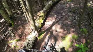
I’m not sure how or why this trail got its name. But after riding it a few times you’ll notice that the name is strangely apt. Nevertheless, local riders have invented their own variations of the name, Zebeedeebee for one, which somehow seems even more apropos.

Local Trail Association
Traditionally Indigenous Territory

Recent Activity on Trail

Past Week
  • 0 rides
  •  
6 Months
  • 21 rides
  • 11 miles avg distance
All
  • 301 rides
  • Last: Jun 29, 2026
c1c2c3c4
January
February
March
April
May
June
July
August
September
October
November
December
update trails status or condition

Zebedee Trail Reports

Status:
on Jun 28, 2026
Variable
Avg: 4.44 (5 votes)
Your vote: 0

view (1,903)
close
3D
Trail Conditions
  • Unknown
  • Snow Groomed
  • Snow Packed
  • Snow Covered
  • Snow Cover Partial
  • Freeze/thaw Cycle
  • Icy
  • Prevalent Mud
  • Wet
  • Variable
  • Ideal
  • Dry
  • Very Dry
Trail Flow (Ridden Direction)
Trailforks scans users ridelogs to determine the most popular direction each trail is ridden. A good flowing trail network will have most trails flowing in a single direction according to their intension.
The colour categories are based on what percentage of riders are riding a trail in its intended direction.
  • > 96%
  • > 90%
  • > 80%
  • > 70%
  • > 50%
  • < 50%
  • bi-directional trail
  • no data
Trail Last Ridden
Trailforks scans ridelogs to determine the last time a trail was ridden.
  • < 2 days
  • < 1 week
  • < 2 weeks
  • < 1 month
  • < 6 months
  • > 6 months
Trail Ridden Direction
The intended direction a trail should be ridden.
  • Downhill Only
  • Downhill Primary
  • Both Directions
  • Uphill Primary
  • Uphill Only
  • One Direction
Contribute Details
Colors indicate trail is missing specified detail.
  • Description
  • Photos
  • Description & Photos
  • Videos
Trail Popularity ?
Trailforks scans ridelogs to determine which trails are ridden the most in the last 9 months. Trails are compared with nearby trails in the same city region with a possible 25 colour shades. Think of this as a heatmap, more rides = more kinetic energy = warmer colors.
  • most popular
  • popular
  • less popular
  • not popular
ATV/ORV/OHV Filter
Max Vehicle Width
inches
US Cell Coverage
Legend
cell carrier legend

Radar Time
Activity Recordings
Trailforks uses anonymized public activity data. ?
Activity Recordings
Trailforks uses anonymized public activity data. ?
Personal Heatmap
Activity Types
all / none
Options
2
Date range month
Winter Trails
Warning A routing network for winter maps does not exist. Selecting trails using the winter trails layer has been disabled.
Missing Trails
Most Popular
Least Popular
Trails are colored based on popularity. The more popular a trail is, the more red. Less popular trails trend towards green.
Jump Magnitude Heatmap
Heatmap of where riders jump on trails. Zoom in to see individual jumps, click circles to view jump details.
BC Backroad Status

Service Road Atlas is a free to use, community-driven service for viewing and creating reports on the numerous back-country service roads around B.C. and Alberta.

map legend
Slope Aspect
Direction the slope faces
Flat N NE E SE S SW W NW
Trails Deemphasized
Trails are shown in grey.
disable
Only show trails with no bike usage.
Enable
Suggested Layers
Based on selected activity type

    Save the current map location and zoom level as your default home location whenever this page is loaded.

    Save
        Directions to zebedee trailhead (43.760590, -72.800140)

        Photos

        1 more »
        131 |
        Jul 14, 2019 @ 8:15am
        Jul 14, 2019

        Videos

        1 more »
        Zebedee - Green Mountain Trails - Pittsfield, VT
        7:26 | 143 | Jul 19, 2024 , Pittsfield

        Routes with this trail

        17 miles 2,594 ft 24 Point to Point
        This route encompasses most of the expert descents and adds in new trails to the system. Enjoy
        18 miles 2,957 ft 26 Point to Point
        This route encompasses most of the expert descents and adds in new trails to the system. Enjoy
        17 miles 2,853 ft 25 Point to Point
        This route encompasses most of the expert descents and adds in new trails to the system. Enjoy

        1 Review & Comments


        We hope you've been enjoying Trailforks!

        Create a FREE account to view trail comments and much more.

        • By gmtrails PMBC & contributors
        • #39053 - 1,658 views

        Frequently Asked Questions About Zebedee

        Where is Zebedee located?
        Zebedee is located in Green Mountain Trails, Pittsfield, Vermont, United States. It is part of the Green Mountain Trails trail network. The trailhead is located at coordinates 43.76059, -72.80014.
        How hard is Zebedee?
        Zebedee is rated as Blue difficulty. The physical rating is Easy. The average grade is 0.1%. The climb difficulty is rated Green.
        What is the elevation gain for Zebedee?
        Zebedee has 66 ft of elevation gain. The trail has 70 ft of elevation descent. The elevation ranges from 1,718 ft to 1,772 ft.
        Is Zebedee a point to point trail?
        Zebedee is not a point to point trail. The direction is Both Directions. The trail type is singletrack.

        Hit the Trail

        Open in App

        Get this trail on your phone instantly.
        open trail in app

        Download Trail

        Save to wishlist, Garmin & download.
        save the trail

        Find Related Routes

        Find routes and users activities that include this trail.
        find routes for this trail

        You must enter a description before submitting.