close
-
Layers w
- Weather Layers
- Pro
- Pro
- Pro
- Pro
- Pro
- Pro
- More Layers
- Pro
- Pro
- Pro
- Pro
-
Upgrade to

3D
Trail Conditions
- Unknown
- Snow Groomed
- Snow Packed
- Snow Covered
- Snow Cover Partial
- Freeze/thaw Cycle
- Icy
- Prevalent Mud
- Wet
- Variable
- Ideal
- Dry
- Very Dry
Trail Flow (Ridden Direction)
Trailforks scans users ridelogs to determine the most popular direction each trail is ridden. A good flowing trail network will have most trails flowing in a single direction according to their intension.
The colour categories are based on what percentage of riders are riding a trail in its intended direction.
The colour categories are based on what percentage of riders are riding a trail in its intended direction.
- > 96%
- > 90%
- > 80%
- > 70%
- > 50%
- < 50%
- bi-directional trail
- no data
Trail Last Ridden
Trailforks scans ridelogs to determine the last time a trail was ridden.
- < 2 days
- < 1 week
- < 2 weeks
- < 1 month
- < 6 months
- > 6 months
Trail Ridden Direction
The intended direction a trail should be ridden.
- Downhill Only
- Downhill Primary
- Both Directions
- Uphill Primary
- Uphill Only
- One Direction
Contribute Details
Colors indicate trail is missing specified detail.
- Description
- Photos
- Description & Photos
- Videos
Trail Popularity ?
Trailforks scans ridelogs to determine which trails are ridden the most in the last 9 months.
Trails are compared with nearby trails in the same city region with a possible 25 colour shades.
Think of this as a heatmap, more rides = more kinetic energy = warmer colors.
- most popular
- popular
- less popular
- not popular
ATV/ORV/OHV Filter
Max Vehicle Width
inches
US Cell Coverage
Legend

Radar Time
Activity Recordings
Trailforks uses anonymized public activity data.
?
Activity Recordings
Trailforks uses anonymized public activity data.
?
Personal Heatmap
▶
Activity Types
all
/
none
▶
Options
2
Date range
month
–
Winter Trails
Warning
A routing network for winter maps does not exist. Selecting trails using the winter trails layer has been disabled.
Missing Trails
Most Popular
Least Popular
Trails are colored based on popularity. The more popular a trail is, the more red. Less popular trails trend towards green.
Jump Magnitude Heatmap
Heatmap of where riders jump on trails. Zoom in to see individual jumps, click circles to view jump details.
BC Backroad Status
![map legend]()
Service Road Atlas is a free to use, community-driven service for viewing and creating reports on the numerous back-country service roads around B.C. and Alberta.

Slope Aspect
Direction the slope faces
Trails Deemphasized
Trails are shown in grey.
Only show trails with no bike usage.
Suggested Layers
Based on selected activity type
Save the current map location and zoom level as your default home location whenever this page is loaded.
SavePrimarily a purpose-built mountain bike trail system managed by the Bureau of Land Management.
The mountain biking trails are accessed on the south side of the main South Fork Road, via the Fall Creek Trailhead. Hiking trails are accessed on the north side of the main road, either via the campground or the day-use area. There is one multi-use trail open to bikes on the north side of the road between the campground and day-use.
Currently the main mountain biking loop is 1900ft of descent over 5 miles with a 10-mile loop back to the parking lot. With alternate routes and other lines, total trail length stands at about 12 miles. Trail styles range from sustainable bench-cut trail to rolling flow trail to freeride. There is a lot of smooth natural tread with some exposed root features. The most difficult trails feature rocks and jumps, some of which are blind and should be scouted beforehand. Difficulty is in the beginner to advanced range, with the most difficult trails being higher up in elevation.
Hiking / running trails on the north side are mostly narrow natural bench-cut trails, with some steep options going up the ridge and down on the other side of the south fork of the Alsea River. The best hike is a 2-mile out-and-back to Green Peak Falls that will take you through the McBee campground.
Primary Trail Type: All-Mountain & Downhill
Land Status: National Forest
Land Manager: BLM
 google parking directions
Links
Region Supporters & Maintainers
Activities Click to view
- Mountain Bike
23 trails
- Hike
24 trails
- Trail Running
24 trails
Region Details
- 11
- 1
- 5
- 4
- 1
- 1
Region Status
Open as of Jul 4, 2026Local Trail Association
Stats
- Avg Trail Rating
- Trails (view details)
- 26
- Trails Mountain Bike
- 23
- Trails Hike
- 24
- Trails Trail Running
- 24
- Total Distance
- 28 miles
- Total Descent
- 5,349 ft
- Total Vertical
- 2,060 ft
- Highest Trailhead
- 2,745 ft
- Reports
- 1,704
- Photos
- 204
- Ridden Counter
- 15,206
Popular Alsea Falls Mountain Biking Trails
• 100 ★ 4.7 • 2 miles • 19 ft • 1,934 •
The 1.75-mile Trail is suitable for beginning riders. It is the signature flow trail of the trail system, full of undulating rollers and berms like a pump track on the side of a hill. Opportunities for air are there for more advanced...
• 100 ★ 4.4 • 1 mile • 12 ft • 1,898 •
Singletrack trail that starts narrow and winding with some roots and very short uphills to negotiate. As it descends it opens up into a series of hand-built berms with a few small rollers and kickers. Midway it comes out onto a landing...
• 95 ★ 4.2 • 2,103 ft • 0 ft • 1,554 •
A quick trail that starts with three long open legs of uneven and varying difficulty, including roots, rocks, and unpredictable terrain. Towards the bottom the trail opens up into big berms and a few good-sized rollers and optional...
• 95 ★ 4.7 • 3,632 ft • 0 ft • 1,295 •
Flow and jump trail with lots of hidden lines and jibs among the rocks. Technical if you ride slowly and gets more flowy the faster you go and the more of the hidden kickers you find. Jumps and step-ups, rock spines, some very small...
• 90 ★ 4.9 • 3,376 ft • 7 ft • 1,205 •
is a black diamond flow / jump trail, starting from the highest point in the trail system. Riders will first hit a sequence of doubled jumps, hips/sharkfins, and steep berms. One of the features is a blind scrub; if you send it you are...
• 90 ★ 4.6 • 4,098 ft • 16 ft • 750 •
Climbing/descending trail, predominantly benched singletrack with rollers. Many little jump opportunities on the upper section, above the first bridge. This trail provides access to and , as well as an alternate descending line.
• 75 ★ 4.0 • 1 mile • 7 ft • 596 •
Classic or old-school narrow single track with some roots and tight corners as it winds through the forest. The upper section starts by descending old hand-built singletrack that traverses the ridgeline above , with several switchbacks...
Alsea Falls Mountain Bike Routes
★ 4.5 • 9 miles • 1,573 ft • 8 • Loop •
The full climb and descent option as of the 2015 season. This includes the only route to the top of via a...
★ 5.0 • 7 miles • 1,043 ft • 5 • Loop •
Middle option for climbing and descending. Other shorter options exist as well as alternate descents...
★ 5.0 • 9 miles • 1,645 ft • 8 • Loop •
A full climb and descent route with an optional change to ride in the lower 1/2 to 1/3, which gets you...
★ 5.0 • 5 miles • 600 ft • 4 • Loop •
Lower option for climbing and descending. Start by going to the left of the main gate at the parking lot...
10 miles • 1,929 ft • 4 • Loop •
This is the main gravity line in its entirety, bypassing (lower) for adaptive riders via the fire road...
11 miles • 2,355 ft • 3 •
Best trails at Alsea for advanced riders, without having to endure the awkward and flat lower trails all...
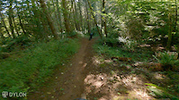
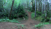
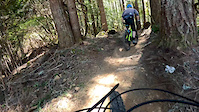
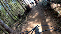
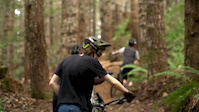
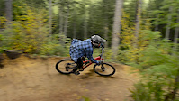
Photos of Alsea Falls Mountain Bike
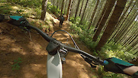
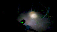
Videos of Alsea Falls Mountain Bike
trail: Chutes and Boulders Tie Rd
0:11 |
42 |
Sep 28, 2024
trail: Chutes and Boulders
0:18 |
445 |
Jul 7, 2023
trail: Chutes and Boulders
0:22 |
1190 |
Jun 28, 2020
trail: Highballer
0:07 |
115 |
Jun 6, 2020
trail: Middle Whistlepunk
4:45 |
323 |
Apr 20, 2020
trail: Misery Whip
2:01 |
333 |
Apr 20, 2020
trail: Misery Whip
3:01 |
422 |
Feb 28, 2020
trail: Middle Whistlepunk
8:17 |
1885 |
Jan 25, 2016
Recent Trail Reports
Activity Feed
| username | action | type | title | date |
|---|---|---|---|---|
| KyleB2 | wishlist | trail | activity #98668080 | Jul 7, 2026 @ 2:44pm Jul 7, 2026 |
| CinnabarScar | wishlist | trail | activity #98659904 and 1 more | Jul 7, 2026 @ 12:19pm Jul 7, 2026 |
| wolvesnotsheep | wishlist | region | activity #98551027 | Jul 5, 2026 @ 6:59pm Jul 5, 2026 |
| Ecollins109 | wishlist | trail | activity #98467628 | Jul 4, 2026 @ 7:08pm Jul 4, 2026 |
| tbmaddux | add | report | activity #98454549 and 8 more | Jul 4, 2026 @ 2:51pm Jul 4, 2026 |
Recent Comments
| username | type | title | comment | date |
|---|---|---|---|---|
| trail | Great trail for getting more comfortable with... | Jun 21, 2026 @ 8:57pm Jun 21, 2026 | ||
| trail | Pre-2026 comments no longer apply. The remodel... | May 15, 2026 @ 12:43pm May 15, 2026 | ||
| trail | Very fun trail to get comfortable with doubles... | May 6, 2026 @ 8:17pm May 6, 2026 | ||
| report | No, I asked the crew and it will remain closed... | Mar 19, 2026 @ 3:59pm Mar 19, 2026 | ||
| report | Thanks for your report! Will it be open... | Mar 19, 2026 @ 2:51pm Mar 19, 2026 |
Nearby Areas
| name | distance | ||||
|---|---|---|---|---|---|
| Marys Peak | 2 | 2 | 13.9 km | ||
| Tum Tum | 5 | 10 | 2 | 16.7 km | |
| Bald Hill Natural Area | 14 | 2 | 19.4 km | ||
| Alder Creek | 3 | 4 | 22.5 km | ||
| Chip Ross Park | 5 | 22.7 km |
Local Badges
-

Completionist0 awarded
Activity Type Stats
| activitytype | trails | distance | descent | descent distance | total vertical | rating | global rank | state rank | photos | reports | routes | ridelogs |
|---|---|---|---|---|---|---|---|---|---|---|---|---|
| Mountain Bike | 23 | 26 miles | 4,885 ft | 12 miles | 1,936 ft | #1,810 | #613 | 209 | 1,704 | 9 | 8,933 | |
| Hike | 24 | 24 miles | 3,550 ft | 9 miles | 2,060 ft | #1,134 | #567 | 1 | 1,575 | 126 | ||
| Trail Running | 24 | 24 miles | 3,550 ft | 9 miles | 2,060 ft | #5,777 | #1,798 | 1,575 | 1 | 25 |
Frequently Asked Questions About Alsea Falls
▼
What are the highest rated mountain biking trails in Alsea Falls?
The highest rated mountain biking trails in Alsea Falls are:
- Misery Whip (4.7/5)
- Springboard (4.6/5)
- Middle Whistlepunk (4.6/5)
- Highballer (4.3/5)
- Gutrobber (4.3/5)
▼
What is the best time of the year to ride in Alsea Falls?
Based on ride log data, the most popular months to ride in Alsea Falls are:
- July (180 activities)
- August (145 activities)
- September (135 activities)
▼
Where can I park to ride in Alsea Falls?
There are 2 parking locations listed in Alsea Falls. The most popular parking spots are:
▼
What is the longest trail in Alsea Falls?
The longest trail in Alsea Falls is Chutes and Boulders at 2.6 miles. View all trails sorted by distance.
Activities
Trails
Points of Interest
- By tbmaddux
 Team Dirt Alsea Falls TC & contributors
 - Admins: Team Dirt, Team Dirt
- #3941 - 66,949 views
- alsea falls activity log | embed map of Alsea Falls mountain bike trails | alsea falls mountain biking points of interest
Downloading of trail gps tracks in kml & gpx formats is enabled for Alsea Falls.
You must login to download files.