
close
3D
Trail Conditions
- Unknown
- Snow Groomed
- Snow Packed
- Snow Covered
- Snow Cover Partial
- Freeze/thaw Cycle
- Icy
- Prevalent Mud
- Wet
- Variable
- Ideal
- Dry
- Very Dry
Trail Flow (Ridden Direction)
Trailforks scans users activity logs to determine the most popular direction each trail is ridden. A good flowing trail network will have most trails flowing in a single direction according to their intension.
The colour categories are based on what percentage of users are riding a trail in its intended direction.
The colour categories are based on what percentage of users are riding a trail in its intended direction.
- > 96%
- > 90%
- > 80%
- > 70%
- > 50%
- < 50%
- bi-directional trail
- no data
Trail Last Used
Trailforks scans activity logs to determine the last time a trail was ridden.
- < 2 days
- < 1 week
- < 2 weeks
- < 1 month
- < 6 months
- > 6 months
Trail Ridden Direction
The intended direction a trail should be ridden.
- Downhill Only
- Downhill Primary
- Both Directions
- Uphill Primary
- Uphill Only
- One Direction
Contribute Details
Colors indicate trail is missing specified detail.
- Description
- Photos
- Description & Photos
- Videos
Trail Popularity ?
Trailforks scans activity logs to determine which trails are ridden the most in the last 9 months.
Trails are compared with nearby trails in the same city region with a possible 25 colour shades.
Think of this as a heatmap, more activities = more kinetic energy = warmer colors.
- most popular
- popular
- less popular
- not popular
ATV/ORV/OHV Filter
Max Vehicle Width
inches
US Cell Coverage
Legend

Radar Time
Activity Recordings
Trailforks uses anonymized public activity data.
?
Activity Recordings
Trailforks uses anonymized public activity data.
?
Winter Trails
Warning
A routing network for winter maps does not exist. Selecting trails using the winter trails layer has been disabled.
Missing Trails
Most Popular
Least Popular
Trails are colored based on popularity. The more popular a trail is, the more red. Less popular trails trend towards green.
Jump Magnitude Heatmap
Heatmap of where users jump on trails. Zoom in to see individual jumps, click circles to view jump details.
BC Backroad Status
![map legend]()
Service Road Atlas is a free to use, community-driven service for viewing and creating reports on the numerous back-country service roads around B.C. and Alberta.

Slope Aspect
Direction the slope faces
Trails Deemphasized
Trails are shown in grey.
Only show trails with no bike usage.
Suggested Layers
Based on selected activity type
Save the current map location and zoom level as your default home location whenever this page is loaded.
SaveCorner Canyon is the "Go To" riding area in South Salt Lake and for many riders it is worth the drive (or ride) from Utah County. It is a good mix of everything from beginner training trails in Little Valley to big table tops and wall rides in Maple Hollow. The Rush Downhill only trail and Anne's Trail are favorites for riders that like fast flow on any type of mountain bike. For a little more primitive and loose downhill there is the Jacobs Ladder Trail. The rest of the trails are mostly easy to intermediate smooth trails with the occasional sandy sections down below and hard clay pack up top.
The city of Draper has a trail closures and conditions map.
The city has big plans for this area and they continue to up their game with the recent addition of a jump track and cyclocross course just south of the Equestrian Center. Future plans include trail access from the south side of Traverse Ridge.
The city of Draper has a trail closures and conditions map.
The city has big plans for this area and they continue to up their game with the recent addition of a jump track and cyclocross course just south of the Equestrian Center. Future plans include trail access from the south side of Traverse Ridge.
 google parking directions plan a road trip here
Trail info last updated
Activities Click to view
- Mountain Bike
163 trails
- E-Bike
145 trails
- Horse
15 trails
- Hike
158 trails
- Trail Running
158 trails
- Snowshoe
9 trails
Region Details
- 19
- 7
- 39
- 81
- 15
- 2
Region Status
Open as of 12 hoursLocal Trail Association

Stats
- Avg Trail Rating
- Trails (view details)
- 189
- Trails Mountain Bike
- 163
- Trails E-Bike
- 145
- Trails Gravel Bike
- 28
- Trails Adaptive Bike
- 27
- Trails Winter Fat Bike
- 6
- Trails Horse
- 15
- Trails Hike
- 158
- Trails Trail Running
- 158
- Trails Snowshoe
- 9
- Total Distance
- 131 miles
- Total Descent
- 23,458 ft
- Total Vertical
- 5,113 ft
- Highest Trailhead
- 9,449 ft
- Reports
- 14,978
- Photos
- 1,230
- Completed Counter
- 339,689
Popular Corner Canyon Mountain Biking Trails
• 90 ★ 4.5 • 1 mile • 0 ft • 6,788 •
This is the upper part of the trail that is a very popular mountain bike trail going downhill. Riders love it for many reasons: It is fast, steep in multiple spots, and has different lines through some gnarled rocky formations. Several...
• 100 ★ 4.4 • 2 miles • 15 ft • 6,599 •
This is the improved section with that offers some great speed, but some turns are not bermed, like around the bridge crossing. Little double ups occasionally, does get a lot of traffic and brake bumps as well. Most the turns have high...
• 100 ★ 4.4 • 2,205 ft • 26 ft • 6,372 •
Flow trail is a bit tight at the top, but gets really fast as you transition to the lower Rush. Plenty of kick ups, jumps, drops, and huge berms. This is a favorite downhill trail for beginners and XC riders. The turns are frequent, it...
• 100 ★ 4.2 • 4,209 ft • 3 ft • 5,875 •
New lower rush with big rock armor berms and fast flow, now provides a full descent. This lowe section is no called Limelight and is the latest section with big rollers that can be doubled and trippled as gaps.
Rush Climb Permanently Closed
• 100 ★ 3.8 • 712 ft • 27 ft • 5,776 •
The quick right turn at the bottom of Rush, takes you on a short singletrack trail towards to the road where you can hook back up with Canyon Hollow, and start the fun over again.
• 100 ★ 4.0 • 597 ft • 66 ft • 5,684 •
Super fast flow connector between Canyon Hollow and Ghost Falls. Love dropping in on this, nice bridge crossing too.
• 95 ★ 2.7 • 951 ft • 0 ft • 5,352 •
Easy loop around the ball park with connection to the equestrian tracks
Corner Canyon Mountain Bike Routes
★ 4.3 • 7 miles • 1,278 ft • 22 • Loop •
This is a really popular option for folks to park at the skills park and make their way up to Rush. Lower...
★ 4.4 • 6 miles • 947 ft • 9 • Loop •
This is a great fast loop with an easy downhill.
★ 5.0 • 11 miles • 2,040 ft • 13 • Loop •
Fun loop up to Jacob's Ladder then back over to come down Rush. Take Canyon Hollow up to the top, then...
★ 3.7 • 8 miles • 1,064 ft • 14 • Loop •
A loop around the upper part of Draper, winding around Suncrest.
★ 5.0 • 6 miles • 978 ft • 4 •
Rush to Exit Stage Left. BST to Coyote Hollow. BST to Ann's back to top of Rush.
★ 4.0 • 7 miles • 1,018 ft • 6 • Loop •
Ann's Ghost starts at Potato Hill, proceeds across Ann's East then descends down Ghost Falls. From the...
Photos of Corner Canyon Mountain Bike
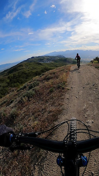
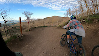
Videos of Corner Canyon Mountain Bike
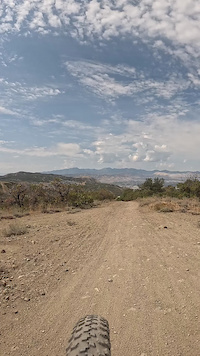
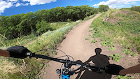
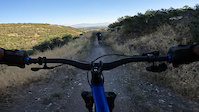


Current Trail Warnings
| status | trail | date | condition | user | info |
|---|---|---|---|---|---|
| Peak View (Lower) | Nov 15, 2026 @ 2:23pm (America/Boise) 1 day | Prevalent Mud | UtahBikeMike | ||
| Peak View | Nov 15, 2026 @ 2:23pm (America/Boise) 1 day | Variable | UtahBikeMike |
Recent Trail Reports
| status | trail | date | condition | info | user |
|---|---|---|---|---|---|
| Limelight (Rush) | Nov 16, 2026 @ 2:19pm (America/Denver) 12 hours | Variable | cam-lo | ||
| Rush, Lowest | Nov 16, 2026 @ 2:19pm (America/Denver) 12 hours | Ideal | cam-lo | ||
| Ghost Falls North | Nov 16, 2026 @ 2:18pm (America/Denver) 12 hours | Ideal | cam-lo | ||
| Ghost Falls | Nov 16, 2026 @ 2:18pm (America/Denver) 12 hours | Ideal | cam-lo | ||
| Corner Canyon Road, Lower | Nov 16, 2026 @ 2:18pm (America/Denver) 12 hours | Ideal | cam-lo | ||
| Sadler (Upper) | Nov 16, 2026 @ 2:18pm (America/Denver) 12 hours | Ideal | cam-lo | ||
| Jacob's Ladder | Nov 15, 2026 @ 2:23pm (America/Boise) 1 day | Ideal | UtahBikeMike | ||
| Corner Canyon Road, Upper | Nov 15, 2026 @ 2:23pm (America/Boise) 1 day | Variable | UtahBikeMike | ||
| Creek View (Equestrian Center) | Nov 15, 2026 @ 10:36am (America/Denver) 2 days | Wet | coulier | ||
| Rattler | Nov 15, 2026 @ 10:36am (America/Denver) 2 days | Wet | coulier |
National Scenic Trails & Official Routes
-
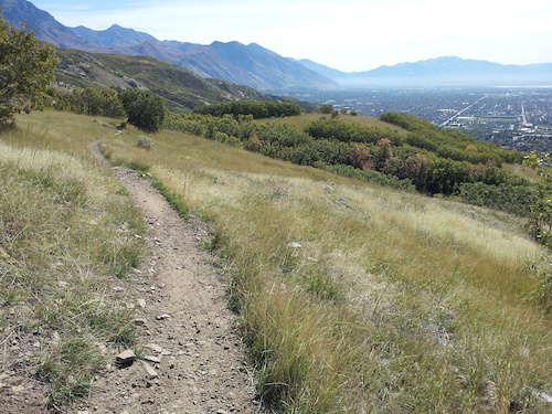
Bonneville Shoreline Trail
- Mountain Bike
- E-Bike
- Horse
- Hike
- Trail Running
- Snowshoe
- Nordic Ski
Activity Feed
| username | action | type | title | date |
|---|---|---|---|---|
| cam-lo | add | report | activity #107904192 and 5 more | Nov 16, 2026 @ 1:18pm 12 hours |
| UtahBikeMike | add | report | activity #107873376 and 3 more | Nov 15, 2026 @ 9:23pm 1 day |
| coulier | add | report | activity #107869416 and 6 more | Nov 15, 2026 @ 5:13pm 1 day |
| tguertler | wishlist | route | activity #107765323 | Nov 14, 2026 @ 8:08am 3 days |
| ahypio | add | report | activity #107760738 and 3 more | Nov 14, 2026 @ 7:10am 3 days |
Recent Comments
| username | type | title | comment | date |
|---|---|---|---|---|
| report | ditches, not dishes | Nov 7, 2026 @ 9:21pm Nov 7, 2026 | ||
| report | closed. large ditches and gates and signs... | Nov 7, 2026 @ 9:19pm Nov 7, 2026 | ||
| report | Are you able to elaborate? “Closed”... | Nov 5, 2026 @ 1:05am Nov 5, 2026 | ||
| report | immmmmm no mmmmm | Oct 29, 2026 @ 10:11am Oct 29, 2026 | ||
| trail | I Aq Q q want wow | Oct 23, 2026 @ 3:19pm Oct 23, 2026 |
Nearby Areas
| name | distance | ||||
|---|---|---|---|---|---|
| Traverse Mountain Trails | 5 | 8 | 3 | 2 | 2.7 km |
| Hidden Valley | 1 | 2 | 3.1 km | ||
| Cedar Hills | 4 km | ||||
| Lambert Park | 16 | 37 | 2 | 1 | 4.4 km |
| Dimple Dell | 11 | 5 | 4.4 km |
Local Badges
-

Completionist4 awarded
Bike & Skill Parks
| name | type | city | rating |
|---|---|---|---|
| Draper Cycle Park | skill park | Draper | |
| Draper Cycle Park Pumptrack | skill park | Draper |

Local Products



Activity Type Stats
| activitytype | trails | distance | descent | descent distance | total vertical | rating | global rank | state rank | photos | reports | routes | activity logs |
|---|---|---|---|---|---|---|---|---|---|---|---|---|
| Mountain Bike | 163 | 109 miles | 20,374 ft | 57 miles | 2,336 ft | #2 | #1 | 1,138 | 14,969 | 84 | 223,481 | |
| E-Bike | 145 | 104 miles | 19,075 ft | 54 miles | 2,336 ft | #22 | #15 | 13 | 14,749 | 12 | 18,488 | |
| Gravel Bike | 28 | 25 miles | 3,707 ft | 12 miles | 2,336 ft | #2 | #1 | 4 | 1,234 | 2 | 241 | |
| Adaptive Bike | 27 | 28 miles | 4,491 ft | 14 miles | 2,096 ft | #2 | #1 | 3,608 | 10 | |||
| Winter Fat Bike | 6 | 12 miles | 1,234 ft | 6 miles | 1,312 ft | #2 | #1 | 176 | 23 | |||
| Horse | 15 | 21 miles | 2,743 ft | 7 miles | 1,647 ft | #741 | #24 | 4,260 | 2 | 3 | ||
| Hike | 158 | 113 miles | 16,854 ft | 49 miles | 5,112 ft | #106 | #5 | 66 | 13,800 | 7 | 6,305 | |
| Trail Running | 158 | 113 miles | 16,854 ft | 49 miles | 5,112 ft | #160 | #4 | 6 | 13,797 | 13 | 12,225 | |
| Snowshoe | 9 | 9 miles | 919 ft | 2 miles | 2,037 ft | #224 | #1 | 40 | 1 | 66 |
Frequently Asked Questions
▼
What are the highest rated mountain biking trails in Corner Canyon?
The highest rated mountain biking trails in Corner Canyon are:
- Vertigo Jump Line #3 (4.6/5)
- Jacob's Ladder (4.5/5)
- Vertigo (4.5/5)
- Ghost Falls (4.5/5)
- Vertigo Jump Line #2 (4.5/5)
▼
What is the best time of the year to ride in Corner Canyon?
Based on activity log data, the most popular months to ride in Corner Canyon are:
- May (2,510 activities)
- June (2,496 activities)
- September (2,221 activities)
▼
Where can I park to ride in Corner Canyon?
There are 10 parking locations listed in Corner Canyon. The most popular parking spots are: View all parking and trailhead locations on the map to plan your visit.
▼
What is the longest trail in Corner Canyon?
The longest trail in Corner Canyon is Porter Rockwell at 4.6 miles. View all trails sorted by distance.
▼
What are the best & highest rated hiking trails in Corner Canyon?
The best hiking trails in Corner Canyon are: View all hiking trails sorted by popularity score.
▼
What are the best & highest rated trail running trails in Corner Canyon?
The best trail running trails in Corner Canyon are: View all trail running trails sorted by popularity score.
▼
How many trails are in Corner Canyon?
Corner Canyon has a total of 189 trails. Of those, 163 are designated for mountain biking. Browse top mountain biking trails in Corner Canyon to find detailed information including difficulty ratings, distances, and trail conditions.
▼
Which trail has the most elevation gain in Corner Canyon?
The trail with the most elevation gain in Corner Canyon is Longview with 736 ft of elevation gain. View all trails sorted by elevation gain.
▼
Which trail has the most elevation descent in Corner Canyon?
The trail with the most elevation descent in Corner Canyon is Carpe Diem with 959 ft of elevation descent. View all trails sorted by elevation descent.
▼
What activities are most popular in Corner Canyon?
Corner Canyon supports the following activities: Mountain Biking, E-Biking, Horseback, Hiking, Trail Running, Snowshoeing.
▼
What are the steepest mountain biking trails in Corner Canyon?
The steepest mountain biking trail in Corner Canyon is Rush Connector with an average grade of 20.4%. View all trails sorted by grade.
▼
Are there any trails with scenic viewpoints in Corner Canyon?
Yes, there are 4 scenic viewpoints marked along trails in Corner Canyon. Some popular viewpoints include: Explore more points of interest to find trails with the best views.
▼
What trails have the biggest jumps in Corner Canyon?
The trails with the biggest jumps in Corner Canyon are: Browse all mountain bike trails to find trails with jumps and technical features.
▼
Are the trails open in Corner Canyon?
The overall region status for Corner Canyon is Clear / Green. Out of 181 trails:
- Clear / Green: 165
- Minor Issue / Yellow: 12
- Significant Issue / Amber: 3
- Closed: 1
▼
What are the trail conditions in Corner Canyon?
Based on trail reports from the past week in Corner Canyon:
- Ideal: 9 trails
- Variable: 5 trails
- Dry: 1 trail
▼
Can I ride an ebike in Corner Canyon?
Yes, Corner Canyon supports e-bike riding. There are 146 trails in Corner Canyon that allow e-bikes. Check the e-bike trails listing for specific trail access details and any local regulations.
▼
What are the most popular mountain biking routes in Corner Canyon?
The most popular mountain biking routes in Corner Canyon are:
- Corner Canyon Cruise
- Up Canyon Hollow Down Ghost Falls and Rattler Loop
- Canyon Hollow to Jacob's Ladder to Rush
▼
What type of bike is most common in Corner Canyon?
Based on activity log data, the most common bike types used in Corner Canyon are:
- AM (1,500 activities)
- XC (422 activities)
- RD (65 activities)
- DH (21 activities)
- Fat (20 activities)
▼
What are the most popular Strava Segments in Corner Canyon?
The most popular Strava segments in Corner Canyon are:
- OLD VERSION - Boosting Corners (36,076 athletes)
- SUSTAINED SPEED!!!! (30,576 athletes)
- Lower Rush (29,278 athletes)
▼
What are some popular technical trail features in Corner Canyon?
There are 10 technical trail features (TTFs) in Corner Canyon. Some popular features include:
- Maple Hollow DH Filter (Bridge)
- Maple Hollow Wall Ride (Wallride)
- Maple Hollow Rock Drop (Rock Face)
- TTF Gap Jump (With B-line ride around) (Gap Jump)
- Rock Tunnel (Other)
▼
What trails are closed in Corner Canyon?
There are currently 1 closed trails in Corner Canyon. The breakdown of all trail statuses is:
- Clear / Green: 165
- Minor Issue / Yellow: 12
- Significant Issue / Amber: 3
- Closed: 1
▼
What are the most popular mountain biking trails in Corner Canyon?
The most popular mountain biking trails in Corner Canyon are: View all mountain biking trails sorted by popularity.
▼
What are the best beginner ride trails in Corner Canyon?
The best beginner mountain biking trails in Corner Canyon are:
- Canyon Hollow (4.5/5)
- Edelweiss (4/5)
- Rattle and Hum (4.5/5)
Activities
Trails
- By todd
 Trailforks & contributors
- Admins: apply
- #4876 - 152,332 views
- corner canyon activity log | embed map of Corner Canyon mountain bike trails | corner canyon mountain biking points of interest
Downloading of trail gps tracks in kml & gpx formats is enabled for Corner Canyon.
You must login to download files.
