

more stats
4,872 ft
Distance
88 ft
Climb
-40 ft
Descent
00:07:21
Avg time
50 ft
Altitude change
4,436 ft
Altitude min
4,510 ft
Altitude max
4,460 ft
Altitude start
4,511 ft
Altitude end
1%
Grade
-8%
Grade max
12.7%
Grade min
2,057 ft
Distance climb
1,132 ft
Distance down
1,686 ft
Distance flat
00:07:21
Avg time

Dawa Details

  • Activities
    • Mountain Bike
    • Adaptive Bike
    • Horse
    • Hike
    • Trail Running
  • Riding Area
    Upper Dry Creek
    Sedona, Arizona
  • Difficulty Rating
  • Voted Difficulty
    Green (1 vote)
  • Local Popularity
    90 in Mountain Biking [+]
    • 85 in Trail Running
    • 65 in Hiking
    • 100 in Horseback
    • 5 in Adaptive Biking
  • Global Ranking
    #5161 in Mountain Biking [+]
    • #34501 in Trail Running
    • #89256 in Hiking
  • Trail Type
    Singletrack
  • Bike Type
    AM, XC, Adaptive MTB
  • Direction
    Both Directions
  • Dogs Allowed
    Yes
  • eBike Allowed

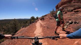
This trail is 1.68 miles long and is a combination of intermediate and advanced skilled sections to ride without having to stop or walk steep rocky sections. This is a multi-use trail, so beware of horses, hikers and trail runners.

What makes this trail routing interesting is that it is shaped like a slightly collapsed L and it joins the Cockscomb trail near the midpoint for about 50 yards. The northeast corner of the trail starts at the Boynton Pass Rd. and the southern end of the trail intersects with the AZ Cypress trail.

The section of Dawa between the Cockscomb intersection and the AZ Cypress trail is of a more advanced level trail due to rather steep loose rocky terrain in several sections.

My preferred direction of riding Dawa is from northeast to the southern end.

Adaptive Bike Info
aMTB Green Rating: Beginner features and moderate terrain.

During the wet season, when the Boynton Canyon is running, some aMTB's might need assistance getting up out of the creek.

Trail Supporters

  • USFS
    Land Manager
Local Trail Association

Recent Activity on Trail

Past Week
  • 1 rides
  • 21 miles average
6 Months
  • 101 rides
  • 14 miles avg distance
All
  • 1,249 rides
  • Last: Sep 18, 2026
c1c2c3c4
January
February
March
April
May
June
July
August
September
October
November
December
Status:
on Aug 31, 2026
Ideal
Avg: 3.37 (29 votes)
Your vote: 0

view (5,335)
close
      Directions to dawa trailhead (34.895900, -111.836880)

      Photos

      No photos have been added for Dawa yet, add a photo.

      Videos

      4 more »
      Mescal Trails Sedona, Arizona
      mtb
      23:33 | 292 | Aug 25, 2021 , Sedona
      Dawa UNCUT - Adaptive MTB - West Sedona, AZ
      mtb
      9:27 | 388 | May 9, 2021 , Sedona
      Sedona MTB Festival 2020 - Day 2 | West Sedona...
      mtb
      10:45 | 311 | Mar 16, 2020 , Sedona
      UNCUT - Dawa - Adaptive MTB - West Sedona, AZ
      mtb
      4:31 | 364 | Jul 19, 2019 , Sedona

      Trail Lists

      Routes with this trail

      5.0 10 miles 825 ft 7
      Starts and returns from the Aerie trialhead includes Upper Aerie Deadman's pass, , Fools Canyon and .
      5.0 17 miles 1,331 ft 7 Loop
      Beginner / Intermediate ride starting from Thunder Mountain Bikes. From the shop, ride down to the...
      3.5 18 miles 1,723 ft 8 Loop
      Moderate loop for the intermediate to advanced rider that hits most of the goods in the area. , , , Ground...
      3.3
      29 Ratings
      5 3%
      4 34%
      3 48%
      2 10%
      1 3%

      3 Reviews & Comments

      chromegurl chromegurl
      Agreed- this is maybe a blue- def not black. Fun trail though!
      cemoorelife cemoorelife
      This is definitely NOT a black trail, blue at best. Should be reclassified.
      otbspecialist
      This trail is definitely not black diamond. It's mostly green with a few blue spots. Should be re-categorized. Aerie trail is MUCH more challenging.

      We hope you've been enjoying Trailforks!

      Create a FREE account to view all trail reviews and much more.

      Nearby Trails

      • By toddTF Pro Trailforks & contributors
      • #14680 - 4,176 views

      Frequently Asked Questions

      Where is Dawa located?
      Dawa is located in Upper Dry Creek, Sedona, Arizona, United States. It is part of the Upper Dry Creek trail network. The trailhead is located at coordinates 34.8959, -111.83688.
      How hard is Dawa?
      Dawa is rated as Blue difficulty. The average grade is 1%.
      What is the elevation gain for Dawa?
      Dawa has 88 ft of elevation gain. The trail has 40 ft of elevation descent. The elevation ranges from 4,436 ft to 4,510 ft.
      Is Dawa a point to point trail?
      Dawa is not a point to point trail. The direction is Both Directions. The trail type is singletrack.
      How long is Dawa?
      Dawa is 4,872 ft long. The trail type is singletrack.
      Are dogs allowed on Dawa?
      Yes, dogs are allowed on Dawa. Please keep dogs on a leash where required and clean up after them.
      How do I access Dawa? Where is the closest parking trailhead?
      The closest parking and trailhead locations to Dawa are: View all parking locations in the area.
      How long does it take to ride Dawa?
      Based on recorded activities, it takes an average of 8 minutes to ride Dawa. The trail is 4,872 ft long. Actual times will vary based on fitness level, conditions, and pace. View recent activity logs for more details.
      How busy is Dawa?
      Dawa is a very popular trail. There have been 5,159 recorded activities on this trail. The trail has received 5,334 check-ins. View recent activity on this trail.

      Hit the Trail

      Open in App

      Get this trail on your phone instantly.

      open trail in app

      Download Trail

      Save to wishlist, Garmin & download.
      save the trail

      Find Related Routes

      Find routes and users activities that include this trail.
      find routes for this trail

      You must enter a description before submitting.