

more stats
1.8 miles
Distance
510 ft
Climb
-332 ft
Descent
00:18:23
Avg time
178 ft
Altitude change
7,342 ft
Altitude min
7,602 ft
Altitude max
7,359 ft
Altitude start
7,537 ft
Altitude end
1.85%
Grade
-33.738%
Grade max
39.47%
Grade min
1 mile
Distance climb
3,638 ft
Distance down
419 ft
Distance flat
00:18:23
Avg time

Salamander Flat Details

  • Activities
    • Mountain Bike
    • E-Bike
    • Horse
    • Hike
    • Trail Running
    • Dirtbike/Moto
    • Snowshoe
  • Riding Area
    American Fork Canyon
    Cedar Hills, Utah
  • Ref Number
    #150
  • AKA
  • Difficulty Rating
  • Voted Difficulty
    Blue (2 votes)
  • Local Popularity
    95 in Mountain Biking heatmap [+]
    • 95 in E-Biking
    • 90 in Trail Running
    • 90 in Hiking
    • 80 in Dirtbiking
    • 5 in Horseback
    • 5 in Snowshoeing
  • Global Ranking
    #93207 in Mountain Biking [+]
    • #94927 in E-Biking
    • #95296 in Trail Running
    • #102442 in Hiking
    • #2725 in Dirtbiking
    • #20036 in Horseback
    • #16334 in Snowshoeing
  • State Ranking
    #1,576 in Mountain Biking · Utah [+]
    • #1,040 in E-Biking
    • #2,057 in Trail Running
    • #2,291 in Hiking
    • #261 in Dirtbiking
    • #851 in Horseback
    • #99 in Snowshoeing
  • Hiking SAC Scale
    T2 Mountain Hiking
  • Trail Type
    Singletrack
  • Direction
    Both Directions
  • Climb Difficulty
    Blue
  • Physical Rating
    Moderate
  • Dogs Allowed
    Yes
  • eBike Allowed
    Yes up to Class 1
  • Land Owner
    Uinta-Wasatch-Cache National Forest

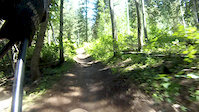
Local favorite ride, to connect from Timpanooke or drop out. Trail goes up and down, and is mostly pretty smooth. The drop down to Timpanooke is fast and fun. This trail connected with Ridge 157 and South Fork Little Deer Creek are probably the most biked and liked trails up at the Alpine Loop Summit.

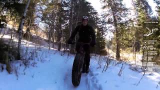
Winter - This trail is excellent in either direction. It rolls enough for some fun downhill both ways. If you spin up the road from Pine Hollow this is a great place to start the real fat bike riding, and you can roll on some great packed singletrack all the way back to the trail head via Pine Hollow.

Tags
AlpineSummitWater source

Trail Supporters

Traditionally Indigenous Territory

Recent Activity on Trail

Past Week
  • 0 rides
  •  
6 Months
  • 40 rides
  • 15 miles avg distance
All
  • 374 rides
  • Last: Nov 7, 2026
c1c2c3c4
January
February
March
April
May
June
July
August
September
October
November
December
Status:
on Oct 29, 2026
Ideal
Avg: 4.15 (15 votes)
Your vote: 0

view (5,201)
close
      Directions to salamander-flat trailhead (40.431290, -111.639120)

      Photos

      45 more »
      mtb
      273 |
      Nov 23, 2016 @ 4:46pm
      Nov 23, 2016
      mtb
      245 |
      Nov 23, 2016 @ 4:47pm
      Nov 23, 2016
      mtb
      315 |
      Jun 20, 2015 @ 11:05am
      Jun 20, 2015
      mtb
      62 |
      Feb 5, 2024 @ 6:38pm
      Feb 5, 2024

      Videos

      3 more »
      Salamander Flat (150) AF Canyon
      mtb
      4:30 | 819 | Oct 19, 2018 , Cedar Hills
      Global Fat Bike Day, 2015 Ride
      mtb
      872 | Dec 6, 2015 , Cedar Hills
      Salamaner Flat POV with mud crash
      mtb
      3:34 | 135 | Mar 14, 2015 , Cedar Hills

      Trail Lists

      Routes with this trail

      more »
      ★ 4.0 • 13 miles • 2,422 ft • 5 • Loop •
      This is a popular and fun loop in American Fork Canyon
      AFC Fight Night Featured
      ★ 5.0 • 9 miles • 1,185 ft • 3 • Shuttled •
      This is a local favorite loop to do after work and chase the light on some of the more technical trails in...
      ★ 5.0 • 13 miles • 2,046 ft • 12 •
      Fun loop from and back to Timpooneke.
      4.2 ★★★★★
      15 Ratings
      5 ★ 40%
      4 ★ 40%
      3 ★ 20%
      2 ★
      1 ★

      5 Reviews & Comments

      spenny_rides spenny_rides
      Its a fun trail! I'd say beginner or barely intermediate. Its got some drop offs to one side that might be nerve-racking if it was your first time on a dirtbike. Good trail tho!
      NathanRE3WLg
      The timpooneke parking lot is now only accessible by USFS reservations on weekends and holidays. Weekdays it is open to everyone. The only other legal parking is at the designated “turn offs” usually marked with green signs. The trail is overall in great shape.
      g33kboy
      Fully clear and rideable, but this is the most torn up I have ever seen it.

      We hope you've been enjoying Trailforks!

      Create a FREE account to view all trail reviews and much more.

      • By toddTF Pro Trailforks & contributors
      • #9385 - 6,536 views

      Frequently Asked Questions

      ▼ Where is Salamander Flat located?
      Salamander Flat is located in American Fork Canyon, Cedar Hills, Utah, United States. It is part of the American Fork Canyon trail network. The trailhead is located at coordinates 40.43129, -111.63912.
      ▼ How hard is Salamander Flat?
      Salamander Flat is rated as Blue difficulty. The physical rating is Moderate. The average grade is 1.85%. The climb difficulty is rated Blue.
      ▼ What is the elevation gain for Salamander Flat?
      Salamander Flat has 510 ft of elevation gain. The trail has 332 ft of elevation descent. The elevation ranges from 7,342 ft to 7,602 ft.
      ▼ Is Salamander Flat a point to point trail?
      Salamander Flat is not a point to point trail. The direction is Both Directions. The trail type is singletrack.
      ▼ How long is Salamander Flat?
      Salamander Flat is 1.8 miles long. The trail type is singletrack.
      ▼ Are dogs allowed on Salamander Flat?
      Yes, dogs are allowed on Salamander Flat. Please keep dogs on a leash where required and clean up after them.
      ▼ How do I access Salamander Flat? Where is the closest parking trailhead?
      The closest parking and trailhead locations to Salamander Flat are: View all parking locations in the area.
      ▼ How long does it take to ride Salamander Flat?
      Based on recorded activities, it takes an average of 18 minutes to ride Salamander Flat. The trail is 1.8 miles long. Actual times will vary based on fitness level, conditions, and pace. View recent activity logs for more details.
      ▼ How busy is Salamander Flat?
      Salamander Flat is a very popular trail. There have been 4,644 recorded activities on this trail. The trail has received 5,201 check-ins. View recent activity on this trail.

      Hit the Trail

      Open in App

      Get this trail on your phone instantly.

      open trail in app

      Download Trail

      Save to wishlist, Garmin & download.
      save the trail

      Find Related Routes

      Find routes and users activities that include this trail.
      find routes for this trail

      You must enter a description before submitting.


