

more stats
1,161 ft
Distance
2 ft
Climb
-132 ft
Descent
00:02:52
Avg time
-131 ft
Altitude change
2,807 ft
Altitude min
2,939 ft
Altitude max
2,938 ft
Altitude start
2,807 ft
Altitude end
-11.271%
Grade
-22.526%
Grade max
0.775%
Grade min
26 ft
Distance climb
1,004 ft
Distance down
105 ft
Distance flat
00:02:52
Avg time

THE Trail Details

  • Activities
    • Mountain Bike
    • Winter Fat Bike
    • Hike
    • Trail Running
  • Riding Area
    Molista
    Konitsa
  • Difficulty Rating
  • Local Popularity
    5 in Mountain Biking [+]
    • 5 in Trail Running
    • 5 in Hiking
    • 5 in Winter Fat Biking
  • Global Ranking
    #144629 in Mountain Biking [+]
    • #219103 in Trail Running
    • #210258 in Hiking
    • #7753 in Winter Fat Biking
  • National Ranking
    #799 in Mountain Biking · Greece [+]
    • #432 in Trail Running
    • #300 in Hiking
    • #19 in Winter Fat Biking
  • Trail Type
    Singletrack
  • Bike Type
    DH, AM, Fat
  • Direction
    Downhill Primary
    Popular Direction Shown
  • Climb Difficulty
    Green
  • Physical Rating
    Moderate
  • Season
    April - November
  • Dogs Allowed
    Yes
  • TTFs on Trail
    Rock Face
  • Year Opened
    2016

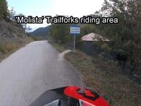
This is the old trail that used to be the primary route that connected the villages of Molista and Gannadio before a motorized road was created. In its entirety, it is a trail paved with black cobble stone, making it a full scale rock garden, but due to the fact that it has been out of use for many years the first half of the paved part is covered with soft dirt providing excellent grip. The last part is rather tricky and slippery since the ancient old rocks are well rounded and also the exit consists of a tight switchback.
It has been named as "THE Trail" since this is the way it has been reffered to by locals for the last 30 years or so.

Disclaimer

Users enter at own risk and are required to take necessary precautions

Tags
Rock gardensRock slabsWater source
Local Trail Association

Recent Activity on Trail

Past Week
  • 0 rides
  •  
6 Months
  • 0 rides
  •  
All
  • 3 rides
  • Last: Jun 20, 2021
update trails status or condition

THE Trail Trail Reports

statusdatedescription
Jun 28, 2020 @ 7:31am
Jun 28, 2020
Major tree down blocking the trail
Sep 2, 2019 @ 2:10am
Sep 2, 2019
May 21, 2019 @ 7:49am
May 21, 2019
Minor erosion (trail braiding, small ruts developing, brake bumps)
Jul 25, 2018 @ 3:12am
Jul 25, 2018
Some water is creating a pool towards the end of the trail. Caution advised
Feb 7, 2017 @ 3:20am
Feb 7, 2017
Second half very slippery due to ice on the rocky section
more »
Status:
on Jun 28, 2020
Avg: 3.98 (1 votes)
Your vote: 0

view (6)
close
      Directions to the-trail trailhead (40.128830, 20.818620)

      Photos

      5 more »
      mtb
      136 |
      Sep 1, 2016 @ 2:17am
      Sep 1, 2016
      mtb
      156 |
      Sep 1, 2016 @ 2:17am
      Sep 1, 2016
      mtb
      141 |
      May 8, 2016 @ 1:19pm
      May 8, 2016
      mtb
      157 |
      May 8, 2016 @ 1:18pm
      May 8, 2016

      Videos

      2 more »
      How to get to THE Trail
      mtb
      0:06 | 522 | Nov 10, 2016 , Konitsa
      My hometrail
      mtb
      0:08 | 402 | Oct 23, 2014 , Konitsa
      4.0 ★★★★★
      1 Ratings
      5 ★
      4 ★ 100%
      3 ★
      2 ★
      1 ★

      Reviews / Comments

      No reviews yet, be the first to write a review or ask a question.
      Use trail reports to comment on trail conditions.


      We hope you've been enjoying Trailforks!

      Create a FREE account to view all trail reviews and much more.

      • By hellequine & contributors
      • #55647 - 1,242 views

      Frequently Asked Questions

      ▼ Where is THE Trail located?
      THE Trail is located in Molista, Konitsa, Greece. It is part of the Molista trail network. The trailhead is located at coordinates 40.12883, 20.81862.
      ▼ How hard is THE Trail?
      THE Trail is rated as Blue difficulty. The physical rating is Moderate. The average grade is 11.271%. The climb difficulty is rated Green.
      ▼ What is the elevation gain for THE Trail?
      THE Trail has 2 ft of elevation gain. The trail has 132 ft of elevation descent. The elevation ranges from 2,807 ft to 2,939 ft.
      ▼ Is THE Trail a point to point trail?
      THE Trail is not a point to point trail. The direction is Downhill Primary. The trail type is singletrack.
      ▼ How long is THE Trail?
      THE Trail is 1,161 ft long. The trail type is singletrack.
      ▼ Are dogs allowed on THE Trail?
      Yes, dogs are allowed on THE Trail. Please keep dogs on a leash where required and clean up after them.
      ▼ When is the best time of year to ride THE Trail?
      THE Trail is best visited during: April - November.
      ▼ How do I access THE Trail? Where is the closest parking trailhead?
      The closest parking and trailhead locations to THE Trail are: View all parking locations in the area.
      ▼ How long does it take to ride THE Trail?
      The estimated time to ride THE Trail is approximately 3 minutes. The trail is 1,161 ft long. Actual times will vary based on fitness level, conditions, and pace.
      ▼ How busy is THE Trail?
      THE Trail is a less popular trail with lighter traffic. There have been 3 recorded activities on this trail. The trail has received 6 check-ins. View recent activity on this trail.

      Hit the Trail

      Open in App

      Get this trail on your phone instantly.

      open trail in app

      Download Trail

      Save to wishlist, Garmin & download.
      save the trail

      Find Related Routes

      Find routes and users activities that include this trail.
      find routes for this trail

      You must enter a description before submitting.


