more stats
1.1 miles
Distance
53 ft
Climb
-373 ft
Descent
00:11:23
Avg time
-321 ft
Altitude change
985 ft
Altitude min
1,309 ft
Altitude max
1,306 ft
Altitude start
984 ft
Altitude end
-5.6%
Grade
-35.6%
Grade max
18.6%
Grade min
787 ft
Distance climb
4,170 ft
Distance down
732 ft
Distance flat
00:11:23
Avg time

Upper Leaping Lizard Details

  • Activities
    • Mountain Bike
    • E-Bike
    • Hike
    • Trail Running
  • Riding Area
  • Difficulty Rating
  • Voted Difficulty
    Blue (13 votes)
  • Local Popularity
    85 in Mountain Biking [+]
    • 95 in E-Biking
    • 55 in Trail Running
    • 75 in Hiking
  • Global Ranking
    #18292 in Mountain Biking [+]
    • #2379 in E-Biking
    • #65030 in Trail Running
    • #61601 in Hiking
  • Trail Type
    Singletrack
  • Bike Type
    AM, XC
  • Direction
    Downhill Only
  • Climb Difficulty
    Blue
  • Physical Rating
    Moderate
  • Dogs Allowed
    Yes
  • eBike Allowed
    Yes up to Class 1
  • TTFs on Trail
    Berm, Jump
  • Ride in Rain
    Yes
  • Year Opened
    2018
  • Land Owner
    Wellington City Council

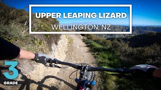
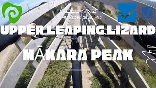
Originally built in 2003 by Makara Peak Supporters, an extension was funded by WCC and built by TGL in 2018 which links the summit to Aratihi and then onwards to the south west corner of the park.

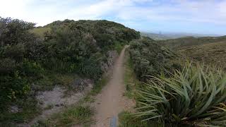
The new section is a machine built flow trail with berms, rollers and table tops to keep riders of all abilities interested. The top section of trail crosses a short bridge over the top of the A2Z trench before winding it's way down the hill to meet the original Upper Leaping Lizard trail. Located on the north side of the peak, expect to be battered and blown around in a strong northerly.

The original trail is a bit narrower, with a rockier surface and is a touch more technical. Surfacing and drainage work was completed by TGL in late 2018, plus a bypass of a particularly steep section of the trail was built.

Access Info

Starting from the summit, it can also be accessed 50 metres uphill from the intersection of Upswing and Aratihi

Trail Supporters
  • past supporters

  • TGL Contracting
    2018
    Builder
Local Trail Association

Recent Activity on Trail

Past Week
  • 0 rides
  •  
6 Months
  • 93 rides
  • 16 miles avg distance
All
  • 931 rides
  • Last: Jul 2, 2026
c1c2c3c4
January
February
March
April
May
June
July
August
September
October
November
December
update trails status or condition

Upper Leaping Lizard Trail Reports

Status:
on Jun 21, 2026
Variable
Avg: 3.94 (12 votes)
Your vote: 0

view (13,070)
close
3D
Trail Conditions
  • Unknown
  • Snow Groomed
  • Snow Packed
  • Snow Covered
  • Snow Cover Partial
  • Freeze/thaw Cycle
  • Icy
  • Prevalent Mud
  • Wet
  • Variable
  • Ideal
  • Dry
  • Very Dry
Trail Flow (Ridden Direction)
Trailforks scans users ridelogs to determine the most popular direction each trail is ridden. A good flowing trail network will have most trails flowing in a single direction according to their intension.
The colour categories are based on what percentage of riders are riding a trail in its intended direction.
  • > 96%
  • > 90%
  • > 80%
  • > 70%
  • > 50%
  • < 50%
  • bi-directional trail
  • no data
Trail Last Ridden
Trailforks scans ridelogs to determine the last time a trail was ridden.
  • < 2 days
  • < 1 week
  • < 2 weeks
  • < 1 month
  • < 6 months
  • > 6 months
Trail Ridden Direction
The intended direction a trail should be ridden.
  • Downhill Only
  • Downhill Primary
  • Both Directions
  • Uphill Primary
  • Uphill Only
  • One Direction
Contribute Details
Colors indicate trail is missing specified detail.
  • Description
  • Photos
  • Description & Photos
  • Videos
Trail Popularity ?
Trailforks scans ridelogs to determine which trails are ridden the most in the last 9 months. Trails are compared with nearby trails in the same city region with a possible 25 colour shades. Think of this as a heatmap, more rides = more kinetic energy = warmer colors.
  • most popular
  • popular
  • less popular
  • not popular
ATV/ORV/OHV Filter
Max Vehicle Width
inches
US Cell Coverage
Legend
cell carrier legend

Radar Time
Activity Recordings
Trailforks uses anonymized public activity data. ?
Activity Recordings
Trailforks uses anonymized public activity data. ?
Personal Heatmap
Activity Types
all / none
Options
2
Date range month
Winter Trails
Warning A routing network for winter maps does not exist. Selecting trails using the winter trails layer has been disabled.
Missing Trails
Most Popular
Least Popular
Trails are colored based on popularity. The more popular a trail is, the more red. Less popular trails trend towards green.
Jump Magnitude Heatmap
Heatmap of where riders jump on trails. Zoom in to see individual jumps, click circles to view jump details.
BC Backroad Status

Service Road Atlas is a free to use, community-driven service for viewing and creating reports on the numerous back-country service roads around B.C. and Alberta.

map legend
Slope Aspect
Direction the slope faces
Flat N NE E SE S SW W NW
Trails Deemphasized
Trails are shown in grey.
disable
Only show trails with no bike usage.
Enable
Suggested Layers
Based on selected activity type

    Save the current map location and zoom level as your default home location whenever this page is loaded.

    Save
        Directions to upper-leaping-lizard trailhead (-41.288750, 174.707180)

        Photos

        10 more »
        40 |
        Nov 26, 2021 @ 8:05pm
        Nov 26, 2021
        37 |
        Nov 26, 2021 @ 8:05pm
        Nov 26, 2021
        53 |
        Nov 26, 2021 @ 8:05pm
        Nov 26, 2021
        96 |
        Apr 8, 2020 @ 10:45pm
        Apr 8, 2020

        Videos

        9 more »
        youtuber FAST FLOW - Upper Leaping Lizard Mountain Bike...
        4:26 | 844 | Aug 15, 2020 , Wellington
        youtuber Upper Leaping Lizard @ Makara Peak 4K
        4:44 | 644 | Dec 16, 2018 , Wellington
        Upper Leaping Lizard - Mākara Peak Mountain...
        2:22 | 65 | Dec 6, 2024 , Wellington
        Upper Leaping Lizard | Mākara Peak |...
        6:43 | 288 | Nov 20, 2021 , Wellington

        Routes with this trail

        5.0 6 miles 1,489 ft 16 Loop
        An Advanced grade loop taking you out to the wilds of Makara Peak. Harder than an Intermediate grade due...
        3.0 4 miles 729 ft 4 Loop
        A great loop for riders looking for some variety or to extend their normal ride. This largely intermediate...
        10 miles 2,165 ft 26
        Easy Intermediate Loop - longer distance, but suited to less tech riders

        1 Review & Comments


        We hope you've been enjoying Trailforks!

        Create a FREE account to view trail comments and much more.

        Frequently Asked Questions About Upper Leaping Lizard

        Where is Upper Leaping Lizard located?
        Upper Leaping Lizard is located in Mākara Peak Mountain Bike Park, Wellington, New Zealand. It is part of the Mākara Peak Mountain Bike Park trail network. The trailhead is located at coordinates -41.28875, 174.70718.
        How hard is Upper Leaping Lizard?
        Upper Leaping Lizard is rated as Blue difficulty. The physical rating is Moderate. The average grade is 5.6%. The climb difficulty is rated Blue.
        What is the elevation gain for Upper Leaping Lizard?
        Upper Leaping Lizard has 16 m of elevation gain. The trail has 114 m of elevation descent. The elevation ranges from 300 m to 399 m.
        Is Upper Leaping Lizard a point to point trail?
        Yes, Upper Leaping Lizard is a point to point trail. The direction is Downhill Only. The trail type is singletrack.

        Hit the Trail

        Open in App

        Get this trail on your phone instantly.
        open trail in app

        Download Trail

        Save to wishlist, Garmin & download.
        save the trail

        Find Related Routes

        Find routes and users activities that include this trail.
        find routes for this trail

        You must enter a description before submitting.