
close
3D
Trail Conditions
- Unknown
- Snow Groomed
- Snow Packed
- Snow Covered
- Snow Cover Partial
- Freeze/thaw Cycle
- Icy
- Prevalent Mud
- Wet
- Variable
- Ideal
- Dry
- Very Dry
Trail Flow (Ridden Direction)
Trailforks scans users activity logs to determine the most popular direction each trail is ridden. A good flowing trail network will have most trails flowing in a single direction according to their intension.
The colour categories are based on what percentage of users are riding a trail in its intended direction.
The colour categories are based on what percentage of users are riding a trail in its intended direction.
- > 96%
- > 90%
- > 80%
- > 70%
- > 50%
- < 50%
- bi-directional trail
- no data
Trail Last Used
Trailforks scans activity logs to determine the last time a trail was ridden.
- < 2 days
- < 1 week
- < 2 weeks
- < 1 month
- < 6 months
- > 6 months
Trail Ridden Direction
The intended direction a trail should be ridden.
- Downhill Only
- Downhill Primary
- Both Directions
- Uphill Primary
- Uphill Only
- One Direction
Contribute Details
Colors indicate trail is missing specified detail.
- Description
- Photos
- Description & Photos
- Videos
Trail Popularity ?
Trailforks scans activity logs to determine which trails are ridden the most in the last 9 months.
Trails are compared with nearby trails in the same city region with a possible 25 colour shades.
Think of this as a heatmap, more activities = more kinetic energy = warmer colors.
- most popular
- popular
- less popular
- not popular
ATV/ORV/OHV Filter
Max Vehicle Width
inches
US Cell Coverage
Legend

Radar Time
Activity Recordings
Trailforks uses anonymized public activity data.
?
Activity Recordings
Trailforks uses anonymized public activity data.
?
Winter Trails
Warning
A routing network for winter maps does not exist. Selecting trails using the winter trails layer has been disabled.
Missing Trails
Most Popular
Least Popular
Trails are colored based on popularity. The more popular a trail is, the more red. Less popular trails trend towards green.
Jump Magnitude Heatmap
Heatmap of where users jump on trails. Zoom in to see individual jumps, click circles to view jump details.
BC Backroad Status
![map legend]()
Service Road Atlas is a free to use, community-driven service for viewing and creating reports on the numerous back-country service roads around B.C. and Alberta.

Slope Aspect
Direction the slope faces
Trails Deemphasized
Trails are shown in grey.
Only show trails with no bike usage.
Suggested Layers
Based on selected activity type
Save the current map location and zoom level as your default home location whenever this page is loaded.
SaveThis area formerly known as Pima/Dynamite and then Browns Ranch was incorporated into the McDowell Sonoran Preserve. Some of the old trails were adopted into the Preserve while others were decommissioned or re-routed. The main trailhead is Brown's Ranch at the north end of Alma School Rd. There is plentiful parking here, with water, toilets, and maps. Two more trailheads, Fraesfield off Rio Verde and Granite Mountain off 136th St, are on the east side of the area. There is another trailhead at the NE corner of Pima/Dynamite Rds (can be accessed from either road), which also has water, bathrooms, and maps (upgraded at the end of 2021). The area is multi-use, popular with hikers, runners, equestrians and MTBrs. The farther north you ride, the fewer people you will see.
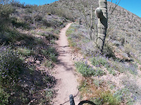
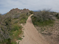
As for the trails, they are remarkably different than the rest of the valley. The vast majority of the trails are buff smooth, with very few on-trail obstacles. Some technical areas exist and are clearly marked with black diamond signage, and offer rock rolls/drops of various size and difficulty, and technical climbs. There are plenty of spiky flora just off the trail, which probably represents the biggest threat to you and your bike. There is also very little elevation change in the area. The steeper climbs tend to be very short and punchy, and the longer climbs are easy and gradual--most well below 5% grade; Brown's Mountain trail is the one sustained steep climb in the area, rideable either direction. The trails tend to climb when heading toward one of the mountains in the area, and are a fun cruise when heading away. All of this adds up to a great place for beginners, kids, and significant others looking to build their skills. It is also a great single-speed destination for riders looking to avoid hike-a-bike, or for gravel bikes. Note: E-bikes are not allowed on the trails.
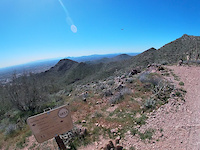
The setting is unspoiled Sonoran desert, with very little development nearby. Majestic Saguaros mix with huge granite boulders, with the most dramatic scenery surrounding Cholla and Granite Mountains. Due to the remoteness, come prepared with plenty of water, a bit of food, and the means to fix a flat or chain--it would be a long walk out from the north side trails.
As for the trails, they are remarkably different than the rest of the valley. The vast majority of the trails are buff smooth, with very few on-trail obstacles. Some technical areas exist and are clearly marked with black diamond signage, and offer rock rolls/drops of various size and difficulty, and technical climbs. There are plenty of spiky flora just off the trail, which probably represents the biggest threat to you and your bike. There is also very little elevation change in the area. The steeper climbs tend to be very short and punchy, and the longer climbs are easy and gradual--most well below 5% grade; Brown's Mountain trail is the one sustained steep climb in the area, rideable either direction. The trails tend to climb when heading toward one of the mountains in the area, and are a fun cruise when heading away. All of this adds up to a great place for beginners, kids, and significant others looking to build their skills. It is also a great single-speed destination for riders looking to avoid hike-a-bike, or for gravel bikes. Note: E-bikes are not allowed on the trails.
The setting is unspoiled Sonoran desert, with very little development nearby. Majestic Saguaros mix with huge granite boulders, with the most dramatic scenery surrounding Cholla and Granite Mountains. Due to the remoteness, come prepared with plenty of water, a bit of food, and the means to fix a flat or chain--it would be a long walk out from the north side trails.
Primary Trail Type: Cross-Country
eBikes Allowed:
No
Land Status: Regional Recreation Area
 google parking directions plan a road trip here
 Trail info last updated
Activities Click to view
- Mountain Bike
77 trails
- E-Bike
0 trails
- Hike
93 trails
- Trail Running
93 trails
- Dirtbike/Moto
0 trails
Region Details
- 14
- 1
- 19
- 31
- 9
- 3
Region Status
Open as of Sep 23, 2026Local Trail Association

Stats
- Avg Trail Rating
- Trails (view details)
- 94
- Trails Mountain Bike
- 77
- Trails Gravel Bike
- 19
- Trails Adaptive Bike
- 17
- Trails Winter Fat Bike
- 1
- Trails Horse
- 1
- Trails Hike
- 93
- Trails Trail Running
- 93
- Total Distance
- 103 miles
- Total Descent
- 11,965 ft
- Total Vertical
- 2,582 ft
- Highest Trailhead
- 3,954 ft
- Reports
- 727
- Photos
- 314
- Completed Counter
- 55,719
Popular McDowell Sonoran Preserve Trails
• 75 ★ 3.9 • 1 mile • 7 ft • 954 •
is a fairly smooth, fast and flowy trail that climbs/descends between the Pemberton Loop and the trails accessed from the Tom's Thumb trailhead (which are very popular with hikers). The elevation change and a few short, slightly...
• 70 ★ 4.2 • 7 miles • 305 ft • 900 •
Lots of twists & turns, a few short sand trap crossings keep the speed in check.
• 65 ★ 3.0 • 2,260 ft • 64 ft • 691 •
Moderately popular blue difficulty singletrack. This multi-use trail can be used both directions. On average it takes 4 minutes to complete this trail.
• 85 ★ 2.0 • 548 ft • 8 ft • 523 •
Reroute of Service Road #1 at crossing of North 128th St.
• 75 ★ 3.7 • 3,799 ft • 73 ft • 516 •
Popular green difficulty singletrack. This multi-use trail can be used both directions and has a easy overall physical rating with a 73 ft green climb. On average it takes 4 minutes to complete this trail.
• 80 ★ 3.9 • 2 miles • 444 ft • 515 •
is a fairly mellow access trail into the larger McDowell Preserve, or a good neighborhood ride if you live in the area. It makes a nice shorter loop when combined with trail. The trail has some rocky sections, but overall this is one of...
• 80 ★ 0.0 • 509 ft • 12 ft • 467 •
Popular blue difficulty singletrack. This multi-use trail can be used both directions. It features other. On average it takes minutes to complete this trail.
Mountain Bike Routes
★ 4.0 • 47 miles • 9,391 ft • 14 • Loop •
This route goes over all the passes & saddles in the McDowell Mtns. including all 3 trails to Tom's...
★ 4.5 • 9 miles • 2,021 ft • 7 •
Hike-a-bike to a little downhill to steep uphill to a lotta downhill.
★ 3.0 • 63 miles • 6,191 ft • 32 • Loop •
This is the of the AES McDowell Mountains course, at approximately 63 miles. No longer on the AES race...
27 miles • 1,732 ft • 16 • Loop •
Here's a great route for the singlespeeders out there. I made this route to take advantage of a single's...
14 miles • 551 ft • 9 • Loop •
A nice beginner trail without much climbing. It is quite scenic and flowy for Arizona.
16 miles • 893 ft • 12 • Loop •
A moderate (mostly) loop in the Middle part of McDowell Sonoran Preserve (formerly Brown's Ranch).
Photos of McDowell Sonoran Preserve Mountain Bike
Videos of McDowell Sonoran Preserve Mountain Bike

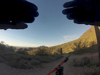
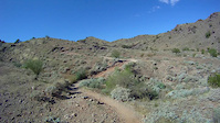
Recent Trail Reports
| status | trail | date | condition | info | user |
|---|---|---|---|---|---|
| Gooseneck Trail | Sep 23, 2026 @ 12:22pm (America/Phoenix) Sep 23, 2026 | Ideal | tbowmaster | ||
| Rock Knob | May 24, 2026 @ 7:04am (America/Phoenix) May 24, 2026 | Ideal | JetinJeff29r | ||
| Feldspar Trail | May 24, 2026 @ 7:04am (America/Phoenix) May 24, 2026 | Ideal | JetinJeff29r | ||
| Sunrise Trail | May 2, 2026 @ 9:36am (America/Phoenix) May 2, 2026 | Dry | K6fel8 | ||
| McDowell Mountain Park Acc | Apr 26, 2026 @ 7:33am (America/Phoenix) Apr 26, 2026 | Ideal | JetinJeff29r | ||
| Saguaro Nest Trail | Apr 26, 2026 @ 7:33am (America/Phoenix) Apr 26, 2026 | Ideal | JetinJeff29r | ||
| Marcus Landslide | Apr 5, 2026 @ 8:08am (America/Phoenix) Apr 5, 2026 | Dry | Peeejrides | ||
| East End | Mar 13, 2026 @ 7:08am (America/Phoenix) Mar 13, 2026 | Very Dry | yelofleahcim | ||
| Quartz T.H. Connector | Mar 10, 2026 @ 11:54am (America/Phoenix) Mar 10, 2026 | Ideal | javadown1969 | ||
| Quartz | Mar 10, 2026 @ 11:54am (America/Phoenix) Mar 10, 2026 | Ideal | javadown1969 |
Activity Feed
| username | action | type | title | date |
|---|---|---|---|---|
| tbowmaster | add | report | activity #104440031 | Sep 23, 2026 @ 12:30pm Sep 23, 2026 |
| ramsdude47 | ridden | trail | activity #102277192 | Aug 24, 2026 @ 11:28pm Aug 24, 2026 |
| oscarrHShJ | wishlist | route | activity #101062618 | Aug 8, 2026 @ 9:11pm Aug 8, 2026 |
| adlmtb | comment | trail | activity #97105312 | Jun 16, 2026 @ 6:31am Jun 16, 2026 |
| adlmtb | add | photo | activity #97105236 | Jun 16, 2026 @ 6:30am Jun 16, 2026 |
Recent Comments
| username | type | title | comment | date |
|---|---|---|---|---|
| trail | This is… not a blue. Black diamond for sure. | Jun 16, 2026 @ 6:31am Jun 16, 2026 | ||
| trail | Awesome descent if you're looking for... | Apr 30, 2026 @ 2:24pm Apr 30, 2026 | ||
| trail | This trail is extremely rocky and more... | Feb 18, 2026 @ 3:13pm Feb 18, 2026 | ||
| trail | Bowhead Reach does not go. Shitty gates and... | Jan 17, 2026 @ 8:48am Jan 17, 2026 | ||
| trail | Bowhead reach goes | Jan 17, 2026 @ 8:47am Jan 17, 2026 |
Nearby Areas
| name | distance | ||||
|---|---|---|---|---|---|
| McDowell Mountain Regional Park | 21 | 15 | 4 | 4.4 km | |
| Pinacle Peak Park | 5.7 km | ||||
| Brown's Ranch | 59 | 49 | 24 | 8.7 km | |
| Reach 11 Recreation Area | 7 | 9.1 km | |||
| Desert Vista | 18 | 40 | 8 | 12 km |
Local Badges
-

Completionist0 awarded




Activity Type Stats
| activitytype | trails | distance | descent | descent distance | total vertical | rating | global rank | state rank | photos | reports | routes | activity logs |
|---|---|---|---|---|---|---|---|---|---|---|---|---|
| Mountain Bike | 77 | 93 miles | 10,197 ft | 30 miles | 2,536 ft | #813 | #307 | 287 | 726 | 13 | 41,451 | |
| Gravel Bike | 19 | 22 miles | 833 ft | 5 miles | 2,536 ft | #794 | #408 | 93 | 447 | |||
| Adaptive Bike | 17 | 21 miles | 804 ft | 5 miles | 2,536 ft | #792 | #406 | 100 | 1 | |||
| Winter Fat Bike | 1 | 1,135 ft | 7 ft | 541 ft | 20 ft | #794 | #408 | 11 | ||||
| Horse | 1 | 942 ft | 43 ft | 830 ft | 43 ft | 148 | 6 | |||||
| Hike | 93 | 98 miles | 11,965 ft | 33 miles | 2,582 ft | #663 | #335 | 22 | 726 | 25 | 6,073 | |
| Trail Running | 93 | 98 miles | 11,965 ft | 33 miles | 2,582 ft | #994 | #309 | 726 | 2,605 |
Frequently Asked Questions
▼
What are the highest rated mountain biking trails in McDowell Sonoran Preserve?
The highest rated mountain biking trails in McDowell Sonoran Preserve are:
- Andrews-Kinsey Trail (4.1/5)
- Gooseneck Trail (4.1/5)
- Caballo Trail (4.1/5)
- Sunrise Trail (4/5)
- Prospector (4/5)
▼
Where can I park to ride in McDowell Sonoran Preserve?
There are 13 parking locations listed in McDowell Sonoran Preserve. The most popular parking spots are:
- Competitive Loop TH
- Trailhead Staging Area
- Fraesfield Mountain TH
- Adero Canyon Trailhead
- 104th Street (McDowell)
▼
What is the longest trail in McDowell Sonoran Preserve?
The longest trail in McDowell Sonoran Preserve is Gooseneck Trail at 6.6 miles. View all trails sorted by distance.
▼
What are the best & highest rated hiking trails in McDowell Sonoran Preserve?
The best hiking trails in McDowell Sonoran Preserve are: View all hiking trails sorted by popularity score.
▼
What are the best & highest rated trail running trails in McDowell Sonoran Preserve?
The best trail running trails in McDowell Sonoran Preserve are: View all trail running trails sorted by popularity score.
▼
How many trails are in McDowell Sonoran Preserve?
McDowell Sonoran Preserve has a total of 94 trails. Of those, 77 are designated for mountain biking. Browse top mountain biking trails in McDowell Sonoran Preserve to find detailed information including difficulty ratings, distances, and trail conditions.
▼
Which trail has the most elevation gain in McDowell Sonoran Preserve?
The trail with the most elevation gain in McDowell Sonoran Preserve is Tom`s Thumb with 1,410 ft of elevation gain. View all trails sorted by elevation gain.
▼
Which trail has the most elevation descent in McDowell Sonoran Preserve?
The trail with the most elevation descent in McDowell Sonoran Preserve is Bell Pass with 1,175 ft of elevation descent. View all trails sorted by elevation descent.
▼
What activities are most popular in McDowell Sonoran Preserve?
McDowell Sonoran Preserve supports the following activities: Mountain Biking, E-Biking, Hiking, Trail Running, Dirtbiking.
▼
What are the steepest mountain biking trails in McDowell Sonoran Preserve?
The steepest mountain biking trail in McDowell Sonoran Preserve is Sunrise Peak North with an average grade of 20.6%. View all trails sorted by grade.
▼
Are there any trails with scenic viewpoints in McDowell Sonoran Preserve?
Yes, there are 2 scenic viewpoints marked along trails in McDowell Sonoran Preserve. Some popular viewpoints include: Explore more points of interest to find trails with the best views.
▼
Are the trails open in McDowell Sonoran Preserve?
The overall region status for McDowell Sonoran Preserve is Clear / Green. Out of 79 trails:
- Clear / Green: 70
- Minor Issue / Yellow: 8
- Significant Issue / Amber: 1
▼
What are the trail conditions in McDowell Sonoran Preserve?
Based on trail reports from the past week in McDowell Sonoran Preserve:
- Ideal: 1 trail
▼
Can I ride an ebike in McDowell Sonoran Preserve?
Yes, McDowell Sonoran Preserve supports e-bike riding. However, individual trail e-bike permissions vary. Check the e-bike trails listing for specific trail access details and any local regulations.
▼
What are the most popular mountain biking routes in McDowell Sonoran Preserve?
The most popular mountain biking routes in McDowell Sonoran Preserve are: View all mountain biking routes in McDowell Sonoran Preserve.
▼
What are the top sights to see in McDowell Sonoran Preserve?
There are 2 notable sights in McDowell Sonoran Preserve. Some of the top sights include: Explore all points of interest in McDowell Sonoran Preserve.
▼
What are the most popular Strava Segments in McDowell Sonoran Preserve?
The most popular Strava segments in McDowell Sonoran Preserve are:
- Via Linda Link Fhills the easy way! (5,118 athletes)
- Adero Canyon path up (5,118 athletes)
- Skeleton Crew (4,538 athletes)
▼
What are the most popular mountain biking trails in McDowell Sonoran Preserve?
The most popular mountain biking trails in McDowell Sonoran Preserve are: View all mountain biking trails sorted by popularity.
▼
What are the best beginner ride trails in McDowell Sonoran Preserve?
The best beginner mountain biking trails in McDowell Sonoran Preserve are:
- Saguaro Nest Trail (3.7/5)
- Saguaro Nest Trail (3.8/5)
- WestWorld (3.4/5)
Activities
Trails
- Hard trails in McDowell Sonoran Preserve
- Easy trails in McDowell Sonoran Preserve
- Favorite trails in McDowell Sonoran Preserve
- Most ridden trails in McDowell Sonoran Preserve
- Singletrack in McDowell Sonoran Preserve
- Viewpoint trails in McDowell Sonoran Preserve
- Trails with technical features in McDowell Sonoran Preserve
- Race routes in McDowell Sonoran Preserve
- By todd
 Trailforks & contributors
 - Admins: DFMBA
- #4985 - 41,840 views
- mcdowell sonoran preserve activity log | embed map of McDowell Sonoran Preserve mountain bike trails | mcdowell sonoran preserve mountain biking points of interest
Downloading of trail gps tracks in kml & gpx formats is enabled for McDowell Sonoran Preserve.
You must login to download files.