
close
3D
Trail Conditions
- Unknown
- Snow Groomed
- Snow Packed
- Snow Covered
- Snow Cover Partial
- Freeze/thaw Cycle
- Icy
- Prevalent Mud
- Wet
- Variable
- Ideal
- Dry
- Very Dry
Trail Flow (Ridden Direction)
Trailforks scans users activity logs to determine the most popular direction each trail is ridden. A good flowing trail network will have most trails flowing in a single direction according to their intension.
The colour categories are based on what percentage of users are riding a trail in its intended direction.
The colour categories are based on what percentage of users are riding a trail in its intended direction.
- > 96%
- > 90%
- > 80%
- > 70%
- > 50%
- < 50%
- bi-directional trail
- no data
Trail Last Used
Trailforks scans activity logs to determine the last time a trail was ridden.
- < 2 days
- < 1 week
- < 2 weeks
- < 1 month
- < 6 months
- > 6 months
Trail Ridden Direction
The intended direction a trail should be ridden.
- Downhill Only
- Downhill Primary
- Both Directions
- Uphill Primary
- Uphill Only
- One Direction
Contribute Details
Colors indicate trail is missing specified detail.
- Description
- Photos
- Description & Photos
- Videos
Trail Popularity ?
Trailforks scans activity logs to determine which trails are ridden the most in the last 9 months.
Trails are compared with nearby trails in the same city region with a possible 25 colour shades.
Think of this as a heatmap, more activities = more kinetic energy = warmer colors.
- most popular
- popular
- less popular
- not popular
ATV/ORV/OHV Filter
Max Vehicle Width
inches
US Cell Coverage
Legend

Radar Time
Activity Recordings
Trailforks uses anonymized public activity data.
?
Activity Recordings
Trailforks uses anonymized public activity data.
?
Winter Trails
Warning
A routing network for winter maps does not exist. Selecting trails using the winter trails layer has been disabled.
Missing Trails
Most Popular
Least Popular
Trails are colored based on popularity. The more popular a trail is, the more red. Less popular trails trend towards green.
Jump Magnitude Heatmap
Heatmap of where users jump on trails. Zoom in to see individual jumps, click circles to view jump details.
BC Backroad Status
![map legend]()
Service Road Atlas is a free to use, community-driven service for viewing and creating reports on the numerous back-country service roads around B.C. and Alberta.

Slope Aspect
Direction the slope faces
Trails Deemphasized
Trails are shown in grey.
Only show trails with no bike usage.
Suggested Layers
Based on selected activity type
Save the current map location and zoom level as your default home location whenever this page is loaded.
Save
Snow & Rain 3D forecast Pro
See where it will snow, sleet or rain on Richmond hour by hour, on 3D terrain.
View 3D snow forecast
Town of Richmond, Vermont — Community and Trails Overview
Richmond is a small, historic town in Chittenden County, Vermont, situated in the Winooski River Valley at the western edge of the Green Mountains. Known for its rural character, scenic landscape, working farms, forested hills and strong community spirit, Richmond offers a range of outdoor recreation opportunities, including hiking, mountain biking, walking and other forms of trail-based recreation.
The town's trail network includes public recreation areas, conserved lands, community trails and connections to the wider regional trail system. These trails serve residents and visitors alike, providing access to forests, hillsides, riverside landscapes and the surrounding countryside.
Trail management in Richmond involves cooperation among the Town of Richmond, the Richmond Town Trails Committee, landowners, conservation organizations and local outdoor recreation groups. Responsibilities vary by property: some trails are located on town-owned land, while others cross conserved properties or privately owned land made available for public recreation. Trail construction, maintenance, access policies and stewardship therefore depend on the organization responsible for each individual property or trail system.
The Richmond Town Trails Committee
The Richmond Town Trails Committee is the town's principal municipal body for developing and maintaining a connected network of non-motorized trails. Its mission includes establishing paths for transportation and recreation, maintaining those paths, connecting with neighboring towns where feasible, and promoting safe trail use. The committee works with volunteers, landowners, conservation organizations and other town bodies to improve public access and trail connectivity.
The committee's work complements that of Richmond Mountain Trails, a nonprofit founded in 2017 that focuses on sustainable multi-use trail construction, mountain biking, hiking, trail running and accessible trail design. Richmond Mountain Trails works with private landowners, businesses, volunteers and community partners to build and maintain trails, including networks that serve different experience levels and adaptive mountain-bike users.
Major trail areas and their management
The following overview distinguishes municipal paths and conservation properties from purpose-built mountain-bike networks and regional trails. Ownership and maintenance are not always the same: a conservation organization or the town may own a property while another group performs trail work.
1. Volunteers' Green Trail
Town recreation area · Riverside walking trail
A short, accessible riverside trail beside the Winooski River, located at Volunteers' Green in the village. The area is town recreational land and provides a convenient connection between the village, park facilities and the river.
Management: Richmond Town Trails Committee, in coordination with town recreation management.
2. Warren and Ruth Beeken Rivershore Preserve
Conservation property · Riverside trails
A riverside conservation area along the Winooski River, featuring wooded paths, river views and important riparian habitat. The trail system provides access to one of the area's notable natural landscapes.
Ownership and stewardship: The Richmond Land Trust is associated with the preserve and its conservation stewardship. The trail network has been developed through cooperation among conservation interests, landowners and town trail volunteers.
3. Old Jericho Road Trail
Community trail · Hiking and biking
A wooded trail following an old roadbed through a ravine, with a rocky brook and stands of native trees. It is part of Richmond's network of local non-motorized routes.
Management: Richmond Town Trails Committee, working within the relevant landowner permissions and property boundaries.
4. Johnnie Brook Trail
Local trail and regional connection
A route through farmland and river-valley scenery, including a bridge over Johnnie Brook. It forms part of the broader Cross Vermont Trail network, which connects communities across Vermont.
Management: Richmond's Trails Committee collaborates with regional trail partners, including the Cross Vermont Trail Association.
5. Preston Forest Legacy
Conserved and private forestland · Hiking and mountain biking
A wooded hillside network featuring several loops, ridge trails and challenging terrain. The area includes the Lower Loop, Upper (Preston) Loop and Lung Ta Path, with certain routes crossing private land.
Management: Richmond Mountain Trails is a key trail-building and stewardship partner. Access and management are subject to conservation arrangements, landowner permissions and seasonal closures.
6. Chamberlain Hills
Mountain-bike trail network · Multi-use recreation
A purpose-built singletrack area offering climbs and downhill trails, with a mix of flowing and technical terrain. It contributes to Richmond's reputation as a destination for mountain biking.
Management: Richmond Mountain Trails builds and maintains trails in cooperation with landowners. Individual property ownership and access conditions should be confirmed for specific trail segments.
7. Andrews Community Forest
Town-owned conservation forest
A conserved community forest that protects natural resources while providing opportunities for outdoor recreation. The property is managed as a community asset, with trail access governed by the forest's designated uses and management policies.
Ownership and management: The Town of Richmond owns the forest, with planning and stewardship coordinated through the Andrews Community Forest Committee. The Vermont Land Trust and Vermont Housing and Conservation Board have been among the conservation partners supporting its protection.
8. Safford Uplands Nature Preserve
Conservation area · Hiking
A quiet woodland trail through a hillside setting, with occasional views across the Winooski River Valley. The preserve is intended to provide nature-oriented recreation while protecting the surrounding landscape.
Management: Trail access and stewardship involve conservation land interests and town trail coordination. Visitors should remain on the established loop and respect posted access instructions.
9. Vermont Youth Conservation Corps (VYCC) Trails
Conservation property · Hiking
A network of wooded trails established on land conserved by the Vermont Youth Conservation Corps. Trails include forest paths, bridges and stone steps constructed through conservation work.
Management: VYCC has a direct role in the property's conservation and trail development. These trails are designated for non-motorized use, with bicycles excluded under the published town trail information.
10. The Long Trail and regional connections
Long-distance hiking · Regional trail network
The Long Trail passes through the surrounding Green Mountains, providing access to the region's larger hiking network. Richmond's connections to the Cross Vermont Trail and neighboring communities also help integrate local trails into a wider system of outdoor recreation and non-motorized travel.
Management: The Green Mountain Club is the principal steward of the Long Trail. Regional connections involve other trail organizations, municipalities and landowners.
Other organizations and partners
Several additional organizations contribute to the wider outdoor recreation network in and around Richmond:
- Richmond Conservation Commission — advises the town on conservation and protection of natural, scenic and recreational resources. Its work supports land conservation and the long-term protection of places where trails may be developed.
- Richmond Land Trust — protects land and natural resources, including properties that support public access and conservation-compatible recreation.
- Vermont Mountain Bike Association (VMBA) — provides statewide advocacy, support and a network of local mountain-bike chapters. Richmond Mountain Trails is affiliated with VMBA.
- Richmond Recreation Committee — works on community recreation programmes and collaborates with town committees, including the Trails Committee, to improve recreational opportunities.
- Private landowners, volunteers and conservation partners — play a crucial role in providing access, authorizing trails, funding improvements and carrying out maintenance. Some of Richmond's most significant trail networks depend on these partnerships rather than solely on public ownership.
Richmond is a small, historic town in Chittenden County, Vermont, situated in the Winooski River Valley at the western edge of the Green Mountains. Known for its rural character, scenic landscape, working farms, forested hills and strong community spirit, Richmond offers a range of outdoor recreation opportunities, including hiking, mountain biking, walking and other forms of trail-based recreation.
The town's trail network includes public recreation areas, conserved lands, community trails and connections to the wider regional trail system. These trails serve residents and visitors alike, providing access to forests, hillsides, riverside landscapes and the surrounding countryside.
Trail management in Richmond involves cooperation among the Town of Richmond, the Richmond Town Trails Committee, landowners, conservation organizations and local outdoor recreation groups. Responsibilities vary by property: some trails are located on town-owned land, while others cross conserved properties or privately owned land made available for public recreation. Trail construction, maintenance, access policies and stewardship therefore depend on the organization responsible for each individual property or trail system.
The Richmond Town Trails Committee
The Richmond Town Trails Committee is the town's principal municipal body for developing and maintaining a connected network of non-motorized trails. Its mission includes establishing paths for transportation and recreation, maintaining those paths, connecting with neighboring towns where feasible, and promoting safe trail use. The committee works with volunteers, landowners, conservation organizations and other town bodies to improve public access and trail connectivity.
The committee's work complements that of Richmond Mountain Trails, a nonprofit founded in 2017 that focuses on sustainable multi-use trail construction, mountain biking, hiking, trail running and accessible trail design. Richmond Mountain Trails works with private landowners, businesses, volunteers and community partners to build and maintain trails, including networks that serve different experience levels and adaptive mountain-bike users.
Major trail areas and their management
The following overview distinguishes municipal paths and conservation properties from purpose-built mountain-bike networks and regional trails. Ownership and maintenance are not always the same: a conservation organization or the town may own a property while another group performs trail work.
1. Volunteers' Green Trail
Town recreation area · Riverside walking trail
A short, accessible riverside trail beside the Winooski River, located at Volunteers' Green in the village. The area is town recreational land and provides a convenient connection between the village, park facilities and the river.
Management: Richmond Town Trails Committee, in coordination with town recreation management.
2. Warren and Ruth Beeken Rivershore Preserve
Conservation property · Riverside trails
A riverside conservation area along the Winooski River, featuring wooded paths, river views and important riparian habitat. The trail system provides access to one of the area's notable natural landscapes.
Ownership and stewardship: The Richmond Land Trust is associated with the preserve and its conservation stewardship. The trail network has been developed through cooperation among conservation interests, landowners and town trail volunteers.
3. Old Jericho Road Trail
Community trail · Hiking and biking
A wooded trail following an old roadbed through a ravine, with a rocky brook and stands of native trees. It is part of Richmond's network of local non-motorized routes.
Management: Richmond Town Trails Committee, working within the relevant landowner permissions and property boundaries.
4. Johnnie Brook Trail
Local trail and regional connection
A route through farmland and river-valley scenery, including a bridge over Johnnie Brook. It forms part of the broader Cross Vermont Trail network, which connects communities across Vermont.
Management: Richmond's Trails Committee collaborates with regional trail partners, including the Cross Vermont Trail Association.
5. Preston Forest Legacy
Conserved and private forestland · Hiking and mountain biking
A wooded hillside network featuring several loops, ridge trails and challenging terrain. The area includes the Lower Loop, Upper (Preston) Loop and Lung Ta Path, with certain routes crossing private land.
Management: Richmond Mountain Trails is a key trail-building and stewardship partner. Access and management are subject to conservation arrangements, landowner permissions and seasonal closures.
6. Chamberlain Hills
Mountain-bike trail network · Multi-use recreation
A purpose-built singletrack area offering climbs and downhill trails, with a mix of flowing and technical terrain. It contributes to Richmond's reputation as a destination for mountain biking.
Management: Richmond Mountain Trails builds and maintains trails in cooperation with landowners. Individual property ownership and access conditions should be confirmed for specific trail segments.
7. Andrews Community Forest
Town-owned conservation forest
A conserved community forest that protects natural resources while providing opportunities for outdoor recreation. The property is managed as a community asset, with trail access governed by the forest's designated uses and management policies.
Ownership and management: The Town of Richmond owns the forest, with planning and stewardship coordinated through the Andrews Community Forest Committee. The Vermont Land Trust and Vermont Housing and Conservation Board have been among the conservation partners supporting its protection.
8. Safford Uplands Nature Preserve
Conservation area · Hiking
A quiet woodland trail through a hillside setting, with occasional views across the Winooski River Valley. The preserve is intended to provide nature-oriented recreation while protecting the surrounding landscape.
Management: Trail access and stewardship involve conservation land interests and town trail coordination. Visitors should remain on the established loop and respect posted access instructions.
9. Vermont Youth Conservation Corps (VYCC) Trails
Conservation property · Hiking
A network of wooded trails established on land conserved by the Vermont Youth Conservation Corps. Trails include forest paths, bridges and stone steps constructed through conservation work.
Management: VYCC has a direct role in the property's conservation and trail development. These trails are designated for non-motorized use, with bicycles excluded under the published town trail information.
10. The Long Trail and regional connections
Long-distance hiking · Regional trail network
The Long Trail passes through the surrounding Green Mountains, providing access to the region's larger hiking network. Richmond's connections to the Cross Vermont Trail and neighboring communities also help integrate local trails into a wider system of outdoor recreation and non-motorized travel.
Management: The Green Mountain Club is the principal steward of the Long Trail. Regional connections involve other trail organizations, municipalities and landowners.
Other organizations and partners
Several additional organizations contribute to the wider outdoor recreation network in and around Richmond:
- Richmond Conservation Commission — advises the town on conservation and protection of natural, scenic and recreational resources. Its work supports land conservation and the long-term protection of places where trails may be developed.
- Richmond Land Trust — protects land and natural resources, including properties that support public access and conservation-compatible recreation.
- Vermont Mountain Bike Association (VMBA) — provides statewide advocacy, support and a network of local mountain-bike chapters. Richmond Mountain Trails is affiliated with VMBA.
- Richmond Recreation Committee — works on community recreation programmes and collaborates with town committees, including the Trails Committee, to improve recreational opportunities.
- Private landowners, volunteers and conservation partners — play a crucial role in providing access, authorizing trails, funding improvements and carrying out maintenance. Some of Richmond's most significant trail networks depend on these partnerships rather than solely on public ownership.
Trail info last updated
Region Supporters & Maintainers

Activities Click to view
- Mountain Bike
72 trails
- E-Bike
9 trails
- Gravel Bike
12 trails
- Adaptive Bike
1 trails
- Winter Fat Bike
2 trails
- Hike
82 trails
- Trail Running
82 trails
- Downhill Ski
8 trails
- Nordic Ski
2 trails
Region Details
- 9
- 14
- 34
- 9
- 5
- 1
Region Status
Caution as of Nov 6, 2026

Stats
- Avg Trail Rating
- Trails (view details)
- 91
- Trails Mountain Bike
- 72
- Trails E-Bike
- 9
- Trails Gravel Bike
- 12
- Trails Adaptive Bike
- 1
- Trails Winter Fat Bike
- 2
- Trails Horse
- 1
- Trails Hike
- 82
- Trails Trail Running
- 82
- Trails Snowshoe
- 3
- Trails Downhill Ski
- 8
- Trails Nordic Ski
- 2
- Total Distance
- 54 miles
- Total Descent
- 12,596 ft
- Total Vertical
- 1,808 ft
- Highest Trailhead
- 2,100 ft
- Reports
- 4,015
- Photos
- 636
- Completed Counter
- 31,856
Sub Regions
-
Andrews Community Forest
- 2
- 2
-
Chamberlain Hill
- 1
- 5
- 2
- 2
-
Cochran's Ski Area
- 5
- 9
- 5
-
Hillside
- 1
- 4
-
Maple Wind Farm
- 5
- 1
- 2
-
Preston Forest Legacy
- 4
- 1
- 1
-
Richmond River Trail
- 5
-
Sip of Sunshine Trails
- 3
Popular Richmond Mountain Biking Trails
• 90 ★ 4.2 • 4,239 ft • 305 ft • 1,542 •
Highly rated popular blue difficulty singletrack. This multi-use trail can be used both directions and has a moderate overall physical rating with a 305 ft blue climb. On average it takes 11 minutes to complete this trail.
• 100 ★ 0.0 • 3,267 ft • 52 ft • 1,046 •
Popular green difficulty singletrack. This multi-use trail can be used downhill primary. On average it takes 4 minutes to complete this trail.
• 80 ★ 4.4 • 5,272 ft • 376 ft • 1,006 •
Primarily a climbing trail, but can be ridden as a descent as well. Starts from the top of the Skully's climb and leads up all the way up to the top of the ridge. The trial up is steep with lots of switchbacks, and a few technical...
• 100 ★ 3.5 • 4,921 ft • 318 ft • 940 •
Popular blue difficulty singletrack. This multi-use trail can be used downhill primary. On average it takes 12 minutes to complete this trail.
Richmond Mountain Bike Routes
★ 5.0 • 3 miles • 624 ft • 6 • Loop •
Quick out/back loop from the trailhead to the summit and down and back. Miles are low but it's challenging...
★ 5.0 • 5 miles • 1,359 ft • 8 • Out & Back •
Scenic Payoff First This route tops out with a wide 180° view of Mount Mansfield and the surrounding...
★ 5.0 • 8 miles • 1,777 ft • 3 •
Starting from Maple Wind Farm (MWF) parking lot. Lap on Urbanik Way at Andrew's (ACF). MWF Connector trail...
★ 5.0 • 22 miles • 3,916 ft • 22 •
The full route includes 22 trails, offering a mix of flow, climb, road, tech, and descending challenge. It...
★ 4.0 • 8 miles • 1,911 ft • 15 •
8.0 miles • ~1,970 ft climbing • 2–3 hours recommended An adventure-style loop connecting Andrews...
★ 4.0 • 48 miles • 8,694 ft • 20 • Loop •
Richmond Mountain Trails meets Fellowship of the Wheel (RichFellow) Tour 5 MTB Networks- Chamberlain Hill,...
Photos of Richmond Mountain Bike
Videos of Richmond Mountain Bike
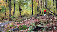
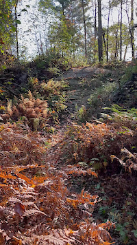
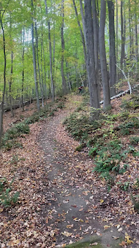
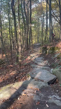
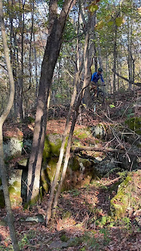
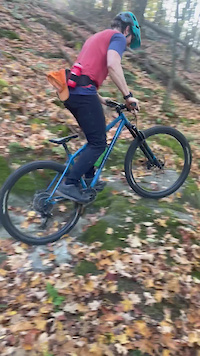
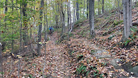
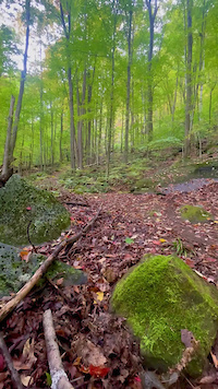
Recent Trail Reports
| status | trail | date | condition | info | user |
|---|---|---|---|---|---|
| The Connector | Nov 6, 2026 @ 9:45pm (America/New_York) Nov 6, 2026 | Dry | htfmybackyard | ||
| IPT | Nov 6, 2026 @ 8:22pm (America/New_York) Nov 6, 2026 | Unknown | htfmybackyard | ||
| Wiley's | Oct 16, 2026 @ 6:31pm (America/New_York) Oct 16, 2026 | Unknown | morse-ah FOTW | ||
| Skully's | Oct 16, 2026 @ 6:31pm (America/New_York) Oct 16, 2026 | Unknown | morse-ah FOTW | ||
| Rooster's Comb | Oct 16, 2026 @ 6:31pm (America/New_York) Oct 16, 2026 | Unknown | morse-ah FOTW | ||
| Rock n Roll Loop | Oct 16, 2026 @ 6:31pm (America/New_York) Oct 16, 2026 | Unknown | morse-ah FOTW | ||
| Return to River Lot | Oct 16, 2026 @ 6:31pm (America/New_York) Oct 16, 2026 | Unknown | morse-ah FOTW | ||
| Ravine Trail | Oct 16, 2026 @ 6:31pm (America/New_York) Oct 16, 2026 | Unknown | morse-ah FOTW | ||
| Ravine Connector 2 | Oct 16, 2026 @ 6:31pm (America/New_York) Oct 16, 2026 | Unknown | morse-ah FOTW | ||
| Ravine Connector | Oct 16, 2026 @ 6:31pm (America/New_York) Oct 16, 2026 | Unknown | morse-ah FOTW |
Activity Feed
| username | action | type | title | date |
|---|---|---|---|---|
| JakeSaltz | add | photo | activity #107793477 and 9 more | Nov 14, 2026 @ 2:40pm 2 days |
| JakeSaltz | add | poi | activity #107793476 and 8 more | Nov 14, 2026 @ 2:40pm 2 days |
| Liamprussell | comment | trail | activity #107564682 | Nov 10, 2026 @ 3:23pm Nov 10, 2026 |
| htfmybackyard | add | report | activity #107322323 | Nov 6, 2026 @ 6:45pm Nov 6, 2026 |
| htfmybackyard | add | report | activity #107319959 | Nov 6, 2026 @ 5:22pm Nov 6, 2026 |
Recent Comments
| username | type | title | comment | date |
|---|---|---|---|---|
| trail | This will get your heart rate up. | Nov 10, 2026 @ 3:23pm Nov 10, 2026 | ||
| trail | The most action packed 300 feet of riding in... | Sep 24, 2026 @ 10:31am Sep 24, 2026 | ||
| report | All downed trees cleared, riding great. | Sep 16, 2026 @ 1:10pm Sep 16, 2026 | ||
| report | All downed trees cleared. Riding great | Sep 16, 2026 @ 1:09pm Sep 16, 2026 | ||
| trail | Comments are out-dated, most of the sap lines... | Aug 22, 2026 @ 7:43pm Aug 22, 2026 |
Local Badges
-

10 Blue Trails600 awarded -

Epic Ride Climb 2k112 awarded -

Climbing 10k Badge221 awarded -

Climbing 100k Badge7 awarded -

Epic Ride Descent 2k110 awarded -

Descent 10k Badge221 awarded
Bike & Skill Parks
| name | type | city | rating |
|---|---|---|---|
| Pump Track | skill park | Richmond |

Activity Type Stats
| activitytype | trails | distance | descent | descent distance | total vertical | rating | global rank | state rank | photos | reports | routes | activity logs |
|---|---|---|---|---|---|---|---|---|---|---|---|---|
| Mountain Bike | 72 | 41 miles | 9,948 ft | 19 miles | 1,152 ft | #796 | #8 | 621 | 3,997 | 12 | 33,532 | |
| E-Bike | 9 | 3 miles | 974 ft | 1 mile | 390 ft | #5,627 | #35 | 2 | 837 | 3 | 297 | |
| Gravel Bike | 12 | 4 miles | 305 ft | 4,485 ft | 499 ft | #2,208 | #12 | 7 | 233 | |||
| Adaptive Bike | 1 | 3,520 ft | 79 ft | 650 ft | 223 ft | #3,436 | #15 | 6 | 1 | |||
| Winter Fat Bike | 2 | 2 miles | 420 ft | 5,128 ft | 344 ft | #1,723 | #9 | 14 | 9 | |||
| Horse | 1 | 2,411 ft | 243 ft | 116 | 4 | |||||||
| Hike | 82 | 53 miles | 11,614 ft | 23 miles | 1,808 ft | #3,260 | #11 | 8 | 3,999 | 1 | 1,568 | |
| Trail Running | 82 | 53 miles | 11,614 ft | 23 miles | 1,808 ft | #2,706 | #6 | 3 | 3,998 | 3 | 2,215 | |
| Snowshoe | 3 | 1 mile | 279 ft | 2,982 ft | 259 ft | 69 | 55 | |||||
| Downhill Ski | 8 | 1 mile | 981 ft | 1 mile | 344 ft | #454 | #14 | 1,093 | 253 | |||
| Nordic Ski | 2 | 2,444 ft | 92 ft | 876 ft | 338 ft | #688 | #19 | 708 | 371 |
Frequently Asked Questions
▼
What are the best places to ride in Richmond?
Richmond has 9 areas to explore for mountain biking. The top rated areas are:
▼
What are the highest rated mountain biking trails in Richmond?
The highest rated mountain biking trails in Richmond are:
- Full House (4.6/5)
- Egg Salad (4.4/5)
- CoCo (4.4/5)
- Visceral (4.4/5)
- Skully's (4.3/5)
▼
What is the best time of the year to ride in Richmond?
Based on activity log data, the most popular months to ride in Richmond are:
- September (657 activities)
- August (619 activities)
- July (529 activities)
▼
Where can I park to ride in Richmond?
There are 14 parking locations listed in Richmond. The most popular parking spots are: View all parking and trailhead locations on the map to plan your visit.
▼
What is the longest trail in Richmond?
The longest trail in Richmond is The Connector at 1.7 miles. View all trails sorted by distance.
▼
What are the best & highest rated hiking trails in Richmond?
The best hiking trails in Richmond are:
- Libby's Look Loop (East)
- Libby's Look Loop
- Preston Pond Loop
- Preston Pond Loop Cutoff
- Long Trail - Winooski River Crossing
▼
What are the best & highest rated trail running trails in Richmond?
The best trail running trails in Richmond are:
- Warren and Ruth Beeken Rivershore Trail Part 2
- Warren and Ruth Beeken Rivershore Trail Part 3
- Warren and Ruth Beeken Rivershore Trail Part 4
- Warren and Ruth Beeken Rivershore Trail Section 1
- Warren and Ruth Beeken Rivershore Trail Part 5
▼
How many trails are in Richmond?
Richmond has a total of 91 trails. Of those, 72 are designated for mountain biking. Browse top mountain biking trails in Richmond to find detailed information including difficulty ratings, distances, and trail conditions.
▼
Which trail has the most elevation gain in Richmond?
The trail with the most elevation gain in Richmond is Preston Loop with 468 ft of elevation gain. View all trails sorted by elevation gain.
▼
Which trail has the most elevation descent in Richmond?
The trail with the most elevation descent in Richmond is IPT with 672 ft of elevation descent. View all trails sorted by elevation descent.
▼
What activities are most popular in Richmond?
Richmond supports the following activities: Mountain Biking, E-Biking, Gravel Biking, Adaptive Biking, Winter Fat Biking, Hiking, Trail Running, Skiing, Nordic Skiing.
▼
What bike services are there in Richmond?
The following bike services are available in Richmond:
- Trail Association (3)
- Land Managers (2)
- Other (1)
- Bike Shop (1)
▼
What are the steepest mountain biking trails in Richmond?
The steepest mountain biking trail in Richmond is Climb to Skully's with an average grade of 11.2%. View all trails sorted by grade.
▼
Are there any trails with scenic viewpoints in Richmond?
Yes, there are 7 scenic viewpoints marked along trails in Richmond. Some popular viewpoints include:
- Libby's Look Viewpoint
- Camels Hump View
- Bench & Camels Hump View
- VYCC Barn & Mountain View
- Meadow & Mountain View
▼
What trails have the biggest jumps in Richmond?
The trails with the biggest jumps in Richmond are: Browse all mountain bike trails to find trails with jumps and technical features.
▼
Are the trails open in Richmond?
The overall region status for Richmond is Minor Issue / Yellow. Out of 75 trails:
- Clear / Green: 20
- Minor Issue / Yellow: 28
- Significant Issue / Amber: 25
- Closed: 2
▼
Can I ride an ebike in Richmond?
Yes, Richmond supports e-bike riding. There are 9 trails in Richmond that allow e-bikes. Check the e-bike trails listing for specific trail access details and any local regulations.
▼
What are the most popular mountain biking routes in Richmond?
The most popular mountain biking routes in Richmond are:
- Maple Wind Farm Quick Out-Back
- Maple Wind Farm > VYCC Summit & Back
- Urbanik Way, Maple Wind, VYCC Triple
▼
What type of bike is most common in Richmond?
Based on activity log data, the most common bike types used in Richmond are:
- AM (190 activities)
- XC (17 activities)
- DH (11 activities)
- Fat (1 activities)
- CX (1 activities)
▼
What is the highest summit in Richmond?
The highest summit in Richmond is Robbins Mountain at 2,051 ft elevation.
▼
What are the most popular Strava Segments in Richmond?
The most popular Strava segments in Richmond are:
- Skully's to Wiley's (4,134 athletes)
- cross VT trail towards Cochrans (4,056 athletes)
- cross vt trail to chamberlin (3,194 athletes)
▼
What are some popular technical trail features in Richmond?
There are 21 technical trail features (TTFs) in Richmond. Some popular features include:
- Boardwalk (Other)
- Small Ledge Drop (Drop)
- Ledge Skinny (Rock Face)
- TTF (Other)
- Rock Garden (Rock Garden)
▼
What trails are closed in Richmond?
There are currently 2 closed trails in Richmond. The breakdown of all trail statuses is:
- Clear / Green: 20
- Minor Issue / Yellow: 28
- Significant Issue / Amber: 25
- Closed: 2
▼
Are there accessible or adaptive trails in Richmond?
Yes, there are 1 accessible/adaptive trails in Richmond. View all adaptive trails in Richmond for specific accessibility information.
▼
Are there local clubs or events in Richmond?
There are 4 local clubs or associations listed in the Richmond directory. Browse the local directory for details.
▼
What are the most popular mountain biking trails in Richmond?
The most popular mountain biking trails in Richmond are: View all mountain biking trails sorted by popularity.
▼
What are the best beginner ride trails in Richmond?
The best beginner mountain biking trails in Richmond are:
- Brookside (4/5)
- Rock n Roll Loop (4/5)
- Brookside Loop (5/5)
Activities
Trails
Points of Interest
- By StephaneMarceau
 TRAILFORKS & contributors
- Admins: VMBA, Velomont, Jwduston, RMT, RTTC
- #13125 - 58,285 views
- richmond activity log | embed map of Richmond mountain bike trails | richmond mountain biking points of interest
Downloading of trail gps tracks in kml & gpx formats is enabled for Richmond.
You must login to download files.
