close
3D
Trail Conditions
- Unknown
- Snow Groomed
- Snow Packed
- Snow Covered
- Snow Cover Partial
- Freeze/thaw Cycle
- Icy
- Prevalent Mud
- Wet
- Variable
- Ideal
- Dry
- Very Dry
Trail Flow (Ridden Direction)
Trailforks scans users ridelogs to determine the most popular direction each trail is ridden. A good flowing trail network will have most trails flowing in a single direction according to their intension.
The colour categories are based on what percentage of riders are riding a trail in its intended direction.
The colour categories are based on what percentage of riders are riding a trail in its intended direction.
- > 96%
- > 90%
- > 80%
- > 70%
- > 50%
- < 50%
- bi-directional trail
- no data
Trail Last Ridden
Trailforks scans ridelogs to determine the last time a trail was ridden.
- < 2 days
- < 1 week
- < 2 weeks
- < 1 month
- < 6 months
- > 6 months
Trail Ridden Direction
The intended direction a trail should be ridden.
- Downhill Only
- Downhill Primary
- Both Directions
- Uphill Primary
- Uphill Only
- One Direction
Contribute Details
Colors indicate trail is missing specified detail.
- Description
- Photos
- Description & Photos
- Videos
Trail Popularity ?
Trailforks scans ridelogs to determine which trails are ridden the most in the last 9 months.
Trails are compared with nearby trails in the same city region with a possible 25 colour shades.
Think of this as a heatmap, more rides = more kinetic energy = warmer colors.
- most popular
- popular
- less popular
- not popular
ATV/ORV/OHV Filter
Max Vehicle Width
inches
US Cell Coverage
Legend
Radar Time
x
Activity Recordings
Trailforks users anonymized public ridelogs from the past 6 months.
- mountain biking recent
- mountain biking (>6 month)
- hiking (1 year)
- moto (1 year)
Activity Recordings
Trailforks users anonymized public skilogs from the past 12 months.
- Downhill Ski
- Backcountry Ski
- Nordic Ski
- Snowmobile
Winter Trails
Warning
A routing network for winter maps does not exist. Selecting trails using the winter trails layer has been disabled.
x
Missing Trails
Most Popular
Least Popular
Trails are colored based on popularity. The more popular a trail is, the more red. Less popular trails trend towards green.
Jump Magnitude Heatmap
Heatmap of where riders jump on trails. Zoom in to see individual jumps, click circles to view jump details.
Trails Deemphasized
Trails are shown in grey.
Only show trails with NO bikes.
Save the current map location and zoom level as your default home location whenever this page is loaded.
SaveAs of the 2010 United States Census, the population was 36,400. Its county seat is Butte. In 1977, the city and county governments consolidated to form the single entity of Butte-Silver Bow. Additionally, the town of Walkerville is a separate municipality from Butte and is within the county.
Silver Bow County comprises the Butte-Silver Bow, MT Micropolitan Statistical Area.
Silver Bow County comprises the Butte-Silver Bow, MT Micropolitan Statistical Area.
source: Silverbow County Government
Activities Click to view
- Mountain Bike
412 trails
- E-Bike
143 trails
- Horse
160 trails
- Hike
448 trails
- Trail Running
446 trails
- Dirtbike/Moto
194 trails
- ATV/ORV/OHV
192 trails
- Snowmobile
49 trails
- Snowshoe
36 trails
- Backcountry Ski
4 trails
- Nordic Ski
41 trails
Stats
- Avg Trail Rating
- Trails (view details)
- 452
- Trails Mountain Bike
- 413
- Trails E-Bike
- 143
- Trails Horse
- 160
- Trails Hike
- 448
- Trails Trail Running
- 446
- Trails Dirtbike/Moto
- 194
- Trails ATV/ORV/OHV
- 192
- Trails Snowmobile
- 49
- Trails Snowshoe
- 36
- Trails Downhill Ski
- 1
- Trails Backcountry Ski
- 4
- Trails Nordic Ski
- 41
- Total Distance
- 1,108 mile
- Total Descent
- 138,377 ft
- Total Vertical
- 5,330 ft
- Highest Trailhead
- 10,046 ft
- Reports
- 1,330
- Photos
- 548
- Ridden Counter
- 7,257
Popular Trail Networks
view all areas »Sub Regions
- Butte (268)
- Divide (11)
- Highland Mountains (20)
- Montana Tech Open Space Butte Bike Park (38)
- Moulton Cross Country Ski Area (4)
- Mt Fleecer (57)
- North Butte Divide (38)
- Our Lady (27)
- Sheepshead Recreation Area (1)
- Thompson Park (31)
- Wasteland (23)
Popular Silver Bow County Mountain Biking Trails
| status | title | difficulty | rating |
|---|---|---|---|
| Chimney Trail (Upper Grading Camp) Thompson Park | |||
| Skeeboggen Trail Thompson Park | |||
| Eagles Nest Thompson Park | |||
| Blacktail Access Thompson Park | |||
| CDT - Pipestone-Homestake Butte | |||
| Connector Thompson Park | |||
| Sketchy TwoTrack Butte | |||
| Herman Gulch trail Thompson Park | |||
| CDT - Homestake to top of Maud-S Our Lady | |||
| Graham Canyon Trail Thompson Park | |||
| Blacktail Ridge Trail Thompson Park | |||
| Crook Camp trail Thompson Park | |||
| CDT - 8 Miles of Hell Highland Mountains | |||
| Beaver Ponds Thompson Park | |||
| Placer Connector Thompson Park |
Silver Bow County Mountain Bike Routes
| title | rating | distance |
|---|---|---|
| M to Memorial Loop Montana Tech Open Space Butte Bike Park | 8 miles | |
| Zelda-Milwaukee Rd Loop Thompson Park | 13 miles | |
| North Butte Gravel Loop Butte | 17 miles | |
| Limekiln - CDT Loop Butte | 12 miles | |
| Great Divide MTB Route - Silver Bow County Butte | 68 miles | |
| 90 to Beaver to top of Limekiln Thompson Park | 30 miles | |
| HCC Race Night Course 10-12-22 Montana Tech Open Space Butte Bike Park | 3 miles | |
| Toll Canyon Loop Butte | 9 miles | |
| (Old) 2010 Butte 100 Racecourse Butte | 105 miles | |
| Homestake / Delmoe Gravel Loop Butte | 39 miles |
Photos of Silver Bow County Mountain Bike
trail: Upper Maude S
21 |
Sep 29, 2023 @ 1:37pm
Sep 29, 2023
trail: CDT - 8 Miles of Hell
22 |
Jun 16, 2023 @ 7:30am
Jun 16, 2023Videos of Silver Bow County Mountain Bike
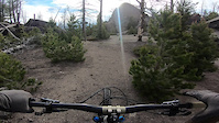
trail: Upper Maude S
40 |
Jun 29, 2023
trail: Sketchy TwoTrack
|
Jan 26, 2022
trail: Neversweat
2:14 |
184 |
Dec 6, 2018

trail: CDT - Pipestone-Homestake
14:24 |
134 |
May 30, 2023 , Butte

trail: CDT - Pipestone-Homestake
17:42 |
89 |
May 30, 2023 , Butte
youtuber
![The Hardest Ride I’ve Ever Done | The Butte...]()

trail: Grading Camp Trail
28:56 |
124 |
Jul 22, 2022 , Butte
youtuber
![Riding Some Of The Best Groomed Trails In...]()

trail: John's Gulch
12:41 |
106 |
Jul 20, 2022 , Butte
youtuber
![Riding Some Of The Best Groomed Trails In...]()

12:41 |
114 |
Jul 20, 2022 , Butte
Current Trail Warnings
| status | trail | date | condition | user | info |
|---|---|---|---|---|---|
| Skeeboggen Trail Thompson Park | May 12, 2024 @ 9:19am May 12, 2024 | Ideal | krisjonnie | Many downed trees |
Recent Trail Reports
| status | trail | date | condition | info | user |
|---|---|---|---|---|---|
| CDT - Homestake to top of Maud-S Our Lady | May 18, 2024 @ 11:16am 1 day | Ideal | Atknaub | ||
| Grading Camp Trail Thompson Park | May 18, 2024 @ 10:57am 1 day | Ideal | bcyr612828 ATS | ||
| Crook Camp trail Thompson Park | May 18, 2024 @ 10:57am 1 day | Ideal | bcyr612828 ATS | ||
| Beaver Ponds Thompson Park | May 18, 2024 @ 8:03pm 19 hours | Ideal | MattinButte ATS | ||
| CDT - Pipestone-Homestake Butte | May 18, 2024 @ 7:53pm 19 hours | Ideal | MattinButte ATS | ||
| Bear Gulch Highland Mountains | May 15, 2024 @ 1:23pm May 15, 2024 | Variable | krisjonnie | ||
| Eagles Nest Thompson Park | May 13, 2024 @ 8:21am May 13, 2024 | Ideal | krisjonnie | ||
| Herman Gulch trail Thompson Park | May 12, 2024 @ 9:19am May 12, 2024 | Wet | krisjonnie | ||
| Chimney Trail (Upper Grading Camp) Thompson Park | May 12, 2024 @ 9:19am May 12, 2024 | Ideal | krisjonnie | ||
| Placer Connector Thompson Park | May 12, 2024 @ 9:19am May 12, 2024 | Ideal | krisjonnie |
National Scenic Trails & Official Routes
-
Continental Divide Trail
- Mountain Bike
- Hike
- Trail Running
Activity Feed
| username | action | type | title | date |
|---|---|---|---|---|
| Atknaub | add | report | activity #52802062 | May 18, 2024 @ 10:02pm 17 hours |
| bcyr612828 | add | report | activity #52799779 and 1 more | May 18, 2024 @ 9:04pm 18 hours |
| MattinButte | add | report | activity #52797418 | May 18, 2024 @ 8:06pm 19 hours |
| MattinButte | add | report | activity #52797249 | May 18, 2024 @ 8:02pm 19 hours |
| krisjonnie | add | report | activity #52674575 | May 16, 2024 @ 5:17am May 16, 2024 |
Recent Comments
| username | type | title | comment | date |
|---|---|---|---|---|
| report | bike list doesn't include Ebikes. You should... | Mar 19, 2024 @ 11:34am Mar 19, 2024 | ||
| report | The report above was from from Pipestone Pass... | Nov 12, 2023 @ 7:37pm Nov 12, 2023 | ||
| report | Keep e-bikes out of Thompson park | Aug 15, 2023 @ 6:57am Aug 15, 2023 | ||
| report | E-bikes are not permitted in Thompson Park, it... | Aug 12, 2023 @ 7:21pm Aug 12, 2023 | ||
| trail | Not great compared to Beaver Ponds or CDT | Aug 2, 2023 @ 2:07pm Aug 2, 2023 |
Local Badges
-

Butte 50 Racecourse7 awarded -

Sorini 25 Racecourse11 awarded -

The East Ridge3 awarded -
Butte 100 Racecourse0 awarded -

CDT Crusher0 awarded -

Completionist0 awarded
Activity Type Stats
| activitytype | trails | distance | descent | descent distance | total vertical | rating | global rank | state rank | photos | reports | routes | ridelogs |
|---|---|---|---|---|---|---|---|---|---|---|---|---|
| Mountain Bike | 412 | 978 miles | 123,976 ft | 376 miles | 5,331 ft | 523 | 1,327 | 30 | 11,664 | |||
| E-Bike | 143 | 432 miles | 52,572 ft | 171 miles | 4,469 ft | 547 | 9 | 164 | ||||
| Horse | 160 | 546 miles | 67,726 ft | 208 miles | 4,701 ft | 321 | 4 | |||||
| Hike | 448 | 1,044 mile | 133,556 ft | 399 miles | 5,331 ft | 7 | 1,328 | 15 | 691 | |||
| Trail Running | 446 | 1,041 mile | 131,696 ft | 396 miles | 5,331 ft | 10 | 1,326 | 16 | 555 | |||
| Dirtbike/Moto | 194 | 627 miles | 79,275 ft | 246 miles | 4,984 ft | 310 | 4 | 11 | ||||
| ATV/ORV/OHV | 192 | 613 miles | 77,644 ft | 241 miles | 4,984 ft | 298 | 3 | 8 | ||||
| Snowmobile | 49 | 224 miles | 23,432 ft | 80 miles | 3,350 ft | 13 | 1 | 3 | ||||
| Snowshoe | 36 | 54 miles | 4,327 ft | 22 miles | 3,281 ft | 4 | 14 | |||||
| Downhill Ski | 1 | 3 | ||||||||||
| Backcountry Ski | 4 | 13 miles | 1,722 ft | 6 miles | 1,647 ft | 82 | ||||||
| Nordic Ski | 41 | 48 miles | 3,888 ft | 19 miles | 3,281 ft | 1 | 11 | 685 |
- By ianjones
 SWMMBA_Full & contributors
 - Admins: MONTANABIKERMAN, evasive, wyomont, SWMMBA_Full, HCC, FTP
- #39371 - 1,433 views
- silver bow county activity log | embed map of Silver Bow County mountain bike trails | silver bow county mountain biking points of interest polygons
Downloading of trail gps tracks in kml & gpx formats is enabled for Silver Bow County.
You must login to download files.

