

more stats
1.9 miles
Distance
249 ft
Climb
-240 ft
Descent
00:20:48
Avg time
10 ft
Altitude change
4,362 ft
Altitude min
4,570 ft
Altitude max
4,434 ft
Altitude start
4,446 ft
Altitude end
0.1%
Grade
-29.9%
Grade max
23.9%
Grade min
4,600 ft
Distance climb
4,249 ft
Distance down
1,142 ft
Distance flat
00:20:48
Avg time

Skywalker Details

  • Activities
    • Mountain Bike
    • Horse
    • Hike
    • Trail Running
  • Riding Area
    Carroll Canyon
    Sedona, Arizona
  • Ref Number
    #669
  • Difficulty Rating
  • Voted Difficulty
    Blue (2 votes)
  • Local Popularity
    95 in Mountain Biking heatmap [+]
    • 90 in Trail Running
    • 75 in Hiking
    • 100 in Horseback
  • Global Ranking
    #39194 in Mountain Biking [+]
    • #80060 in Trail Running
    • #107061 in Hiking
    • #554 in Horseback
  • State Ranking
    #546 in Mountain Biking · Arizona [+]
    • #1,189 in Trail Running
    • #2,035 in Hiking
    • #32 in Horseback
  • Trail Type
    Singletrack
  • Bike Type
    XC
  • Direction
    Both Directions
  • Climb Difficulty
    Blue
  • Physical Rating
    Moderate
  • Season
    All Year
  • Dogs Allowed
    Yes
  • eBike Allowed
  • Ride in Rain
    Yes
  • Year Opened
    2016
  • Land Owner
    USFS

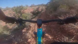
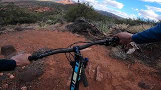
The Skywalker trail is a major connector trail between the Old Post trail and the Herkenham trail. This trail is 97% intermediate and has 3% ledgey exposed sections that an intermediate rider might want to walk. The trail is very scenic and actually climbs to a high point (Skywalker) in West Sedona for a somewhat 360 degree view of the main red rock formations that make Sedona one of the most beautiful riding destinations in the U.S.

What makes the Skywalker trail special is that it is pretty much an all weather trail that is located in a south facing rocky area that handles rain nicely. The south facing aspect drys the trail after the sun appears, so the trail can normally be ridden 3 or 4 hours after a major rainy period.

Many thanks should be given to the USFS for taking what use to be a very advanced trail and routing it so that intermediate riders will enjoy riding it.

Access Info

The east end of the trail is accessed off the Old Post trail and the west end is accessed from the Red Rock High School area. There is also access on the west end from the Over Easy trail that starts near the entrance to the Marriot Hotel.

Tags
ExposureViews

Trail Supporters

Local Trail Association

Recent Activity on Trail

Past Week
  • 8 rides
  • 13 miles average
6 Months
  • 89 rides
  • 13 miles avg distance
All
  • 1,509 rides
  • Last: Nov 14, 2026
c1c2c3c4
January
February
March
April
May
June
July
August
September
October
November
December
update trails status or condition

Skywalker Trail Reports

statusdatedescription
Aug 22, 2026 @ 10:23am (America/Phoenix)
Aug 22, 2026
Apr 29, 2026 @ 11:41am (America/Phoenix)
Apr 29, 2026
The local cycling coalition has done a real number to this trail with significant narrowing to "reduce the speed of bikes" and by replacing the...
Jan 30, 2026 @ 10:00am (America/Phoenix)
Jan 30, 2026
May 15, 2025 @ 12:09pm
May 15, 2025
Apr 29, 2025 @ 10:29am
Apr 29, 2025
more »
Status:
on Aug 22, 2026
Very Dry
Avg: 3.97 (28 votes)
Your vote: 0

view (7,414)
close
      Directions to skywalker-46389 trailhead (34.847670, -111.813640)

      Photos

      34 more »
      mtb
      620 |
      Jan 23, 2018 @ 8:04pm
      Jan 23, 2018
      mtb
      719 |
      Apr 25, 2016 @ 8:56pm
      Apr 25, 2016
      mtb
      566 |
      Jan 9, 2016 @ 10:03pm
      Jan 9, 2016
      mtb
      351 |
      Oct 17, 2020 @ 6:26pm
      Oct 17, 2020

      Videos

      9 more »
      Skywalker
      mtb
      8:49 | 394 | Feb 19, 2023 , Sedona
      Skywalker to Old Post in Sedona: Downhill Hero...
      mtb
      9:29 | 492 | Aug 31, 2022 , Sedona
      Scorpion & Pyramid Trails Sedona, Arizona
      mtb
      12:23 | 663 | Aug 25, 2021 , Sedona
      Mountain Biking in Sedona, AZ.  Skywalker Trail
      mtb
      3:28 | 739 | Jul 18, 2020 , Sedona

      Routes with this trail

      more »
      ★ 5.0 • 12 miles • 1,506 ft • 3 •
      Another option for Carroll Canyon during Inclement Weather - longer.
      ★ 5.0 • 4 miles • 561 ft • 3 •
      ★ 5.0 • 10 miles • 1,120 ft • 7 • Loop •
      Carroll Canyon is a less used trail system in Sedona, but several of the trails make it worth exploring -...
      4.0 ★★★★★
      28 Ratings
      5 ★ 21%
      4 ★ 57%
      3 ★ 18%
      2 ★ 4%
      1 ★

      10 Reviews & Comments

      jayjaygur
      A+ trail A++ views. Too rocky for boomers and ebikes. One of my favorites in Sedona now
      Ampfrog Ampfrog
      Rode eastbound, fun start dropping down some rocks, then not-too-bad climbing (there's easier side tracks around the longer ledgy sections, and rest is not too technical), followed by a long and fun descent. From what I rode down, looked like it might be a little more difficult overall climbing westbound.
      Bonus: Continue south on Old Post all the way to the south end... feels like a REALLY long descent by the end of that.
      Rider51 Rider51
      Excellent intermediate trail with something for almost any rider. An experienced rider could push themselves on this, and a rider getting getting used to technical blue rocky trails won't be too intimidated by most of it. As everyone else says, there are expansive views from the ridge that are awe inspiring.

      We hope you've been enjoying Trailforks!

      Create a FREE account to view all trail reviews and much more.

      Nearby Trails

      • By johnf0246TF Pro & contributors
      • #46389 - 12,367 views

      Frequently Asked Questions

      ▼ Where is Skywalker located?
      Skywalker is located in Carroll Canyon, Sedona, Arizona, United States. It is part of the Carroll Canyon trail network. The trailhead is located at coordinates 34.84767, -111.81364.
      ▼ How hard is Skywalker?
      Skywalker is rated as Blue difficulty. The physical rating is Moderate. The average grade is 0.1%. The climb difficulty is rated Blue.
      ▼ What is the elevation gain for Skywalker?
      Skywalker has 249 ft of elevation gain. The trail has 240 ft of elevation descent. The elevation ranges from 4,362 ft to 4,570 ft.
      ▼ Is Skywalker a point to point trail?
      Skywalker is not a point to point trail. The direction is Both Directions. The trail type is singletrack.
      ▼ How long is Skywalker?
      Skywalker is 1.9 miles long. The trail type is singletrack.
      ▼ Are dogs allowed on Skywalker?
      Yes, dogs are allowed on Skywalker. Please keep dogs on a leash where required and clean up after them.
      ▼ When is the best time of year to ride Skywalker?
      Based on activity log data, the most popular months to ride Skywalker are:
      • March (121 activities)
      • April (99 activities)
      • November (98 activities)
      Check the reports page for current trail conditions.
      ▼ How do I access Skywalker? Where is the closest parking trailhead?
      The closest parking and trailhead locations to Skywalker are: View all parking locations in the area.
      ▼ How long does it take to ride Skywalker?
      Based on recorded activities, it takes an average of 21 minutes to ride Skywalker. The trail is 1.9 miles long. Actual times will vary based on fitness level, conditions, and pace. View recent activity logs for more details.
      ▼ How busy is Skywalker?
      Skywalker is a very popular trail. There have been 7,406 recorded activities on this trail. The trail has received 7,414 check-ins. View recent activity on this trail.

      Hit the Trail

      Open in App

      Get this trail on your phone instantly.

      open trail in app

      Download Trail

      Save to wishlist, Garmin & download.
      save the trail

      Find Related Routes

      Find routes and users activities that include this trail.
      find routes for this trail

      You must enter a description before submitting.