close
-
Layers w
- Weather Layers
- Pro
- Pro
- Pro
- Pro
- Pro
- Pro
- More Layers
- Pro
- Pro
- Pro
- Pro
-
Upgrade to

3D
Trail Conditions
- Unknown
- Snow Groomed
- Snow Packed
- Snow Covered
- Snow Cover Partial
- Freeze/thaw Cycle
- Icy
- Prevalent Mud
- Wet
- Variable
- Ideal
- Dry
- Very Dry
Trail Flow (Ridden Direction)
Trailforks scans users ridelogs to determine the most popular direction each trail is ridden. A good flowing trail network will have most trails flowing in a single direction according to their intension.
The colour categories are based on what percentage of riders are riding a trail in its intended direction.
The colour categories are based on what percentage of riders are riding a trail in its intended direction.
- > 96%
- > 90%
- > 80%
- > 70%
- > 50%
- < 50%
- bi-directional trail
- no data
Trail Last Ridden
Trailforks scans ridelogs to determine the last time a trail was ridden.
- < 2 days
- < 1 week
- < 2 weeks
- < 1 month
- < 6 months
- > 6 months
Trail Ridden Direction
The intended direction a trail should be ridden.
- Downhill Only
- Downhill Primary
- Both Directions
- Uphill Primary
- Uphill Only
- One Direction
Contribute Details
Colors indicate trail is missing specified detail.
- Description
- Photos
- Description & Photos
- Videos
Trail Popularity ?
Trailforks scans ridelogs to determine which trails are ridden the most in the last 9 months.
Trails are compared with nearby trails in the same city region with a possible 25 colour shades.
Think of this as a heatmap, more rides = more kinetic energy = warmer colors.
- most popular
- popular
- less popular
- not popular
ATV/ORV/OHV Filter
Max Vehicle Width
inches
US Cell Coverage
Legend

Radar Time
Activity Recordings
Trailforks uses anonymized public activity data.
?
Activity Recordings
Trailforks uses anonymized public activity data.
?
Personal Heatmap
▶
Activity Types
all
/
none
▶
Options
2
Date range
month
–
Winter Trails
Warning
A routing network for winter maps does not exist. Selecting trails using the winter trails layer has been disabled.
Missing Trails
Most Popular
Least Popular
Trails are colored based on popularity. The more popular a trail is, the more red. Less popular trails trend towards green.
Jump Magnitude Heatmap
Heatmap of where riders jump on trails. Zoom in to see individual jumps, click circles to view jump details.
BC Backroad Status
![map legend]()
Service Road Atlas is a free to use, community-driven service for viewing and creating reports on the numerous back-country service roads around B.C. and Alberta.

Slope Aspect
Direction the slope faces
Trails Deemphasized
Trails are shown in grey.
Only show trails with no bike usage.
Suggested Layers
Based on selected activity type
Save the current map location and zoom level as your default home location whenever this page is loaded.
SaveThe summer lake community of McCall, Idaho has been quietly assembling a large and diverse collection of trails with levels for every rider. Originally the area was known for its rugged backcountry trails, but over the past eighteen years, the Central Idaho Mountain Bike Association began adding trails in cooperation with the USFS, City, Jug Mountain Ranch, Brundage Resort, and Tamarack Resort.
In one summer day in McCall you can ride a fern-lined, family-friendly trail through stands of towering old-growth Ponderosa and pick huckleberries along the way. Ride a lift-served gravity trail over granite boulders while enjoying the view from the summit of Brundage Mountain. Ride an IMBA Epic trail to beautiful Loon Lake and discover the wreckage of a rare WW2 bomber. Ride to Goose Creek falls along a shady river trail and enjoy the sounds of the river below. Ride the rugged backcountry Bear Pete trail and see into three states from the ridgeline, and then soak in some backcountry hot springs. Ride the freeride and flow trails of Jug Mountain Ranch ending your day with a microbrew and dinner at the scenic clubhouse.
In one summer day in McCall you can ride a fern-lined, family-friendly trail through stands of towering old-growth Ponderosa and pick huckleberries along the way. Ride a lift-served gravity trail over granite boulders while enjoying the view from the summit of Brundage Mountain. Ride an IMBA Epic trail to beautiful Loon Lake and discover the wreckage of a rare WW2 bomber. Ride to Goose Creek falls along a shady river trail and enjoy the sounds of the river below. Ride the rugged backcountry Bear Pete trail and see into three states from the ridgeline, and then soak in some backcountry hot springs. Ride the freeride and flow trails of Jug Mountain Ranch ending your day with a microbrew and dinner at the scenic clubhouse.
source: Gravity Sports
Region Supporters & Maintainers
![IMBA Silver Ride Center]()
IMBA Silver Ride Center
since 2015Sponsor
IMBA Ride Center

McCall
Activities Click to view
- Mountain Bike
138 trails
- E-Bike
37 trails
- Gravel Bike
0 trails
- Adaptive Bike
0 trails
- Horse
19 trails
- Hike
130 trails
- Trail Running
124 trails
- Dirtbike/Moto
48 trails
- ATV/ORV/OHV
11 trails
- Snowshoe
29 trails
- Downhill Ski
108 trails
- Nordic Ski
56 trails
Region Details
- 25
- 39
- 53
- 16
- 4
Region Status
Open as of Jul 4, 2026Stats
- Avg Trail Rating
- Trails (view details)
- 318
- Trails Mountain Bike
- 138
- Trails E-Bike
- 37
- Trails Horse
- 19
- Trails Hike
- 130
- Trails Trail Running
- 124
- Trails Dirtbike/Moto
- 48
- Trails Observed Trials
- 3
- Trails ATV/ORV/OHV
- 11
- Trails Snowmobile
- 2
- Trails Snowshoe
- 29
- Trails Downhill Ski
- 109
- Trails Nordic Ski
- 58
- Total Distance
- 556 miles
- Total Descent
- 122,569 ft
- Total Vertical
- 7,381 ft
- Highest Trailhead
- 8,543 ft
- Reports
- 1,024
- Photos
- 465
- Ridden Counter
- 35,194
Articles
Destination Showcase: McCall, Idaho
Mar 9, 2021 from pinkbike.com
Everything you need to know about riding in McCall, Idaho.
Sub Regions
-
Bear Basin
- 9
- 12
- 1
-
Brundage Mountain Bike Park
- 6
- 8
- 3
- 1
-
East Side
- 3
- 9
- 3
-
Jug Mountain
- 11
- 14
- 6
- 1
-
McCall Activity Barn
- 5
-
Ponderosa State Park
- 3
- 1
Popular McCall Mountain Biking Trails
• 100 ★ 4.0 • 1,093 ft • 89 ft • 1,018 •
Connecting / to the start of Berm & Ernie, and
• 95 ★ 4.9 • 5,121 ft • 2 ft • 878 •
One of Idaho's premier flow trails! Berm & Ernie features berms a' plenty! A few rock gardens exist towards the top of the trail, including a few optional black diamond lines. After the rock features its all speed and berms, with few...
• 100 ★ 4.2 • 3,350 ft • 53 ft • 752 •
Warmup and beginner single track out to the "Hub" where most trails meet.
• 95 ★ 4.4 • 3,494 ft • 5 ft • 739 •
Nice downhill with banked berms and multiple switches....very fun, ride downhill.
• 95 ★ 3.8 • 2 miles • 156 ft • 671 •
These hand built singletrack trails offer everything from flowy to tight and technical. Wide open sections speed things up with fun optional rock features while tight trees and switchbacks bring out your technical side. Super fun...
• 90 ★ 4.2 • 2,484 ft • 0 ft • 621 •
more difficult downhill trail, more dirt jumps, less berms. Can be risky for beginner riders to get out of control.
• 90 ★ 3.5 • 1,017 ft • 37 ft • 620 •
Popular green difficulty singletrack. This mountain bike primary trail and has a easy overall physical rating with a 37 ft green climb. On average it takes 1 minutes to complete this trail.
• 85 ★ 4.3 • 3,150 ft • 43 ft • 604 •
Nice easy single track with wooden ramp bridges through a dense shady forested low area.
McCall Mountain Bike Routes
Cow Creek Loop Featured
23 miles • 1,880 ft • 0 • Loop •
Starting from Ponderosa CG, climb uphill on Lick Creek Rd to the turnoff (FS 387), cross the bridge and...
★ 5.0 • 29 miles • 2,617 ft • 3 • Loop •
A great intro to gravel bike riding in the area. Starting from JMR ride the asphalt of Farm to Market and...
★ 5.0 • 17 miles • 2,191 ft • 3 • Loop •
Please ride this direction to reduce conflicts on the new (B2BB) trail. Park at the corrals parking lot on...
★ 5.0 • 9 miles • 1,066 ft • 10 • Loop •
D & C Bear Basin Loop in McCall Area
★ 3.0 • 9 miles • 1,246 ft • 3 • Loop •
Classic McCall area ride that can be ridden either direction and features great scenery throughout....
★ 1.0 • 5 miles • 617 ft • 5 • Loop •
This route is great for a short ride, and offers a fun downhill to.
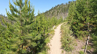
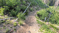
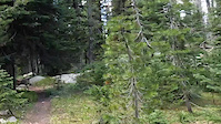
Photos of McCall Mountain Bike
Videos of McCall Mountain Bike
trail: Loon Lake
10:09 |
31 |
Jul 5, 2023
trail: Secesh River Trail
7:06 |
44 |
Jul 4, 2023
trail: 20 Mile
13:29 |
59 |
Jul 3, 2023
trail: Goose Creek
8:18 |
43 |
Jun 26, 2023
trail: Goose Creek
9:53 |
36 |
Jun 25, 2023
trail: Stitches
0:17 |
236 |
Apr 24, 2021

trail: Stitches
0:17 |
|
Apr 24, 2021

trail: Stitches
0:17 |
|
Apr 3, 2021
Current Trail Warnings
| status | trail | date | condition | user | info |
|---|---|---|---|---|---|
| 20 Mile | Jun 23, 2026 @ 11:34am (America/Boise) Jun 23, 2026 | Dry | ama | Lots of trees down after mile three from... |
Recent Trail Reports
| status | trail | date | condition | info | user |
|---|---|---|---|---|---|
| Secesh River Trail | Jul 4, 2026 @ 10:41am (America/Boise) Jul 4, 2026 | Dry | jeffnelson19784 | ||
| Loon Creek Trail | Jul 4, 2026 @ 10:41am (America/Boise) Jul 4, 2026 | Dry | jeffnelson19784 | ||
| High Jump Road | Jul 3, 2026 @ 12:48pm (America/Boise) Jul 3, 2026 | Ideal | jeffnelson19784 | ||
| Brundage Lookout Rd | Jul 3, 2026 @ 12:48pm (America/Boise) Jul 3, 2026 | Dry | jeffnelson19784 | ||
| Brundage South Lodge Lane | Jul 3, 2026 @ 12:48pm (America/Boise) Jul 3, 2026 | Dry | jeffnelson19784 | ||
| Grouse | Jul 3, 2026 @ 12:48pm (America/Boise) Jul 3, 2026 | Ideal | jeffnelson19784 | ||
| Little Bear Basin Meadow Cutoff | Jul 3, 2026 @ 12:48pm (America/Boise) Jul 3, 2026 | Ideal | jeffnelson19784 | ||
| Mack's Connector | Jul 3, 2026 @ 12:48pm (America/Boise) Jul 3, 2026 | Dry | jeffnelson19784 | ||
| Goose Creek Falls Trail | Jul 3, 2026 @ 12:48pm (America/Boise) Jul 3, 2026 | Ideal | jeffnelson19784 | ||
| Goose Creek | Jul 3, 2026 @ 12:48pm (America/Boise) Jul 3, 2026 | Ideal | jeffnelson19784 |
Activity Feed
| username | action | type | title | date |
|---|---|---|---|---|
| Mcanelo | ridden | trail | activity #98787455 | Jul 9, 2026 @ 8:17am 13 hours |
| jdbailey13959 | like | directory | activity #98779993 | Jul 9, 2026 @ 6:13am 15 hours |
| 9fmKonwa | add | list | activity #98730063 | Jul 8, 2026 @ 12:06pm 1 day |
| 9fmKonwa | ridden | trail | activity #98729670 and 1 more | Jul 8, 2026 @ 12:01pm 1 day |
| 9fmKonwa | add | list | activity #98729062 and 1 more | Jul 8, 2026 @ 11:53am 1 day |
Recent Comments
| username | type | title | comment | date |
|---|---|---|---|---|
| trail | Fun cross country trail. If you want a faster... | Jul 4, 2026 @ 8:35am Jul 4, 2026 | ||
| trail | Holly cow this is a blast. We started at... | Jul 4, 2026 @ 8:02am Jul 4, 2026 | ||
| trail | This is a great trail up to Pearl Lake.... | Jul 4, 2026 @ 7:57am Jul 4, 2026 | ||
| trail | Such a great hike. There is a lot of water... | Jul 4, 2026 @ 7:55am Jul 4, 2026 | ||
| trail | Fun little trail with great views. In... | Jun 6, 2026 @ 6:26am Jun 6, 2026 |
Local Badges
-

Completionist0 awarded -

Big Ride 30k1,636 awarded -

Epic Ride 50k397 awarded -

Top 10 Trails18 awarded -

10 Black Trails27 awarded -
Completionist0 awarded
Bike & Skill Parks
| name | type | city | rating |
|---|---|---|---|
| Brundage Mountain Bike Park | bike park | McCall | |
| Brundage Mountain Ski Resort | bike park | McCall | |
| Harshman Skatepark and Bike park | skill park | McCall | |
| Pump Track | skill park | McCall |
Local Products
Activity Type Stats
| activitytype | trails | distance | descent | descent distance | total vertical | rating | global rank | state rank | photos | reports | routes | ridelogs |
|---|---|---|---|---|---|---|---|---|---|---|---|---|
| Mountain Bike | 138 | 316 miles | 56,316 ft | 141 miles | 4,685 ft | #392 | #142 | 426 | 1,025 | 17 | 19,456 | |
| E-Bike | 37 | 155 miles | 30,545 ft | 69 miles | 4,442 ft | #601 | #738 | 12 | 829 | 4 | 1,150 | |
| Horse | 19 | 122 miles | 19,124 ft | 45 miles | 4,685 ft | #270 | #447 | 145 | 2 | 4 | ||
| Hike | 130 | 388 miles | 63,465 ft | 158 miles | 7,382 ft | #272 | #137 | 12 | 1,002 | 2 | 1,993 | |
| Trail Running | 124 | 384 miles | 62,871 ft | 156 miles | 7,382 ft | #290 | #119 | 2 | 998 | 4 | 1,025 | |
| Dirtbike/Moto | 48 | 216 miles | 47,749 ft | 98 miles | 5,082 ft | #32 | #15 | 11 | 147 | 4 | 46 | |
| Observed Trials | 3 | 7 miles | 400 ft | 2 miles | 1,955 ft | 3 | 2 | |||||
| ATV/ORV/OHV | 11 | 40 miles | 7,887 ft | 17 miles | 4,255 ft | #54 | #35 | 99 | 10 | |||
| Snowmobile | 2 | 15 miles | 115 ft | 2 miles | 1,781 ft | 1 | 5 | |||||
| Snowshoe | 29 | 27 miles | 482 ft | 5 miles | 1,781 ft | #409 | #127 | 1 | 123 | |||
| Downhill Ski | 108 | 41 miles | 32,008 ft | 36 miles | 2,526 ft | #161 | #68 | 2,547 | ||||
| Nordic Ski | 56 | 47 miles | 1,919 ft | 13 miles | 1,781 ft | #239 | #67 | 8 | 1 | 1,106 |
Frequently Asked Questions About McCall
▼
What are the best places to ride in McCall?
McCall has 11 areas to explore for mountain biking. The top rated areas are:
▼
What are the highest rated mountain biking trails in McCall?
The highest rated mountain biking trails in McCall are:
- Berm & Ernie (4.6/5)
- Payette Rim (4.4/5)
- Double Shot (4.4/5)
- Huckleberry Bay Loop (4.4/5)
- Brundage To Bear Basin (4.4/5)
▼
What is the best time of the year to ride in McCall?
Based on ride log data, the most popular months to ride in McCall are:
- July (596 activities)
- August (353 activities)
- June (216 activities)
▼
Where can I park to ride in McCall?
There are 22 parking locations listed in McCall. The most popular parking spots are:
- Parking for Mt bike users
- Bear Basin Parking area (both summer and winter use)
- Parking and TH
- Parking and Start point for the Payette Rim trail going up FS Rd 451
- Parking
Activities
Trails
Points of Interest
- Upper Granite Creek Campsite Camping
- Square Beach Campsite Camping
- Lower Granite Creek Campsite Camping
- Three Creek Campsite Camping
- Warm Springs Campsite Camping
- The Bear's Den Lodge
- Main Lodge
- Upper Dry Gulch Campsite Camping
- Rocky Bar Campsite Camping
- Hasting Campsite Camping
- South Loon Mountain (9,272 ft)
- North Loon Mountain (9,262 ft)
- Greeley Mountain (9,226 ft)
- By Studsted & contributors
- Admins: chuktA, IdahoEnduroSeries, macgyver96, CIMBA
- #6298 - 29,825 views
- mccall activity log | embed map of McCall mountain bike trails | mccall mountain biking points of interest
Downloading of trail gps tracks in kml & gpx formats is enabled for McCall.
You must login to download files.