This trail was originally envisioned in the 1990s to stretch the length of the Wasatch Front along the Urban-Wildland boundary, generally following the highest shoreline of Ice Age Lake Bonneville. The trail is a joint effort of dozens of partners and land owners, including citizen groups, cities, counties, the state of Utah, and Uinta-Wasatch-Cache National Forest. Because of this intent, it is generally level, with some climbs of a few hundred feet to circumvent private property. It is currently about half complete officially, also including several stretches of unofficial routes that are open to the public. It is intended to be open to all non-motorized users.
While the route is not totally built, since it is an ongoing project, this official documentation is complete and will continue to be updated as sections are completed
While the route is not totally built, since it is an ongoing project, this official documentation is complete and will continue to be updated as sections are completed
- Mountain Bike
- E-Bike
- Horse
- Hike
- Trail Running
- Snowshoe
- Nordic Ski
Login to see your progress towards riding all the trails and routes in this list.
Trails
Displaying 134
Videos
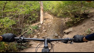
23:43 |
74 |
Feb 22, 2026 , Kaysville

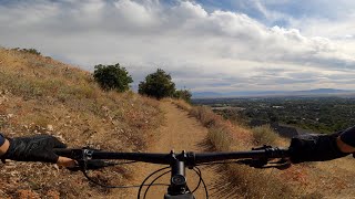
15:57 |
59 |
Feb 22, 2026 , Kaysville
15:57 |
105 |
Feb 22, 2026 , Kaysville
Recent Trail Reports
| status | trail | date | condition | |
|---|---|---|---|---|
| 19th Avenue (Lower) | Jun 28, 2026 @ 8:44am (America/Denver) Jun 28, 2026 | view | ||
| BST (City Creek) | Jun 28, 2026 @ 8:44am (America/Denver) Jun 28, 2026 | view | ||
| BST (Sandhurst) | Jun 28, 2026 @ 8:44am (America/Denver) Jun 28, 2026 | view | ||
| BST (Oak Hollow) | Jun 27, 2026 @ 2:54pm (America/Boise) Jun 27, 2026 | view | ||
| Bonneville Shoreline Trail: Orem to Provo Canyon | Jun 27, 2026 @ 8:34am (America/Boise) Jun 27, 2026 | view |
Total Trails
134
Total Distance
184 miles
Total Descent
-28,925 ft
Total Climb
34,306 ft
close
-
Layers w
- Weather Layers
- Pro
- Pro
- Pro
- Pro
- Pro
- Pro
- More Layers
- Pro
- Pro
- Pro
- Pro
-
Upgrade to

3D
Trail Conditions
- Unknown
- Snow Groomed
- Snow Packed
- Snow Covered
- Snow Cover Partial
- Freeze/thaw Cycle
- Icy
- Prevalent Mud
- Wet
- Variable
- Ideal
- Dry
- Very Dry
Trail Flow (Ridden Direction)
Trailforks scans users ridelogs to determine the most popular direction each trail is ridden. A good flowing trail network will have most trails flowing in a single direction according to their intension.
The colour categories are based on what percentage of riders are riding a trail in its intended direction.
The colour categories are based on what percentage of riders are riding a trail in its intended direction.
- > 96%
- > 90%
- > 80%
- > 70%
- > 50%
- < 50%
- bi-directional trail
- no data
Trail Last Ridden
Trailforks scans ridelogs to determine the last time a trail was ridden.
- < 2 days
- < 1 week
- < 2 weeks
- < 1 month
- < 6 months
- > 6 months
Trail Ridden Direction
The intended direction a trail should be ridden.
- Downhill Only
- Downhill Primary
- Both Directions
- Uphill Primary
- Uphill Only
- One Direction
Contribute Details
Colors indicate trail is missing specified detail.
- Description
- Photos
- Description & Photos
- Videos
Trail Popularity ?
Trailforks scans ridelogs to determine which trails are ridden the most in the last 9 months.
Trails are compared with nearby trails in the same city region with a possible 25 colour shades.
Think of this as a heatmap, more rides = more kinetic energy = warmer colors.
- most popular
- popular
- less popular
- not popular
ATV/ORV/OHV Filter
Max Vehicle Width
inches
US Cell Coverage
Legend

Radar Time
Activity Recordings
Trailforks uses anonymized public activity data.
?
Activity Recordings
Trailforks uses anonymized public activity data.
?
Personal Heatmap
▶
Activity Types
all
/
none
▶
Options
2
Date range
month
–
Winter Trails
Warning
A routing network for winter maps does not exist. Selecting trails using the winter trails layer has been disabled.
Missing Trails
Most Popular
Least Popular
Trails are colored based on popularity. The more popular a trail is, the more red. Less popular trails trend towards green.
Jump Magnitude Heatmap
Heatmap of where riders jump on trails. Zoom in to see individual jumps, click circles to view jump details.
BC Backroad Status
![map legend]()
Service Road Atlas is a free to use, community-driven service for viewing and creating reports on the numerous back-country service roads around B.C. and Alberta.

Slope Aspect
Direction the slope faces
Trails Deemphasized
Trails are shown in grey.
Only show trails with no bike usage.
Suggested Layers
Based on selected activity type
Save the current map location and zoom level as your default home location whenever this page is loaded.
Save
Trail transparency
Featured
This official route list of trails is not complete
Average difficulty
Mountain Bike is not supported on all trail sections, see trails for more details.
Trails and Routes in List - Distance by Difficulty
Trails and Routes in List - Difficulty Totals
- By bplewe
 TRAILFORKS UVTA
 - #704 - 11,535 views